IMG_7064
IMG_7068_adj_trim
IMG_7071_adj
IMG_7072_adj_trim
IMG_7073_adj
IMG_7075
IMG_7076
IMG_7077_adj
IMG_7079_adj
IMG_7080_adj
IMG_7081_adj
IMG_7083_adj
IMG_7085_adj
IMG_7088_adj
IMG_7089_adj
IMG_7091_adj
IMG_7094_adj
IMG_7095_adj
IMG_7096_adj
IMG_7097_adj
IMG_7098_adj
IMG_7099_adj
IMG_7100_adj
IMG_7060_adj_trim
IMG_7058_adj_trim
Spring Valley Wind Farm
IMG_7054_adj_trim
IMG_7052_adj_trim
IMG_7049
IMG_7048
IMG_7046
IMG_7044
IMG_7043
IMG_7042
IMG_7041
IMG_7040
IMG_7039
Comins Lake
IMG_7037
IMG_7035_adj
IMG_7033_adj
IMG_7032_adj
IMG_7031_adj
IMG_7030_adj
IMG_7028_adj
Location
See also...
Keywords
Authorizations, license
-
Visible by: Everyone -
All rights reserved
-
234 visits
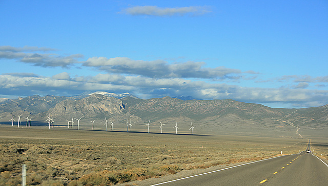
Spring Valley Wind Farm and US 6/50


Eastern Nevada, USA. Out the windshield of the moving Penske truck! (I was helping my son move to his new job in Pennsylvania.) The dirt road that runs straight up the mountain in the distance goes to the old mining camp of Osceola, NV. The main highway bends to the left at that point. The snowcapped peak visible to the left of center is Mt. Moriah, at >12K feet the 4th highest peak in Nevada. It's only the second-highest peak in the Snake Range; Mt. Wheeler, over 13K feet, is off the photo to the right.
RHH, , have particularly liked this photo
- Keyboard shortcuts:
Jump to top
RSS feed- Latest comments - Subscribe to the comment feeds of this photo
- ipernity © 2007-2024
- Help & Contact
|
Club news
|
About ipernity
|
History |
ipernity Club & Prices |
Guide of good conduct
Donate | Group guidelines | Privacy policy | Terms of use | Statutes | In memoria -
Facebook
Twitter

Sign-in to write a comment.