IMG_4107_cleaned
IMG_4108_cleaned
IMG_4109_cleaned
IMG_4113_cleaned
IMG_4114_adj
Checkerboard Mesa
IMG_4116_cleaned
IMG_4117_adj
IMG_4118_adj
IMG_4119_cleaned
IMG_4120_adj
IMG_4122_cleaned
IMG_4128_cleaned
IMG_4136_cleaned
IMG_4137_adj
Bighorns, Zion
Bighorns, Zion
Bighorns, Zion
Bighorns, Zion
Bighorns, Zion
Bighorns, Zion
Bighorns, Zion
Bighorns, Zion
IMG_4105_cleaned
IMG_4104_cleaned
IMG_4103_cleaned
IMG_4102_cleaned
IMG_4101_cleaned
IMG_4100_adj
IMG_4096_adj
Navajo Lake
Navajo Lake (through the trees)
IMG_4090_adj
IMG_4089_adj
IMG_4082_cleaned
IMG_4079_adj
Navajo Lake
Navajo Lake
IMG_4074_cleaned
IMG_4072_cleaned
IMG_4070_cleaned
IMG_4067_cleaned
IMG_4057_cleaned
IMG_4056_cleaned
IMG_4050_cleaned
Location
See also...
See more...Keywords
Authorizations, license
-
Visible by: Everyone -
All rights reserved
-
286 visits
Utah


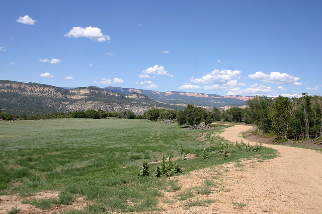
Off the Navajo Lake-North Fork road, looking north. The Wasatch Formation, which produces Bryce Canyon and Cedar Breaks, makes the orange scarps on the skyline. Navajo Lake lies beyond that ridge. The prominent drainage crossing the middle distance is the North Fork of the Virgin River, on its way to Zion National Park. Gung-ho hikers do a point-to-point down the river, thru the Narrows, and into Zion proper, where they pick up a ride. The route is strenuous and subject to flooding--there are lots of warnings about being caught in a flash flood in the narrow parts!
Map position is approximate but gives the flavor.
Map position is approximate but gives the flavor.
- Keyboard shortcuts:
Jump to top
RSS feed- Latest comments - Subscribe to the comment feeds of this photo
- ipernity © 2007-2024
- Help & Contact
|
Club news
|
About ipernity
|
History |
ipernity Club & Prices |
Guide of good conduct
Donate | Group guidelines | Privacy policy | Terms of use | Statutes | In memoria -
Facebook
Twitter

Sign-in to write a comment.