1898 Map of Vancouver Island and Inside Passage
1898 Map of Alaska Showing Panhandle Area
1898 Map of South America Showing Bolivia
1898 Map of South America Showing Patagonia
1898 Map of South America Showing Uruguay
1898 Map of South America Showing Venezuela
1898 Map of British Columbia and Inside Passage Ne…
See also...
Keywords
Authorizations, license
-
Visible by: Everyone -
All rights reserved
-
288 visits
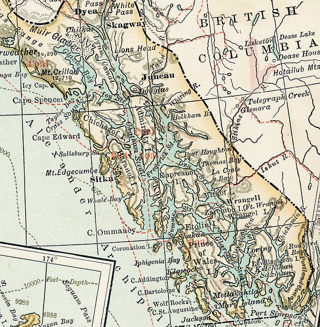
1898 Map of Juneau, Panhandle, and Inside Passage


Scan of a map printed in 1898. Notice the markings showing "coal" areas. The map was created during the Klondike Gold Rush, so it also shows the gold areas. Note in the upper right a shaded gold area above Telegraph Creek in British Columbia.
Nouchetdu38 has particularly liked this photo
- Keyboard shortcuts:
Jump to top
RSS feed- Latest comments - Subscribe to the comment feeds of this photo
- ipernity © 2007-2024
- Help & Contact
|
Club news
|
About ipernity
|
History |
ipernity Club & Prices |
Guide of good conduct
Donate | Group guidelines | Privacy policy | Terms of use | Statutes | In memoria -
Facebook
Twitter

Sign-in to write a comment.