Watzmann
Folder: Klettersteige
Springtime Meets Wintertime
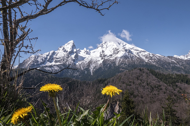
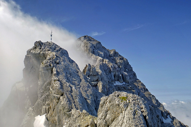
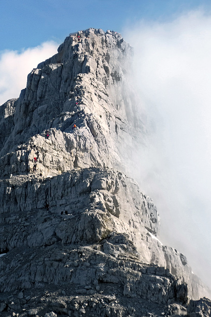
The summit of Watzmann (2.713m, Bavaria, Germany), seen from the fixed rope route Grünstein Isidor yesterday morning. (The Watzman is the highest mountain of Germany, which lies completely on German territory only.)
This northeastern view shows the middle summit (2.713m) - covered by the cloud - in the middle of the picture. Lefthand you see the Little Watzmann (2.307m).
~~~~~
Der Watzmann (2.713m, Bayern, Deutschland), gestern vormittag vom Klettersteig Grünstein Isidor her gesehen. (Der Watzmann ist der höchste Berg Deutschlands, der sich vollständig auf deutschem Staatsgebiet befindet.)
Bei diesem Blick von Nordosten befindet sich die Mittelspitze (2.713m) - von der kleinen Wolke verdeckt - zentral im Bild. Linkerhand sieht man den kleinen Watzmann (2.307m).
~~~~~
The tour:
www.bergsteigen.com/sites/default/files/topos/gruenstein_klettersteig_topo_0.jpg
The photo point:
Watzmann
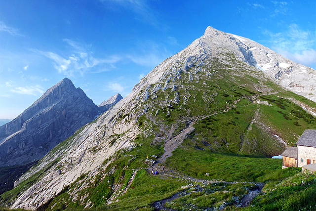
The summits of Watzmann (Bavaria, Germany, view from the alpine hut Watzmannhaus, 1.930m, in the early morning).
~~~~~
Blick auf die Watzmann-Gipfel vom Watzmannhaus (1.930m) am frühen Morgen.
Alpine Hut Watzmannhaus
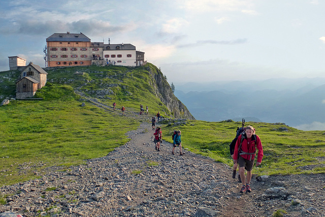
View back from the trail to the summits of Watzmann to the alpine hut Watzmannhaus (Bavaria, Germany, 1.930m, established 1887/88). In the foreground the leader of our group, a former member of mountain infantry.
Mountaineers normally stay there overnight to acclimatize to the altitude before climbing to the summits. (The difference of altitude from the valley to this hut is approx. 1300 mtrs. The way up to here lasts 3-4 hours, depending from condition.)
~~~~~
Blick zurück vom Weg, der auf die Watzmanngipfel führt, auf das Watzmannhaus (Bayern, Berchtesgadener Land, 1.930m, errichtet 1887/88). Rechts im Vordergrund unser Bergführer, ein ehemaliger Gebirgsjäger.
Bergsteiger übernachten hier normalerweise, um sich an die Höhe zu gewöhnem, bevor sie frühmorgens zur Gipfelüberschreitung aufbrechen. (Die Höhendifferenz vom Tal ist knapp 1.300m. Der Weg vom Tal zur Hütte dauert 3-4 Stunden, je nach Kondition.)
Crossing Watzmann
The first summit, called Hocheck (2.651m)
~~~~~
Der erste Gipfel, der Hocheck (2.651m)
Hocheck Summit Cross
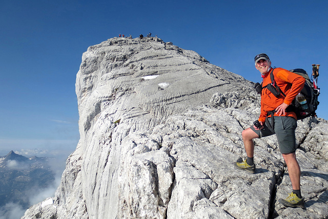
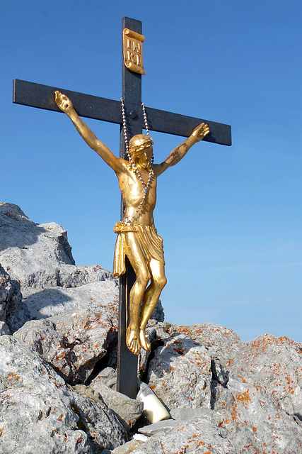
The summit cross of the most northern summit of the Watzmann mountain mass (Bavaria, Germany) called Hocheck (2.651m)
~~~~~
Das Gipfelkreuz des nördlichsten Gipfels des Watzmannmassivs , des Hocheck (Bayern, Berchtesgadener Land, 2.651m)
~~~~~
Der Gipfel von weiter unten:
Hocheck Refuge
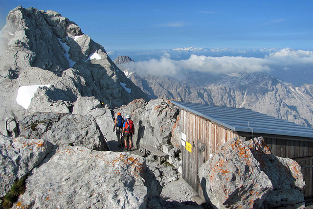
The first main stop during each Watzmann crossing: The refuge directly underneath the summit of the Hocheck (2.651m). At this place you may have a break, check your equipment, change clothing, attach your seat belt assembly and your helmet. After all, the way to the top doesn't pass lefthand upwards, but firstly 50 mtrs. downwards (see PiP).
~~~~~
Der erste große Haltepunkt bei jeder Watzmannüberschreitung: Die Notfall-Hütte knapp unterhalb des Hocheck -Gipfels (2.651m). Hier kann man noch einmal rasten, die Ausrüstung überprüfen, ggf. die Kleidung wechseln, das Klettersteigset anlegen und den Schutzhelm aufsetzen. Danach geht es dann aber noch nicht links den Grat zur Mittelspitze hoch, sondern zunächst mal ca. 50 m abwärts (siehe PiP).
The Watzmann Summits
View from the Hocheck-Biwackhütte (2.651m) to the Watzmann-Mittelspitze (lefthand, 2.713m) and the Watzmann-Südspitze (in the background, 2.712m).
~~~~~
Blick von der Hocheck-Biwackhütte (2.651m) auf die Watzmann-Mittelspitze (links im Bild, 2.713m) und die Watzmann-Südspitze (im Hintergrund, 2.712m).
Go on, or Back?
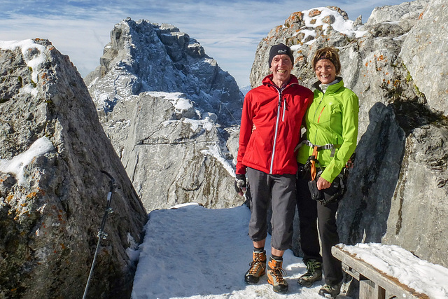
One year later - without guide, but the experience of more than one hundred mountain tours and thirty thousand climbing meters - we had to make a serious decision: Should we go on from here, or not? Even though it was midst of summer, at the summits it had snowed overnight. The rock was varnished with ice in places. Using step irons, climbing accurately and using a diligent safeguarding, that's not really a problem. High-altitude mountain tours often are leading through snow and ice. But it will last considerably longer under those conditions! Because of the early morning time we decided to make an one hour trial and to decide afterwards, whether to continue or not.
This is not worth imitating for less experienced mountain hikers.
~~~~~
Ein Jahr später hatten wir an der gleichen Stelle - ohne Bergführer, aber mit der Erfahrung von über hundert Bergtouren und dreißigtausend Klettermetern - eine ernsthafte Entscheidung zu treffen: Weitergehen oder abbrechen? Obwohl es mitten im Hochsommer war, hatte es über Nacht auf den Gipfeln geschneit. Der Fels war stellenweise glasig mit Eis überzogen. Mit Steigeisen, akkurater Klettertechnik und gewissenhafter Selbstsicherung ist das kein wirkliches Problem. Hochtouren über 3.000 m führen auch sommertags oft durch Eis und Schnee. Aber man ist unter solchen Bedingungen wesentlich langsamer unterwegs. Weil es erst 9 Uhr morgens war, entschieden wir uns, es eine Stunde lang zu versuchen und dann zu entscheiden, ob wir umkehren oder die Tour fortsetzen wollten.
Für wenig erfahrene Bergwanderer ist das keinesfalls nachahmenswert.
What Goes Up Must Come Down
A short interim descent (difficulty A/B within the range from A-E) from the first summit of the Watzmann mountain mass, the Hocheck (2.651m). The trail leads further to the right.
~~~~~
Der Zwischenabstieg (Schwierigkeit A/B in der Skala von A-E) nach dem ersten Watzmann-Gipfel, dem Hocheck (2.651m). Der Weg führt dann weiter nach rechts.
Jump to top
RSS feed- Latest items - Subscribe to the latest items added to this album
- ipernity © 2007-2024
- Help & Contact
|
Club news
|
About ipernity
|
History |
ipernity Club & Prices |
Guide of good conduct
Donate | Group guidelines | Privacy policy | Terms of use | Statutes | In memoria -
Facebook
Twitter

