Cornwall, Devon, Somerset
Folder: Great Britain & Ireland
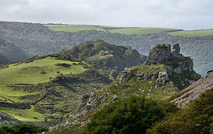
Valley of the Rocks: ‘Castle Rock'
| |
|
|
|
A view from just a little higher than the bench I posted the other day (Pip) showing what is known as the Castle Rock. I can certainly see why it is so named. Behind that I see here another castellation which may be part of the Lee Abbey? There seems a constant haze in the deep valley behind the rock, as this channels sea mist up the valley from the sea to our right. I saw people on the rock at one point and so I presume it is not a difficult climb.
Enjoy full screen
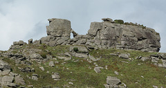
Valley of the Rocks: The White Lady
| |
|
|
|
Posted here in response to Peter Castells comment on the previous page. to A bit stouter than desired she is standing just under that ramped stone by the cube.
Sorry about the lower pixel count on this (it was going to be a PIP only).
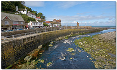
A Post Card from Lynmouth
| |
|
|
|
A view of part of this popular old village with its river and beacon tower.
It’s difficult to imagine that this was the scene for one of our worst flood disasters (see below).
Essential full screen. Enjoy the weekend.
“ON FRIDAY 15 AUGUST 1952, THE TINY VILLAGE OF LYNMOUTH SUFFERED WHAT COULD BE DESCRIBED AS THE WORST RIVER FLOOD IN ENGLISH HISTORY.
On the day itself, just over 9 inches (230mm) of rain fell, 6 inches (150mm) of which fell in a few short hours in the afternoon/early evening. Add in the 6 inches (150mm) of rain that had already fallen in the first two weeks of August, then it is no surprise that the top of Exmoor was unable to absorb the rainfall and was totally overwhelmed.
A noted author, S H Burton, recorded that water stood 18 inches (450mm) deep in the area of the moor around the Chains – indeed, the road between Lynmouth and Simonsbath, ironically at a place called Dry Bridges, was reported to the Devon Constabulary in the early evening as being washed away and impassable. The road here is half a mile above Farley Water, the nearest river. It was estimated that 90 million tons of rain fell in North Devon and West Somerset on that day.
This rainfall flooded into the many tributaries of the East and West Lyn rivers and, consequently, many tons of water, soil, boulders and vegetation descended through the narrow valleys (or coombes) of Exmoor from 500 metres up on the moor to meet at sea level in Lynmouth itself. On its way, various bridges blocked the flow until they collapsed and subsequently a wall of water and rubble hit Lynmouth in the late evening.
Effectively, Lynmouth was destroyed during that night.
The statistics make incredible reading. The West Lyn river rose 60 feet (18.25 meters) above the normal level at its highest point; 34 people in the wider area lost their lives – 28 in the Lynmouth/Barbrook area alone.
In 1953, the “58th report of Scientific Memoranda of the Devonshire Association“, prepared by specialist Mr C H Dobbie, concluded amongst other points that “the flow (of water) in the tributaries and branches exceeded the ‘acute catastrophic flood’ definition for England. As assessed by a preliminary investigation, the flow could be included in the list of extreme flood discharges of the world. The tiny catchment area of 39 square miles yielded a flow that has only been exceeded twice by the River Thames with all its 3812 square miles since measurements started in 1883.“
Further, Mr Dobbie calculated that the water that fell in that one day would supply the water needs of Lynmouth’s total population for 108 years.
Following the devastation, 114,000 tons of rubble was cleared from the village, some of it being used to extend the Esplanade Car Park, but most of it being dumped into the channel and dispersed by tidal motion. "
visitlyntonandlynmouth.com/history-heritage/the-1952-lynmouth-flood-disaster
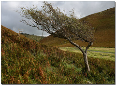
Valley of the Rocks: Windblown lone tree.
| |
|
|
|
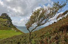
Another view from this wonderful valley demonstrating the direction of the prevailing wind here. Below and behind the tree we see the flock of wild mountain goats that live here.
Enjoy full screen
Valley of the Rocks: Coastal path
| |
|
|
|
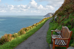
Watch the goat droppings but do enjoy the view looking towards Lynmouth. A lot of seats around here which tells me something about the style of tourist they expect around here, but that suited us fine!
We are looking east over Lynmouth Bay towards Foreland Point where we were to explore a few hours later.
Enjoy full screen.
Have a great day.
Lynton from Porlock Hill
| |
|
|
|
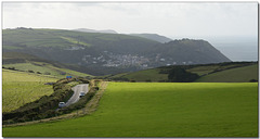
As we leave Lynmouth and the Valley of the Rocks we take a stroll over Foreland Point. This view is looking west over Lynton, the larger sister village to Lynmouth which lies much below that to our right. The Valley of the Rocks is just beyond the 'v' shaped cutting (see note). The road we see here is the infamous Porlock Hill road with its very steep 1 in 4 (25%) inclines at both ends.
Enjoy full screen. Have a good day.
ps Inspired by our Ipernity friend David G Johnson, below - here is that famous hymn, Jerusalem:
www.youtube.com/watch?v=MKRHWT6xdEU
Old harbour and steps at Lynmouth
| |
|
|
|
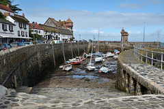
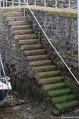
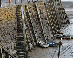
Another capture of the village of Lynmouth showing the harbour walls and old tower. The PiP (last photo) shows one of a number of flights of steps here that, allow boat and fishermen to access their craft. The harbour has been here a long time, in fact since Medieval days. It has been altered by floods, in particularly the 1952 one but there has floods here that devastated the village in 1607 too. In fact the word Lyn comes from the Old English ‘hlynn’ meaning ‘torrent’
HWW, have a great day.
Ye olde steps
| |
|
|
|
One of a number of flights of steps that, allow boat and fishermen to access their craft here in Lynmouth
Valley of the Rocks: The castle and tree
| |
|
|
|
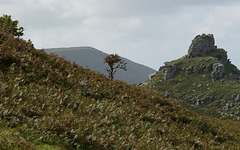
Another look at this lone tree and you can see now that it is not so lonely here in this windswept valley. To our left is the castle rock again but this time we see its proximity to the sea.
Enjoy full screen
The barn on the marsh
| |
|
|
|
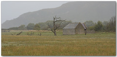
A wet miserable morning takes me down to Porlock Marsh. This big marsh area borders the sea to my left and the inland hillside and villages near Porlock to my right. I fell in love with this area which had many footpaths over the tidal marsh and border but it was the old dead trees that captured my imagination. A real sense of wanting more time in other seasons too so I could explore with different lighting and weather. That being said, I do like this subdued view here which would make a great setting for the Charles Dickens ‘Great Expectations’novel.
Enjoy full screen
The Old harbour, Minehead
| |
|
|
|
A look at the deep wall of Minehead harbour. Being on the Bristol Channel it has one of the highest rise and fall tides in the world. Quite by chance the highest is at the Bay of Fundy in Nova Scotia, a place I also visited only days ago.
HWW, have a great day.
“Allow me to introduce my family"
| |
|
|
|
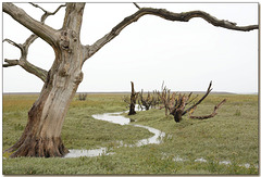
Another look at Porlock Marsh. This time we see just a few of the trees that were once here before the whole area was flooded with saltwater after the sea breached the natural ridge of Porlock Bay in the winter of 1996. Before that, this area was pastoral farm land for grazing animals.
Enjoy full screen
ps a nice friendly face to this tree (in case you missed it on first glance.)
Waiting
| |
|
|
|
A platform view of Minehead Station, Somerset. It was first opened in 1874 as the terminus of the Minehead Railway but closed in 1971. It was reopened in 1976 and is now the headquarters and terminus of the West Somerset heritage Railway. Since this was once a true country branch line of the old ‘Great Western Railway’ we still see the original benches. The train on the left is about to depart being pulled by a steam engine.
Enjoy full screen.
Have a great day.
Lynmouth: the Rhenish Tower
| |
|
|
|
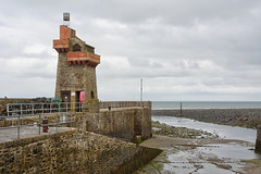
On the quay at the end of the harbour is the Rhenish Tower. This was built in the 1860s to store saltwater for indoor baths but later fitted with a light to act as a beacon. It was badly damaged in the devastating floods of 1952 but rebuilt to its original form. It acquired its name after it was said to resemble a tower on the River Rhine.
HWW, have a great day.
AI, Herb style!
| |
|
|
|
My idea of artificial intelligence here as we see this funny character made from real materials. Seen in Minehead, Somerset, a town where a lot of people have a sense of humour it seems. I think he is trying to send us a message. I have no idea what he/she was called nor what that message was about. He is around 1.5m high to the top of his antenna.
Of course he is accompanied by a real fence gate too!
Enjoy the weekend.
Guardian of the Rock
| |
|
|
|
The valley of the rocks near Lynton can keep a budding photographer busy for weeks. As I stand, the wind buffets me but this central tree stands proud.
Enjoy full screen
The night skies of Somerset
| |
|
|
|
Looking north across the Bristol Channel towards South Wales from Porlock, Somerset.
We are looking towards Ursa Major just above the lit tree with Ursa Minor a little higher, the Milky Way is just about viewable from the bottom right towards the top.
A 11mm, 15 sec exposure at F3.5, 1600 ISO. (The 11mm on my Nikon DX crop sensor delivers a Field of view 90°x70°)
The PiP gives a better idea of what we are looking at, showing the constellations at the exact same coodinates, date and time. Thanks to stellarium.org
Deserves full screen
Rainbow walkers!
| |
|
|
|
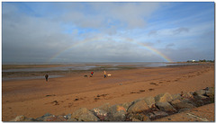
A walk on the beach at Minehead, especially with a child or dog must always be a pleasant experience. Today the walkers have a special treat with this lovely rainbow.
Photographed from the top edge of the promenade wall and path.
Enjoy full size.
Jump to top
RSS feed- Latest items - Subscribe to the latest items added to this album
- ipernity © 2007-2024
- Help & Contact
|
Club news
|
About ipernity
|
History |
ipernity Club & Prices |
Guide of good conduct
Donate | Group guidelines | Privacy policy | Terms of use | Statutes | In memoria -
Facebook
Twitter

