

Don Barrett (aka DBs travels)'s photos with the keyword: Woolwich Riverside Ward
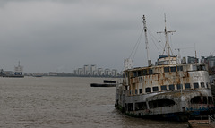
London Thames Barrier / Royal Iris (#0231)
| 07 Feb 2019 |
|
|
|
Just east of the Thames Barrier, the abandoned Royal Iris . The Royal Iris , launched in 1950, served as a ferry and cruise ship on the Mersey River near Liverpool until 1991. Becoming increasingly expensive to maintain, there were various (failed) plans to convert it into a floating nightclub which somehow resulted in it being towed to this location in 2002 where it has slowly deteriorated.
It’s surprising that there aren’t more efforts to salvage it since the Beatles and Gerry & The Pacemakers performed on it, it was used in a TV series, and it was used in the Silver Jubilee of Queen Elizabeth II.
Sources:
en.wikipedia.org/wiki/MV_Royal_Iris
strangeabandonedplaces.com/abandoned-london-mv-royal-iris
(Part of a documentation of 2018 exploration/reflection on Brexit and populist movements in Europe, keyword Europe2018)
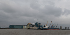
London Thames Barrier / sugar & slavery policy (#0…
| 07 Feb 2019 |
|
|
Sometimes when researching a picture you come up with findings that are completely unexpected. I took this picture of a factory that is downstream from the Thames Barrier just because it looks to be one of the last of the major factories along the Thames near London. On looking up the company (Tate & Lyle), I found a surprising history.
The building here is Tate & Lyle’s sugar refinery, which started in East London in 1878 and appears to have been operating at this site since 1882. Their website describes a socially and environmentally responsible company, but what really stands out on their website is a very upfront section titled “Modern Slavery Act”. In that section they acknowledge that the cane for their sugar comes from suppliers in developing countries where labor and environmental policies are often very questionable and thus the company is taking steps to improve the conditions at their suppliers. I do not recall ever seeing such a detailed and explicit statement by a company about improving the work conditions of suppliers.
Source: www.tateandlylesugars.com/modern-slavery-act
(Part of a documentation of 2018 exploration/reflection on Brexit and populist movements in Europe, keyword Europe2018)
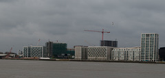
London Thames Barrier / Royal Wharf (#0218)
| 05 Feb 2019 |
|
|
Royal Wharf housing development on the north bank of the Thames, on the upriver side of the Thames Barrier. Per the project’s website this is affordable housing (starting around £350,000), though I doubt the units with a riverview fall within that price range.
Source: www.royalwharflondon.com
(Part of a documentation of 2018 exploration/reflection on Brexit and populist movements in Europe, keyword Europe2018)
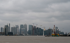
London Thames Barrier / Canary Wharf (#0217)
| 05 Feb 2019 |
|
|
|
From the upriver (west) side of the barrier, looking towards Canary Wharf. If you look closely, you can see one of the pylons for the Emirates Air Line cable car in the picture – the twisting white tower.
As noted with an earlier picture, the whole Canary Wharf area is predicted to be very vulnerable to flooding without the defense of the Thames Barrier.
(Part of a documentation of 2018 exploration/reflection on Brexit and populist movements in Europe, keyword Europe2018)
London Thames Barrier / Royal Wharf (#0216)
| 05 Feb 2019 |
|
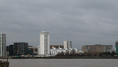
Another portion of the Royal Wharf development. I suspect that units in this tower are not in the ‘affordable’ price range.
(Part of a documentation of 2018 exploration/reflection on Brexit and populist movements in Europe, keyword Europe2018)
London Thames Barrier/Thames Clipper (#0219)
| 04 Feb 2019 |
|
|
|
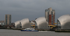
A Thames Clipper ferry passing through the barrier. I had been tempted to take the ferry through the barrier, but on the weekend the ferry’s schedule is infrequent and getting from where the ferry docks to the actual barrier requires a bus trip. Besides, the weather was rather ‘iffy’ for riding on the open deck portion of the ferry so as to see the barrier!
(Part of a documentation of 2018 exploration/reflection on Brexit and populist movements in Europe, keyword Europe2018)
London Thames Barrier (#0215)
| 04 Feb 2019 |
|
|
|
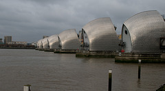
One thing that particularly impressed me about the Thames Barrier was the detail that went into making it architecturally interesting.
(Part of a documentation of 2018 exploration/reflection on Brexit and populist movements in Europe, keyword Europe2018)
London Thames Barrier / Xylonite sailing barge (#0…
| 02 Feb 2019 |
|
|
|
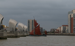
The Xylonite entering gate 4 of the Thames Barrier. The Xylonite was built in 1926, of steel, as a Thames sailing barge (see Wikipedia links). In 1958 the Xylonite was cut down to being a motor barge and continued carrying cargo until 1977. It was subsequently rerigged as a sailing barge and has had other modifications including a ‘new bottom’ per one article (why it doesn’t say “hull”, I don’t know). It’s difficult to determine it’s current use, some sites describe it as being used for sail training, others as it being used as a houseboat. The Daily Mail link (below) has good pictures of the interior and describes how the boat was used in the filming of Dunkirk ; the article (from 2017) also says that the boat is for sale for £425,000 ($557K).
Sources:
Wikipedia Thames sailing barge: en.wikipedia.org/wiki/Thames_sailing_barge
Wikipedia/Xylonite: en.wikipedia.org/wiki/SB_Xylonite
National Historic ships: www.nationalhistoricships.org.uk/register/236/xylonite
Daily Mail: www.dailymail.co.uk/news/article-4706664/Houseboat-used-Hollywood-film-Dunkirk-sale.html
(Part of a documentation of 2018 exploration/reflection on Brexit and populist movements in Europe, keyword Europe2018)
London Thames Barrier (#0203)
| 02 Feb 2019 |
|
|
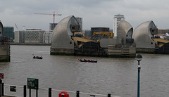
Rowing crew going between two of the barriers along the main channel. The photo also gives a chance to see part of the mechanism for raising and lowering the gate. The Daily Sun article linked below has pictures of the a gate under construction and of the changes in water level that occur when a raised gate is lowered.
Sources:
Wikipedia: en.wikipedia.org/wiki/Thames_Barrier
Gov link: www.gov.uk/guidance/the-thames-barrier
Daily Mail: www.dailymail.co.uk/sciencetech/article-2559399/Thames-Barrier-turns-30-Stunning-images-reveal-complex-machinery-thats-shielding-London-floods.html
(Part of a documentation of 2018 exploration/reflection on Brexit and populist movements in Europe, keyword Europe2018)
London Thames Barrier (#0235)
| 01 Feb 2019 |
|
|
|
Continuing from my earlier post about the Thames Barrier (https://www.ipernity.com/doc/donbrr/47920748 )
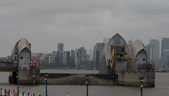
One of the Thames Barrier gates nearest the south shore of the Thames, with the gate closed. If you look at the nearby satellite view of the barrier, you’ll see that the two barriers closest to the south shore, and four closest to the north shore, are much narrower than the barriers on the main channel. The near-shore barriers are often closed, which fortunately gives a view of how they all would look closed. More on the barriers with the nearby pictures.
Sources:
en.wikipedia.org/wiki/Thames_Barrier
www.gov.uk/guidance/the-thames-barrier
(Part of a documentation of 2018 exploration/reflection on Brexit and populist movements in Europe, keyword Europe2018)
London Thames Barrier (#0234)
| 01 Feb 2019 |
|
|
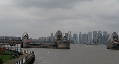
From a different angle and further away, another shot of the closed gate that’s near the south shore and of one of the wider gates in the main channel. I didn’t focus on it at the time, but the narrow gate to the left of the closed gate (a little difficult to see) indicates one of the positions that the gates can be open – they can be rotated to the top so that they are above and parallel to the water line, rather than blocking flow. The GOV link provides a good description of how the gates work.
In the distance is the development at Canary Wharf, a good illustration of the importance of the gates for protection from a tidal surge from the North Sea. The Daily Mail link below has an image of the area that would be flooded without the Thames Barrier – in that image, the China Wharf area (all in the flood zone) is the area surrounded by a large u-shaped dip in the Thames.
The Thames has a long history of flooding from tidal surges, from very heavy rains inland, and from the unfortunate times when heavy inland rain combines with very high tides. A 1953 North Sea Flood that killed 307 in the UK was the impetus to come up with a form of defense, but a means for defense was not figured out until 1966 and the construction didn’t begin until 1974, finishing in 1984. (See the Gizmodo link.) The barrier is regularly tested and was relatively lightly used as defense until recent history – per the Daily Mail link, it was used as a defense 29 times in the winter of 2013/14.
Sources:
Wikipedia: en.wikipedia.org/wiki/Thames_Barrier
Gov link: www.gov.uk/guidance/the-thames-barrier
Gizmodo link: www.gizmodo.co.uk/2016/10/behind-londons-wall-of-steel-designing-the-thames-barrier
Daily Mail: www.dailymail.co.uk/sciencetech/article-2559399/Thames-Barrier-turns-30-Stunning-images-reveal-complex-machinery-thats-shielding-London-floods.html
(Part of a documentation of 2018 exploration/reflection on Brexit and populist movements in Europe, keyword Europe2018)
London Thames Barrier (#0213)
| 30 Dec 2018 |
|
|
|
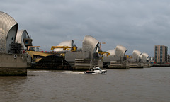
A key goal for me on this trip, to see the Thames Barrier which is on the east side of London. Opened in 1984 to control storm surges which historically flooded from the North Sea up the Thames to London. There will be much more on this later….
Sources:
en.wikipedia.org/wiki/Thames_Barrier
www.gov.uk/guidance/the-thames-barrier
(Part of a documentation of 2018 exploration/reflection on Brexit and populist movements in Europe, keyword Europe2018)
Jump to top
RSS feed- Don Barrett (aka DBs travels)'s latest photos with "Woolwich Riverside Ward" - Photos
- ipernity © 2007-2026
- Help & Contact
|
Club news
|
About ipernity
|
History |
ipernity Club & Prices |
Guide of good conduct
Donate | Group guidelines | Privacy policy | Terms of use | Statutes | In memoria -
Facebook
X
