Erika+Manfred's photos with the keyword: Pazific
Der Zaun im Stanley Park, Vancouver
Der Zaun in Vancouver Downtown
| 07 Jul 2016 |
|
|
|
HFF - Happy Fence Friday to all of you
PIP: aufgenommen vom Schiff
Man sieht es an den Balkonen: Das sind alles Wohnhäuser!
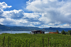
Weinberge im Okanangan Valley, BC, Canada - PIP
| 12 Jul 2016 |
|
|
|
PIP - Die Winzer dort haben noch recht bescheidene Anwesen
Okanagan Lake ist ein langer, schmaler Binnensee in der kanadischen Provinz British Columbia. Der rund 135 km lange und 4-5 km breite See mit einer Oberfläche von 351 km² schlängelt sich im südlichen Teil von British Columbia durch das Okanagan-Becken und geht rund 55 km vor der Grenze zum US-Bundesstaat Washington in den gleichnamigen Fluss über.
Die größte Stadt am Ufer des Sees ist mit 117.312 Einwohnern Kelowna, die sich Anfang des 20. Jahrhunderts entwickelte, als zahlreiche Europäer das Tal besiedelten. Die Bewohner entlang des Sees, darunter viele deutschstämmige Kanadier, leben insbesondere vom Fremdenverkehr, sowie von der Land- und Forstwirtschaft. Insbesondere in Kelowna entwickelte sich zudem ein ertragreiches Dienstleistungsgewerbe. Die Gegend ist innerhalb von Kanada insbesondere für den Anbau von Obst und Wein bekannt.
Der Legende nach lebt im Okanagansee das Seeungeheuer Ogopogo.
Okanagan Lake is a large, deep lake in the Okanagan Valley of British Columbia, Canada. The lake is 135 km long, between 4 and 5 km wide, and has a surface area of 348 km².
Okanagan Lake is called a fjord lake as it has been carved out by repeated glaciations. Although the lake contains numerous lacustrine terraces, it is not uncommon for the lake to be 100m deep only 10m offshore. Major inflows include Mission, Vernon, Trout, Penticton, Equesis, Kelowna, Peachland and Powers Creeks.[7] The lake is drained by the Okanagan River, which exits the lake's south end via a canal through the city of Penticton to Skaha Lake, whence the river continues southwards into the rest of the South Okanagan and through Okanogan County, Washington to its confluence with the Columbia.
The lake's maximum depth is 232 metres near Grant Island (Nahun Weenox). There is one other island known as Rattlesnake Island, much farther south by Squally Point. Some areas of the lake have up to 750 metres of glacial and post-glacial sediment fill which were deposited during the Pleistocene Epoch.
Notable features of the Okanagan Valley include terraces which were formed due to the periodic lowering of the lake's predecessor, glacial Lake Penticton. These terraces are now used extensively for agriculture such as fruit cultivation. Q:Wikipedia
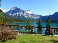
Der Zaun am Emerald Lake, Yoho National Park, Cana…
| 14 Jul 2016 |
|
|
|
HFF - Happy Fence Friday to you
Emerald Lake is located in Yoho National Park, British Columbia, Canada. It is the largest of Yoho's 61 lakes and ponds, as well as one of the park's premier tourist attractions. Emerald Lake Lodge, a high-end lodge perched on the edge of the lake, provides local accommodation. A 5.2 km (3.2 mi) hiking trail circuits the lake, the first half of which is accessible to wheelchairs and strollers. During the summer months, canoe rentals are available; in the winter, the lake is a popular cross country skiing destination.
The lake is enclosed by mountains of the President Range, as well as Mount Burgess and Wapta Mountain. This basin traps storms, causing frequent rain in summer and heavy snowfalls in winter. This influx of moisture works with the lake's low elevation to produce a unique selection of flora. Trees found here are more typical of B.C.'s wet interior forests, such as western red cedar, western yew, western hemlock and western white pine. The alluvial fan on the northeast shore produces wildflowers in abundance during late June and early July.
Due to its high altitude, the lake is frozen from November until June. The vivid turquoise color of the water, caused by powdered limestone, is most spectacular in July as the snow melts from the surrounding mountains.
The first European to set sight on Emerald Lake was guide Tom Wilson, who stumbled upon it by accident in 1882. A string of his horses had gotten away, and it was while tracking them that he first entered the valley. The lake had an impression on even the most seasoned of explorers: "For a few moments I sat [on] my horse and enjoyed the rare, peaceful beauty of the scene." It was Wilson who gave the lake its name because of its remarkable colour, caused by fine particles of glacial sediment, also referred to as rock flour, suspended in the water. However, this was not the first time Wilson had dubbed a lake 'Emerald'. Earlier that same year he had discovered another lake which he had given the same moniker, and the name even appeared briefly on the official map. This first lake however, was shortly renamed Lake Louise. Q:Wikipedia
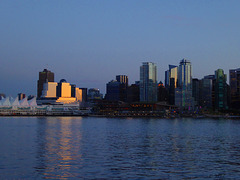
Canada Place und Convention Centre
| 27 Jul 2016 |
|
|
|
Canada Place ist ein markantes Gebäude im Zentrum der kanadischen Stadt Vancouver, am Ufer des Burrard Inlet. Es beherbergt das Messe- und Kongresszentrum Vancouver Convention & Exhibition Centre, das Pan Pacific Hotel und das weltweit erste IMAX-Kino. Darüber hinaus ist es Anlegestelle der meisten ab Vancouver verkehrenden Kreuzfahrtschiffe.
Erbaut vom Architekten Eberhard Zeidler als kanadischer Pavillon der Expo 86, war Canada Place der einzige Teil dieser Weltausstellung, der sich nicht auf dem Ausstellungsgelände am Nordufer des False Creek befand.
Canada Place is a building situated on the Burrard Inlet waterfront of Vancouver, British Columbia. It is the home of the Vancouver Convention Centre, the Pan Pacific Vancouver Hotel, Vancouver's World Trade Centre, and FlyOver Canada (a virtual flight ride which replaced the world's first permanent IMAX 3D theatre and which ceased operation on October 1, 2009). The building's exterior is covered by fabric roofs resembling sails. It is also the main cruise ship terminal for the region, where most of Vancouver's famous cruises to Alaska originate. The building was designed by architects Zeidler Roberts Partnership in joint venture with Musson Cattell Mackey Partnership and DA Architects + Planners.
Canada Place can be reached via the SkyTrain line at the nearby Waterfront Station terminus or via West Cordova Street in Vancouver. The white sails of the building have made it a prominent landmark for the city, as well as drawing comparisons to the Sydney Opera House in Sydney, Australia and the Denver International Airport in Denver, Colorado.[citation needed]
The structure was expanded in 2001 to accommodate another cruise ship berth and in 2009/10, for the 2010 Winter Olympics, Canada Place served as the Main Press Centre. Q:Wikipedia
Der Zaun in Vancouver
| 26 May 2016 |
|
|
|
Smuggler Cove Marine Provincial Park
| 22 May 2016 |
|
|
|
PIP: einfach mal die Seele baumeln lassen
Smuggler Cove Marine Provincial Park is a provincial park in British Columbia, Canada.
Smuggler Cove is a small, picturesque all-weather anchorage on the south side of Sechelt Peninsula near Secret Cove. To access this park by land, visitors can hike 4 km from a parking lot off Hwy 101. This park provides camping, hiking, swimming, kayaking and picnicking. Park Size: 185 hectares. 16 km West of Sechelt on the Sunshine Coast. Accessible by boat from the north end of Welcome Pass. Also accessible from Brooks Road off Hwy 101 halfway between Secret Cove and Halfmoon Bay on the Sunshine Coast. It is a 4 km hike from the parking lot to Smuggler Cove. The Smuggler Cove Marine Provincial Park draws many boaters and sightseers every year to the protected cove. Many come to explore the many bays of the area, rock cliffs and beach areas. The marine park is considered a wetland park so there are some very sensitive ecological areas along the path designed to protect the ecosystem. Please stay on walking paths and have dogs leashed.
Smuggler Cove is an all-weather anchorage with three large anchoring basins for cruising boats. The best entry to the park by boat is through Welcome Passage at low tide when reef and rock projections are visible. The local area has provided many eye bolts located along the shoreline to accommodate stern pins. Smuggler Cove Marine Provincial Park has some wilderness camping facilities on site. Wilderness camping means no amenities. The hike-in campsite is permitted year round only in the five designated campsites located in the cove. Follow the trail for about 1 km ( 0.4 mi.) from the cove to the camping area from the parking lot. There is no drinking water on site so bring your own.
A possible apocryphal story is that Smuggler Cove owes its name to its reported use by Larry Kelly. Kelly, the “King of the Smugglers” who was also known as “Pirate” came up to Canada after fighting for the confederates in the American Civil War. When the Canadian Pacific Railway was completed, many unemployed Chinese workers tried to emigrate to the United States but were forbidden official entry. Kelly assisted the Chinese to cross the border for a fee of $100 each. His insurance against detection was to have the Chinese agree to be roped together and tied to a large hunk of pig iron. If there was a chance that would be apprehended by U.S. customs, he would throw the iron and Chinese overboard. Common misconception is that Larry Kelly was also nicknamed "Pig Iron," but this was another smuggler by the name of Jim Kelly. - Q:Wikipedia
Auf der Fähre nach Vancouver Island
| 21 May 2016 |
|
|
|
Vancouver Island, früher auch Quadra, ist die größte nordamerikanische Pazifikinsel. Sie liegt im Südwesten der kanadischen Provinz British Columbia und ist nach dem britischen Seefahrer George Vancouver benannt.
Vancouver Island ist die größte Insel der Provinz British Columbia und wird durch die Strait of Georgia, die Johnstone Strait und die Queen Charlotte Strait vom kanadischen Festland getrennt. Die Juan-de-Fuca-Straße trennt die Insel vom US-Staat Washington. Die Insel ist über 450 km lang und rund 100 km breit; dabei umfasst sie eine Fläche von 31.285 km².
Der lange Gebirgszug der Vancouver Island Ranges teilt die Insel in die stürmische, zerklüftete, dem Pazifik zugewandte Westseite und die gemäßigtere Ostseite. Der höchste Berg ist die Golden Hinde mit 2195 m. Er steht im rund 2500 km² großen Strathcona Provincial Park. Der einzige Gletscher ist der Comox Glacier. Die Westküste ist von fünf großen, fjordartigen Sundgebieten, den Sounds gekennzeichnet. Der größte See ist der Kennedy Lake nordöstlich von Ucluelet.
Das Klima ist für kanadische Verhältnisse ausgesprochen mild, wobei es im Westen, am Henderson Lake, bis zu 6650 mm pro Jahr regnet - vor allem in Herbst und Winter -, während auf der Saanich-Halbinsel oder in Victoria nur ein Zehntel dieser Regenmenge fällt. Schnee ist, außer im Hochgebirge, eher selten.
Vancouver Island, located in British Columbia, Canada, is the largest Pacific island east of New Zealand.[nb 1] While the city of Vancouver stands on the North American mainland, Victoria, the capital city of British Columbia, is located on the island.
The island was first explored by Europeans when British and Spanish expeditions arrived in the late 18th century. It was originally named Quadra's and Vancouver's Island in commemoration of the friendly negotiations held by Spanish commander of the Nootka Sound settlement, Juan Francisco de la Bodega y Quadra, and by British naval captain George Vancouver in Nootka Sound in 1792, to find a solution to the Nootka Crisis. Quadra's name was eventually dropped and it has since been known solely as Vancouver Island. It is one of several North American locations named after George Vancouver, the British Royal Navy officer who explored the Pacific Northwest coast of North America between 1791 and 1794.
Along with most of the southern Gulf Islands, plus various minor islands offshore from its southern end, the southern part of Vancouver Island is the only part of British Columbia (and of Western Canada) that lies south of the 49th Parallel. The area has one of the warmest climates in Canada and since the mid-1990s has been mild enough in a few areas to grow subtropical Mediterranean crops such as olives and lemons.
The island is 460 kilometres (290 mi) in length, 80 kilometres (50 mi) in width at its widest point, and 32,134 km2 (12,407 sq mi) in area. It is the largest island on the West Coast of North America, the world's 43rd largest island, Canada's 11th largest island, and Canada's second most populous island after the Island of Montreal. The Canada 2011 Census recorded a population of 759,366.[6] Nearly half of that figure (344,630) live in Greater Victoria. Other notable cities and towns on Vancouver Island include Nanaimo, Port Alberni, Parksville, Courtenay, and Campbell River.
Q: Wikipedia
Jump to top
RSS feed- Erika+Manfred's latest photos with "Pazific" - Photos
- ipernity © 2007-2025
- Help & Contact
|
Club news
|
About ipernity
|
History |
ipernity Club & Prices |
Guide of good conduct
Donate | Group guidelines | Privacy policy | Terms of use | Statutes | In memoria -
Facebook
X


