tiabunna's favorite photos
On Top
Gentoo penguins (Pygoscelis papua) nesting on top of Danco Island. Our expedition ship MS Polar Star can be seen down in Errera Channel.
Pygoscelis species build their nest from stones to keep them dry and often go long ways to feed. Even for us humans it was a stiff uphill climb, more so for the penguins hopping and walking through snow and meltwater.
By ╰☆☆June☆☆╮
45 favorites
Dreaming
Model is Laurel, from faestock @ www.deviantart.com Thank you Jessica
Texture from joesista @ www.flickr.com
The Everly Brothers - All I Have to Do Is Dream (1958) - Digitally Remastered 2012
youtu.be/B41OrQup6lE
By Gisela Plewe
30 favorites
Creepers
en.wikipedia.org/wiki/Gardens_by_the_Bay
In the Background: Flowerdome
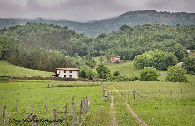
Splendid Isolation
A house on the outskirts of the village of Ituren, Navarre, Spain.
My Website
Getty Images.
6 favorites
CB&Q 5631
Chicago, Burlington & Quincy Railroad Company class O-5-A Mohawk 4-8-4 type highspeed combination passenger/freight locomotive. Built 1940 by the CB&Q. Length of locomotive and tender: 106' 5", Light weight of locomotive and tender: 290 tons, Driver wheel diameter: 6'6", Starting tractive effort: 67500 lbs. In front of the Sheridan Inn, once home to Buffalo Bill Cody, Sheridan Wyoming.
Crown Graphic 4x5, Carl Zeiss Tessar f4.5 15cm, Fuji 160 quickload
85 favorites
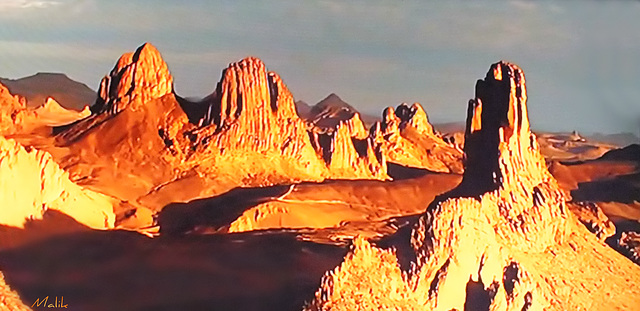
Photo de Malik.
Hoggar (du tamachek Ahaggar, qui signifie « noble »), est le nom donné à un massif montagneux de l'ouest du Sahara, dans le sud de l'Algérie. Il couvre une superficie d'environ 540 000 km2, ce qui représente le quart de la superficie totale du pays. Son plus haut sommet, le mont Tahat au centre de l'Atakor, culmine à 2 918 mètres.
Hoggar (Ahaggar of tamachek, which means "noble"), is the name given to a mountain range in Western Sahara, in southern Algeria. It covers an area of about 540,000 km2, which represents a quarter of the total land area. Its highest peak, Mount Tahats the center of Atakor, culminates at 2918 meters.
20 favorites
"Heat Wave"
~ Explored! ~ Thank you very much :-)))
The Heat Wave has arrived and I am melting :-)
And, so are these candles..... in our conservatory!
They were, previously, perfectly vertical :-)))
The obvious choice for me is 'Heat Wave' by Linda Ronstadt :-)
Added to ~ Sight and Sound
Listen here ♫ ♪ ♪ ♫ ~ Heat Wave ~ Linda Ronstadt
♫ ♪ ~ Live Version
Andvord Bay
Anvers Island and Mount Francais seen from Andvord Bay. The many small iceflows stem from the calving glaciers surrounding Neko Harbour
Jump to top
RSS feed- Latest favorites - Subscribe to the favorite docs of tiabunna
- ipernity © 2007-2024
- Help & Contact
|
Club news
|
About ipernity
|
History |
ipernity Club & Prices |
Guide of good conduct
Donate | Group guidelines | Privacy policy | Terms of use | Statutes | In memoria -
Facebook
Twitter


