

neck stiffing – 1988
Toronto – 1988
Lone Cypress – 1993
Abendrot über Bern, mit zunehmendem Mond.
Über diese Brücke musst du gehen ...
Corona summer 2021 (a preview)
installation with heart.
a delicate seat – 1994
"Objects in mirror are closer than they appear!"…
waves #3
waves #2
waves #1
Merry Christmas to all the IP friends!
fog
After an awful 2020 I wish you a wonderful 2021 !
A brief Christmas summary
above the fog
What is this ?
coffee
Neujahr im Wald
bar code in the forest?
virgin ski slope
a white record to play ... (The White Album)
WaldLichtung
Annoyed cat with energetic urge to act.
A frosty day
A winter as it should be!
Lok down anstatt Lockdown
Nur Meer
Bergsicht
dog art
Stockhornschatten
500 m down
Tunnelfeeling
on the edge
Monument Valley – 2000
Nautische Stirlereien
Erster Schnee! (Schnee von gestern)
North Face
Herbstwolken in Schräglage.
close to the edge – 1988 (3 PiPs)
x x x Ω
the balcony
| │ ǀ ٨ ǀ
rheinabwärts
1/1250 • f/4.0 • 23.4 mm • ISO 200 •
Canon PowerShot G7 X Mark II
Location
Lat, Lng:
You can copy the above to your favourite mapping app.
Address: unknown
You can copy the above to your favourite mapping app.
Address: unknown
Keywords
Authorizations, license
-
Visible by: Everyone -
All rights reserved
-
585 visits
Spie gelungen
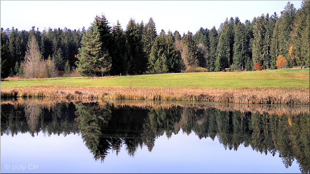

Im Wachseldornmoos.
Das Wachseldornmoos ist ein kleines Hochmoor von nationaler Bedeutung. Es liegt in einer 500 m langen Lichtung inmitten von Tannenwäldern. Heute ist es ein vielfältiger Lebensraum für Amphibien und Vögel. Noch heute zeugen Torfsockel davon, dass hier bis um 1960 herum Torf abgebaut wurde. Seither entstanden Feuchtwiesen und Hochmoorflächen mit Schilf und Lilien. Im Winter führt eine Langlaufloipe entlang des Nordrandes.
► PiP
(46.82597, 07.72334); [280°] – swisstopo map
Translate into English
Das Wachseldornmoos ist ein kleines Hochmoor von nationaler Bedeutung. Es liegt in einer 500 m langen Lichtung inmitten von Tannenwäldern. Heute ist es ein vielfältiger Lebensraum für Amphibien und Vögel. Noch heute zeugen Torfsockel davon, dass hier bis um 1960 herum Torf abgebaut wurde. Seither entstanden Feuchtwiesen und Hochmoorflächen mit Schilf und Lilien. Im Winter führt eine Langlaufloipe entlang des Nordrandes.
► PiP
(46.82597, 07.72334); [280°] – swisstopo map
Annemarie, , Sami Serola (inactive), malona and 12 other people have particularly liked this photo
- Keyboard shortcuts:
Jump to top
RSS feed- Latest comments - Subscribe to the comment feeds of this photo
- ipernity © 2007-2026
- Help & Contact
|
Club news
|
About ipernity
|
History |
ipernity Club & Prices |
Guide of good conduct
Donate | Group guidelines | Privacy policy | Terms of use | Statutes | In memoria -
Facebook
X

Sign-in to write a comment.