2013 LAND ROVER DEFENDER 110 HARD TOP TD LIGHT UTI…
Alien - Victoria - London - 17.11.2014
East from the Ouse Valley Viaduct, Sussex - 19.11.…
At Victoria Bus Station - London - 17.11.2014
Sir Simon Milton - Merchant Square - London - 17.1…
Plaque for Sir Simon Milton - Merchant Square - Lo…
Merchant Square fountain - London - 17.11.2014
Paddington Basin looking west - London - 17.11.201…
Paddington Trail bears - London - 17.11.2014
Didcot Power Station - photographed from a train -…
21 Grosvenor Gardens - Victoria - London - 17.11.2…
5 Merchant Square & St. Mary's Hospital - Paddingt…
19 Norfolk Place - Paddington - London - 17.11.201…
Jonathan Ross' Paddington - 17.11.2014
Paddington Basin East - London - 17.11.2014
St Mary's Hospital, Paddington - London - 17.11.20…
'Still Water' Marble Arch - London - 17.11.2014
Paddington Basin - London - 17.11.2014
Turning in the Paddington Basin - London - 17.11.2…
Paddington Basin East apartments - London - 17.11.…
Not the season for paddle boarding - Paddington -…
Nurses quarters? - Paddington - London - 17.11.201…
The Point - Paddington - London - 17.11.2014
Plymouth map circa 1884 - South-East
Plymouth map circa 1884 - North-West
Plymouth map circa 1884 - North-East
Jaguar XKR - North Hinksey - Oxford - 24.6.2014
1990 Rover Mini - Oxford - 24.6.2014
1972 Triumph Stag - Seaford - 23.6.2014
Vauxhall Cross bus station - London - 30.10.2014
The MI6 building London - 30.10.2014
Snowy Apple Blossom - East Dulwich - London - 6.4.…
East Dulwich snow - 6.4.2008
Stoptrans trailer - Newhaven - 10.11.2014
Shingle shifters’ make tracks - Bishopstone - 10.…
Ringed Plovers on beach - Bishopstone - 10.11.201…
Ringed Plovers landing- Bishopstone - 10.11.2014
Ringed Plovers flying along the surf- Bishopstone…
Ringed Plovers flying along the surf - Bishopstone…
Ringed Plovers flying along the surf- Bishopstone…
North Quay Newhaven - 10.11.2014
Maize at Tidemills - Bishopstone - 10.11.2014
Hewden's JLG lift - Newhaven - 10.11.2014
From Tidemills to Seaford Head - 10.11.2014
Rebuilding the defences - Seaford - 10.11.2014
Keywords
Authorizations, license
-
Visible by: Everyone -
All rights reserved
-
233 visits
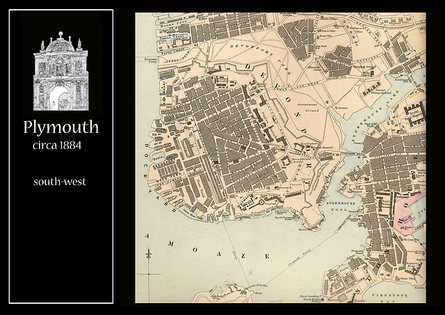
Plymouth map circa 1884 - South-West


These maps come from a gazetteer which has been dated to c1884. It has seen better days; the covers are missing as are the maps of Wales. The counties of England are in a reasonably large scale, sometimes over several sheets. Scotland and Ireland are in a smaller scale. There are larger scale maps of cities and larger towns. There are often overlaps, especially between the north and south of the pages, as they don't fit the landscape format of computer screens.
To see these maps at higher magnification, please use the 'ACTIONS' button, above on the right of the screen, and choose 'See all sizes'.
To see these maps at higher magnification, please use the 'ACTIONS' button, above on the right of the screen, and choose 'See all sizes'.
(deleted account) has particularly liked this photo
- Keyboard shortcuts:
Jump to top
RSS feed- Latest comments - Subscribe to the comment feeds of this photo
- ipernity © 2007-2025
- Help & Contact
|
Club news
|
About ipernity
|
History |
ipernity Club & Prices |
Guide of good conduct
Donate | Group guidelines | Privacy policy | Terms of use | Statutes | In memoria -
Facebook
Twitter

Sign-in to write a comment.