Along Happy Isles Trail, Yosemite National Park, 1…
Downtown Los Angeles from Griffith Park Observator…
Seattle Skyline, June 1980 (060°)
Seattle Skyline, June 1980 (000°)
Rothenburg o.d. Tauber
Bay Windows, San Francisco, Union at Taylor 1980…
Rothenburg o.d. Tauber - Dächer
Erinnerungen an den Sommer / Summer revisited (255…
12 Monate im Kraichgau (180°)
Lower Light Pillar / Untere Lichtsäule
Fog rolling in - Golden Gate, Sept. 1978 (180°)
Devastation Trail - Mauna Loa, Hawaii, Dec. 1980
Waikiki Beach with the old Royal Hawaiian Hotel (T…
Hamburg, St. Nikolai Seitenportal
St Dionys, Esslingen
Im Kaiserdom zu Speyer
Hiking up to Spiterstulen - 24.6.70 (180°)
The Black Canyon of the Gunnison, Sept 22nd, 1990
Rossgumpen Wasserfall (030°)
Body and Soul
Rainy Day
Feet wet? Head cool!
LA Downtown 1980 - Blue Hour I (195°)
Gan Hashlosha, Israel 1975 (300°)
Hamburg Landungsbrücken (255°)
Einkaufswagen mit Winterreifen ;-)
Hamburg, Zollkanal, St. Katharinen und Speichersta…
Another Hour to Seattle - Fraser River Valley, BC,…
Peace River, Alberta, March 21st. 1978 (270°)
Somewhere along the East Coast of Greenland
Seealpsee and Saentis Peak (240°)
Auf dem Weg zum Säntisgipfel / Going for the Summi…
Urnäsch, Schweiz (045°)
Scenic US-163 - The Big Sky, Sept. 14th, 1991 (210…
Goat Rock Beach near Jenner, CA, 1985 (330°)
Dry Owens Lake and High Sierra, March 1980 (315°)
Sierra Wave near Olancha, CA, Febr. 1980 (165°) ..…
Pacific Coast Highway at Bixby Bridge 1978 (000°)
Black and White - El Capitan and (dry) Bridalvail…
Death Valley Dunes, April 1980 (000°)
A classic view - Golden Gate from Hawk Hill, Sept.…
Haleakala Caldera, Maui, Dec. 1980 (120°)
Prairie ... Colorado Route 9, Sept. 22nd, 1990
Enroute to Fairplay, Colorado Rte. 9, Sept. 22nd,…
Rocky Mountains NP - Trail Ridge Road, Sept. 15th,…
1/11 • f/1.0 • ISO 1 •
Zoran Corporation COACH
Location
Lat, Lng:
You can copy the above to your favourite mapping app.
Address: unknown
You can copy the above to your favourite mapping app.
Address: unknown
See also...
Keywords
Authorizations, license
-
Visible by: Everyone -
All rights reserved
- Photo replaced on 28 Nov 2014
-
711 visits
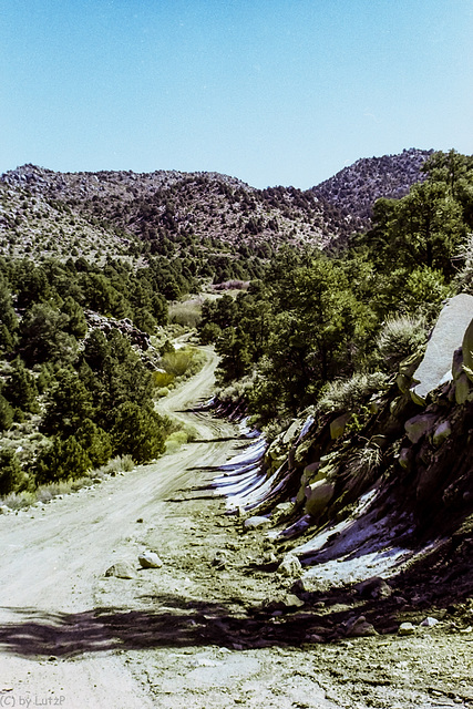
Hunter Mountain Pass Road, March 1980


80 miles dirt road. In times when cellphones were still beyond imagination this trip was a small adventure. This shot was taken close to the summit at almost 2.200m / 7.200 ft. On our way down on the other side we met a park ranger with a 4WD who asked us where we came from. He would not believe that we came over Hunter Mountain with our Toyota Celica Supra. "Can't be done with a car like yours". Well, in retrospect I think he was right, since this was by far not the worst part of the road, but on the other hand we were young and brave! ;-)
, Maria have particularly liked this photo
- Keyboard shortcuts:
Jump to top
RSS feed- Latest comments - Subscribe to the comment feeds of this photo
- ipernity © 2007-2025
- Help & Contact
|
Club news
|
About ipernity
|
History |
ipernity Club & Prices |
Guide of good conduct
Donate | Group guidelines | Privacy policy | Terms of use | Statutes | In memoria -
Facebook
Twitter

Solche und schlechtere Strassen sind wir vor langer Zeit auf griechischen Inseln mit dem Jeep gefahren und vor einigen Jahren auf Fuerteventura...
LutzP club has replied to ©UdoSm clubSign-in to write a comment.