Rocks, minerals and fossils
Folder: Geology and Earth Science
General photos of rocks, minerals, fossils, rock faces, etc.
Bole Hill Plantation - 'holly smelter' slag 2
| |
|
|
Limb Valley Bole Hill lead smelting site
A close-up view of a piece of slag from the 'holly smelter' site slag tip, adjacent to the stone-walled remains of what was almost certainly a lead smelting bole, high up on the northern edge of the Bole Hill Plantation in the Limb Valley, and possibly of 18th or early 19th century age. The slag has a ropy and porous, almost frothy texture, indicative of its former semi-molten condition.
A small square feature, depicting a building or structure of some sort appears on the 1st edition six-inch to one mile Ordnance Survey map published in 1854. It was probably disused even then, as the map shows the plantation all around it. Subsequent editions of the maps fail to show it, although curiously the feature has been resurrected on the latest OS maps, even though the structure has long since disappeared!
There are many 'Bole Hills' in Sheffield and along the west-facing sandstone and gritstone escarpments of the Eastern Edges. Their elevated locations were ideal for wind-blown furnaces ('boles') for smelting lead ore which was brought in by pack-horses from the Peak District mines further to the west.
Bole Hill Plantation - 'holly smelter' slag 1
| |
|
Limb Valley Bole Hill lead smelting site
A close-up view of a piece of slag from the 'holly smelter' site slag tip, adjacent to the stone-walled remains of what was almost certainly a lead smelting bole, high up on the northern edge of the Bole Hill Plantation in the Limb Valley, and possibly of 18th or early 19th century age. The slag has a ropy and porous, almost frothy texture, indicative of its former semi-molten condition.
A small square feature, depicting a building or structure of some sort appears on the 1st edition six-inch to one mile Ordnance Survey map published in 1854. It was probably disused even then, as the map shows the plantation all around it. Subsequent editions of the maps fail to show it, although curiously the feature has been resurrected on the latest OS maps, even though the structure has long since disappeared!
There are many 'Bole Hills' in Sheffield and along the west-facing sandstone and gritstone escarpments of the Eastern Edges. Their elevated locations were ideal for wind-blown furnaces ('boles') for smelting lead ore which was brought in by pack-horses from the Peak District mines further to the west.
Bole Hill Plantation - 'holly smelter' slag tip 2
| |
|
|
Limb Valley Bole Hill lead smelting site
A closer view of the small heap of slag adjacent to the 'holly smelter' site. The holly tree (just out of shot) is growing over the stone-walled remains of what was almost certainly a lead smelting bole, high up on the northern edge of the Bole Hill Plantation in the Limb Valley, and possibly of 18th or early 19th century age. The slag pieces have a ropy and porous, almost frothy texture, indicative of its former semi-molten condition.
A small square feature, depicting a building or structure of some sort appears on the 1st edition six-inch to one mile Ordnance Survey map published in 1854. It was probably disused even then, as the map shows the plantation all around it. Subsequent editions of the maps fail to show it, although curiously the feature has been resurrected on the latest OS maps, even though the structure has long since disappeared!
There are many 'Bole Hills' in Sheffield and along the west-facing sandstone and gritstone escarpments of the Eastern Edges. Their elevated locations were ideal for wind-blown furnaces ('boles') for smelting lead ore which was brought in by pack-horses from the Peak District mines further to the west.
Bole Hill Plantation - 'holly smelter' slag tip 1
| |
|
Limb Valley Bole Hill lead smelting site
The walking stick is located on a small heap of slag adjacent to the 'holly smelter' site on the left. The holly tree is growing over the stone-walled remains of what was almost certainly a lead smelting bole, high up on the northern edge of the Bole Hill Plantation in the Limb Valley, and possibly of 18th or early 19th century age.
A small square feature, depicting a building or structure of some sort appears on the 1st edition six-inch to one mile Ordnance Survey map published in 1854. It was probably disused even then, as the map shows the plantation all around it. Subsequent editions of the maps fail to show it, although curiously the feature has been resurrected on the latest OS maps, even though the structure has long since disappeared!
There are many 'Bole Hills' in Sheffield and along the west-facing sandstone and gritstone escarpments of the Eastern Edges. Their elevated locations were ideal for wind-blown furnaces ('boles') for smelting lead ore which was brought in by pack-horses from the Peak District mines further to the west.
Gravel Bay - calcrete horizon in Moor Cliffs Forma…
| |
|
|
Freshwater West, Gravel Bay and East Pickard Bay
Moor Cliffs Formation in Gravel Bay.
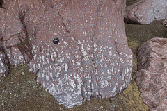
This photo shows an even closer view of a calcrete soil development in mainly reddened mudstone beds in the Moor Cliffs Formation at the western end of Gravel Bay. The white mottled patches are irregular carbonate patches.
The lens cap is 72 mm in diameter.
Background:
The Moor Cliffs Formation overlies the Freshwater East conglomerates, seen in previous photos, and spans the boundary between the Silurian and Devonian periods. It consists of red mudstones and siltstones with occasional thin sandstone beds. These were deposited on a low-reflief floodplain at the edge of an arid continental margin, the sandstones being deposited by seasonal braided streams, the muds and silts deposited in ephemeral marginal lakes. When not inundated, the muds and silts developed carbonate-rich calcrete (caliche) soil horizons along dessication cracks, burrows and early plant root systems.
Gravel Bay - Moor Cliffs Formation with calcretes…
| |
|
|
Freshwater West, Gravel Bay and East Pickard Bay
Moor Cliffs Formation in Gravel Bay.
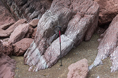
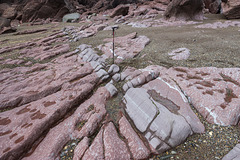
This photo shows a closer view of the mainly reddened mudstone beds in the Moor Cliffs Formation at the western end of Gravel Bay. The white mottling in the mudstones shows extensive calcrete soil horizons. The sequence is dipping to the north (right) at approx. 65°.
The walking stick is about 0.9 m long.
Background:
The Moor Cliffs Formation overlies the Freshwater East conglomerates, seen in previous photos, and spans the boundary between the Silurian and Devonian periods. It consists of red mudstones and siltstones with occasional thin sandstone beds. These were deposited on a low-reflief floodplain at the edge of an arid continental margin, the sandstones being deposited by seasonal braided streams, the muds and silts deposited in ephemeral marginal lakes. When not inundated, the muds and silts developed carbonate-rich calcrete (caliche) soil horizons along dessication cracks, burrows and early plant root systems.
Gravel Bay - Moor Cliffs Formation with calcretes…
| |
|
Freshwater West, Gravel Bay and East Pickard Bay
Moor Cliffs Formation in Gravel Bay.
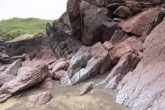
This photo shows the mainly reddened mudstone beds in the Moor Cliffs Formation at the western end of Gravel Bay. The white mottling in the mudstones shows extensive calcrete soil horizons. The sequence is dipping to the north (right) at approx. 65°.
The walking stick is about 0.9 m long.
Background:
The Moor Cliffs Formation overlies the Freshwater East conglomerates, seen in previous photos, and spans the boundary between the Silurian and Devonian periods. It consists of red mudstones and siltstones with occasional thin sandstone beds. These were deposited on a low-reflief floodplain at the edge of an arid continental margin, the sandstones being deposited by seasonal braided streams, the muds and silts deposited in ephemeral marginal lakes. When not inundated, the muds and silts developed carbonate-rich calcrete (caliche) soil horizons along dessication cracks, burrows and early plant root systems.
Gravel Bay - millipede-like burrows in Moor Cliffs…
| |
|
|
Freshwater West, Gravel Bay and East Pickard Bay
Moor Cliffs Formation in Gravel Bay.
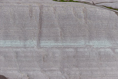
This photo shows a close-up view of the light purple sandstone bed with greenish laminae seen in the previous photo. The darker perpendicular features in the sandstone are trace-fossil Beaconites burrows. Having previously been tentatively ascribed to worm burrows or lung-fish burrows, they are now thought to have been made by primitive millipede-like animals.
The bed is approx. 50 cm thick (top to bottom) in this photo.
Background:
The Moor Cliffs Formation overlies the Freshwater East conglomerates, seen in previous photos, and spans the boundary between the Silurian and Devonian periods. It consists of red mudstones and siltstones with occasional thin sandstone beds. These were deposited on a low-reflief floodplain at the edge of an arid continental margin, the sandstones being deposited by seasonal braided streams, the muds and silts deposited in ephemeral marginal lakes. When not inundated, the muds and silts developed carbonate-rich calcrete (caliche) soil horizons along dessication cracks, burrows and early plant root systems.
Gravel Bay - Moor Cliffs Formation 2
| |
|
|
Freshwater West, Gravel Bay and East Pickard Bay
Moor Cliffs Formation in Gravel Bay.
This photo shows a closer view of the wave cut platform in the Moor Cliffs Formation at the western end of Gravel Bay. A light purple sandstone bed with greenish laminae is seen in the centre of the photo with red mudstones below (left) and above (right). The darker perpendicular features in the sandstone are trace-fossil Beaconites burrows. Having previously been tentatively ascribed to worm burrows or lung-fish burrows, they are now thought to have been made by primitive millipede-like animals.
The white mottling in the mudstones indicate extensive calcrete soil horizons. The sequence is dipping to the north (right) at approx. 60°.
The walking stick is about 0.9 m long.
Background:
The Moor Cliffs Formation overlies the Freshwater East conglomerates, seen in previous photos, and spans the boundary between the Silurian and Devonian periods. It consists of red mudstones and siltstones with occasional thin sandstone beds. These were deposited on a low-reflief floodplain at the edge of an arid continental margin, the sandstones being deposited by seasonal braided streams, the muds and silts deposited in ephemeral marginal lakes. When not inundated, the muds and silts developed carbonate-rich calcrete (caliche) soil horizons along dessication cracks, burrows and early plant root systems.
Conglomerate at Gravel Bay: close-up view 2
| |
|
|
Freshwater West, Gravel Bay and East Pickard Bay
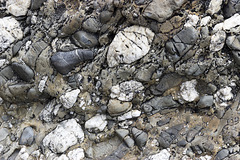
Another close-up view of a conglomerate in the Freshwater East Formation (note name) at Gravel Bay, situated at the northern end of the large Freshwater West bay in south Pembrokeshire. The view is closely adjacent to the previous photo but without the lens cap for scale, as I didn't want it to distract from the lovely textures in this rock.
The vertical dimension of the photo is about 40 cm.
The Freshwater East Formation marks the beginning of 'Old Red Sandstone' type of sediments, formerly believed to be at the base of the Devonian, but now assigned to the uppermost Silurian. The pebbles and cobbles in the conglomerates mostly consist of white vein quartz and quartzite, grey sandstones and darker sitstones. These were depositied in an alluvial fan settting on a shallow floodplain in increasingly arid conditions.
Conglomerate at Gravel Bay: close-up view 1
| |
|
Freshwater West, Gravel Bay and East Pickard Bay
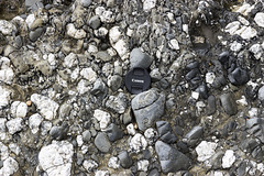
Close-up view of a conglomerate in the Freshwater East Formation (note name) at Gravel Bay, situated at the northern end of the large Freshwater West bay in south Pembrokeshire. The lens cap is 72 mm in diameter.
The Freshwater East Formation marks the beginning of 'Old Red Sandstone' type of sediments, formerly believed to be at the base of the Devonian, but now assigned to the uppermost Silurian. The pebbles and cobbles in the conglomerates mostly consist of white vein quartz and quartzite, grey sandstones and darker sitstones. These were depositied in an alluvial fan settting on a shallow floodplain in increasingly arid conditions.
Conglomerates at Gravel Bay
| |
|
|
|
Freshwater West, Gravel Bay and East Pickard Bay
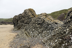
Massive conglomerates and grey sandstones dipping steeply to the north (right) of the Freshwater East Formation (note name) at Gravel Bay, situated at the northern end of the large Freshwater West bay in south Pembrokeshire. The walking stick is 0.9 m long.
The Freshwater East Formation marks the beginning of 'Old Red Sandstone' type of sediments, formerly believed to be at the base of the Devonian, but now assigned to the uppermost Silurian. The pebbles and cobbles in the conglomerates mostly consist of white vein quartz and quartzite, grey sandstones and darker sitstones. These were depositied in an alluvial fan settting on a shallow floodplain in increasingly arid conditions.
Nolton Haven channel lag deposit in beach boulder…
| |
|
Nolton Haven to Newgale
The small Nolton-Newgale coalfield is separated by faulting from the main Pembrokeshire coalfield. It lies mostly within Pennant Sandstone Formation of the Upper Coal Measures rocks.
The cliffs of Nolton Haven expose predominantly deltaic channel sandstones, often with highly erosive bases with coarse, rip-up, channel-lag deposits. The general dip is around 20° to the south-west.
This photo shows a cross-section view of a locally derived beach boulder consisting of a channel lag deposit with ironstone pebbles and fragments set in a pale grey coarse sandstone matrix. The boulder is approx. 50 cm thick.
Nolton Haven channel lag deposit in beach boulder…
| |
|
Nolton Haven to Newgale
The small Nolton-Newgale coalfield is separated by faulting from the main Pembrokeshire coalfield. It lies mostly within Pennant Sandstone Formation of the Upper Coal Measures rocks.
The cliffs of Nolton Haven expose predominantly deltaic channel sandstones, often with highly erosive bases with coarse, rip-up, channel-lag deposits. The general dip is around 20° to the south-west.
This photo shows the uoper surface of a locally derived beach boulder consisting of a channel lag deposit with ironstone pebbles and fragments set in a pale grey coarse sandstone matrix.
Nolton Haven channel sandstones 3
| |
|
Nolton Haven to Newgale
The small Nolton-Newgale coalfield is separated by faulting from the main Pembrokeshire coalfield. It lies mostly within Pennant Sandstone Formation of the Upper Coal Measures rocks.
The cliffs of Nolton Haven expose predominantly deltaic channel sandstones, often with highly erosive bases with coarse, rip-up, channel-lag deposits. The general dip is around 20° to the south-west.
This photo shows planar laminated sandstones with an erosive base resting on the underlying sandstone unit. Planar laminated sandstones in this setting often indicate high energy, fast current flow.
The photo is approx. 60 cm from top to bottom.
Nolton Haven channel sandstones 2
| |
|
Nolton Haven to Newgale
The small Nolton-Newgale coalfield is separated by faulting from the main Pembrokeshire coalfield. It lies mostly within Pennant Sandstone Formation of the Upper Coal Measures rocks.
The cliffs of Nolton Haven expose predominantly deltaic channel sandstones, often with highly erosive bases with coarse, rip-up, channel-lag deposits. The general dip is around 20° to the south-west.
This photo shows planar laminated sandstones with an erosive base (marked by the walking stick handle) cutting into the underlying sandstone unit. Planar laminated sandstones in this setting often indicate high energy, fast current flow.
The walking stick is 90 cm long.
Nolton Haven channel sandstones
| |
|
Nolton Haven to Newgale
The small Nolton-Newgale coalfield is separated by faulting from the main Pembrokeshire coalfield. It lies mostly within Pennant Sandstone Formation of the Upper Coal Measures rocks.
The cliffs of Nolton Haven expose predominantly deltaic channel sandstones, often with highly erosive bases with coarse, rip-up, channel-lag deposits. The general dip is around 20° to the south-west.
This photo shows planar laminated sandstones with an erosive base (marked by the walking stick handle) cutting into the underlying sandstone unit. The walking stick is 90 cm long.
Nolton Haven sandstone channel scours
| |
|
Nolton Haven to Newgale
The small Nolton-Newgale coalfield is separated by faulting from the main Pembrokeshire coalfield. It lies mostly within Pennant Sandstone Formation of the Upper Coal Measures rocks.
The cliffs of Nolton Haven expose predominantly deltaic channel sandstones, often with highly erosive bases with coarse, rip-up, channel-lag deposits. The general dip is around 20° to the south-west.
This photo shows laminated sandstones with two scoured channel bases cutting into the underlying channel-lag deposits. The walking stick is 90 cm long.
Jump to top
RSS feed- Latest items - Subscribe to the latest items added to this album
- ipernity © 2007-2024
- Help & Contact
|
Club news
|
About ipernity
|
History |
ipernity Club & Prices |
Guide of good conduct
Donate | Group guidelines | Privacy policy | Terms of use | Statutes | In memoria -
Facebook
Twitter


