

Mam Tor landslip, Derbyshire
Mam Tor landslip - old A625 road
Mam Tor landslip - old A625 road
Landslip and Cement Works
Fern points
Fern points inverted
Spiral fern 1
Spiral fern 2
Back Tor
Edale illuminations
Hope Valley from Mam Tor
Lose Hill Ridge from Mam Tor
Lose Hill Ridge from Mam Tor
Mam Tor face
Rushup Edge and Lord's Seat from Mam Tor
Rushup Edge and Lord's Seat from Mam Tor
Lighting up the Seat of the Lord
South from Mam Tor
Winnats from Mam Tor
Ynys Penpleidiau, Pembrokeshire
Pillow lavas on Strumble Head, Pembrokeshire
Hogweed seedhead 2
Hogweed seedhead 1
The Experimental Cloning Clinic wasn't proving as…
Sheffield Symmetry
Stanage sunset
Evening grindstones
Woodland clearing
Ex tenebris lux
Red light
Edge of darkness
You lookin' at me?
Clouds, trees and grass
Beeches again
Another view
Low tide at Lytham
Ribble estuary from Lytham
Sphalerite
First inversion
Root position
Section
Middlesection
Mosaic
Lewes structure
Llanmadoc Hill and Llangennith, from Rhosili Down,…
1/25 • f/6.3 • 17.0 mm • ISO 100 •
Canon EOS 350D DIGITAL
Location
Lat, Lng:
You can copy the above to your favourite mapping app.
Address: unknown
You can copy the above to your favourite mapping app.
Address: unknown
See also...
Keywords
Authorizations, license
-
Visible by: Everyone -
All rights reserved
-
297 visits
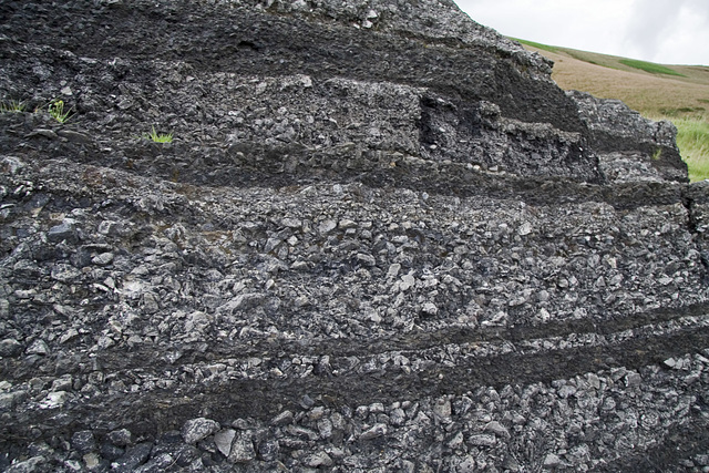
Section of the old A625 road on the Mam Tor landslip, Derbyshire

Originally uploaded for the Guesswhere UK group.
This is a section of the old A625 Sheffield to Chapel-en-le-Frith road at the foot of Mam Tor in the Peak District. The road was built across an extensive active landslip area and was in constant need of repair. The photo shows the repetitive layers of successive repairs made to this section. The road was finally closed in 1979.
The landslip first formed about 3000 years BP, on an oversteepened slope left after Devensian periglacial period. There is an 80 m high back scar in formed in the Mam Tor Beds.
The toe of the landslip is still active today, moving at up to 2 metres per year in places.
- Keyboard shortcuts:
Jump to top
RSS feed- Latest comments - Subscribe to the comment feeds of this photo
- ipernity © 2007-2026
- Help & Contact
|
Club news
|
About ipernity
|
History |
ipernity Club & Prices |
Guide of good conduct
Donate | Group guidelines | Privacy policy | Terms of use | Statutes | In memoria -
Facebook
X

Sign-in to write a comment.