


New Mexico

Folder: Other West
Various trips to New Mexico, one of my favorite states for exploring.
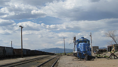
Silver City, NM (145)
| |
|
The odd looking rectangular structure on the far right side of the picture is part of the engine housing from a locomotive.
Best viewed as part of New Mexico set.

Silver City, NM 3178a
| |
|
|
To the west of the area seen in the initial Chino Mine picture (see adjacent) is a part of the mine that is very close to the highway (NM 152), and there is an observation area, which is where these pictures were taken.
Best viewed as part of New Mexico set.

Silver City, NM 3182a
| |
|
Chino Mine. To give a sense of the depth, there is a pickup truck coming out of the curve in the upper part of the picture.
Best viewed as part of New Mexico set.
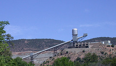
Silver City, NM 3187a
| |
|
Active mining area just north of Chino Mine (see nearby pictures).
Best viewed as part of New Mexico set.

Silver City, NM 3188a
| |
|
Just north of the Chino mine (adjacent pictures) is another mining area where there seems to be a combination of older abandoned mines, and very new mines.
Best viewed as part of New Mexico set.
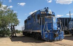
Silver City, NM (144)
| |
|
|
East of Silver City there was a small train yard where locomotives were apparently being dismantled and recycled.
Best viewed as part of New Mexico set.
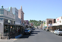
Silver City, NM 3183a
| |
|
At various points over the years I've run into references about interesting cliff dwellings, camping, trails, and hot springs in Gila National Forest, and particularly in the area near Silver City, NM. Based on what I'd read and heard, I had this image of an exciting and relatively primitive, but accessible, area to explore. As happens, images often don't quite meet with reality -- the area wasn't anything like what I expected, but it was still very enjoyable to visit and explore.
The first fantasy to get destroyed was camping. Since I camp alone, I don't usually cook and thus my preference is for the campground to be within 10 - 20 miles of some diner or local restaurant where I can go to eat and meet locals. Also, since part of my traveling is to meet and talk with other travelers, I prefer campgrounds that aren't too crowded but where there are a few other campers. And, I prefer campgrounds where there is at least some form of a toilet (an outhouse is okay) and an accessible flat place to sleep. The public campgrounds near Silver City didn't meet any of these criteria -- they were too far out to get back in easily for breakfast, had only a couple of tent sites, and were very primitive (no toilet, very uneven ground). So, I ended up staying at the KOA in Silver City, which ended up being much more enjoyable than my previous experiences with KOA's. The camp site was fine, the showers were clean, the people were friendly, and ended up having some invigorating political discussions -- the only problem was that the KOA was just off the highway and not exactly a rustic experience.
Silver City itself was also not quite what I expected. There was an older downtown area of historic buildings that was similar to older mining towns I've visited. But then there was the relatively suburban sprawl that stretched several miles to the east, complete with multiple "big box" stores (e.g., WalMart, Home Depot) and chain restaurants. I should have also interpreted the name of the town more literally -- the area has some of the largest open pit mines that I've ever seen. But, I learned quickly -- if I went to the older downtown section where there were refurbished historic structures, I didn't feel like I was in "just another suburbia," and there was plenty to explore.
It was difficult to find a good angle to capture the essence of the older part of Silver City, so this is the only picture. BUT, the architecture was interesting, the people that I encountered were friendly, and the restaurants were quite good.
Best viewed as part of New Mexico set.
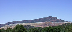
Silver City, NM mining
| |
|
Taking one of the alternate routes from the cliff dwellings back towards Silver City, you come to one of the world's largest copper mines -- the Chino Mine. The Silver City area has been mined extensively for various metals since the late 1800's, and open pit mining at this site has been going on since the early 1900's. The mine is expected to close within the next few years, and there is debate about how to reclaim the mine area.
Best viewed as part of New Mexico set.

Socorro, NM 3299a
| |
|
Restored (and rebuilt) mission in Socorro, NM. Socorro is west of Carrizozo. Unfortunately I had very little time to explore Socorro -- what I saw looked quite interesting.
Best viewed as part of New Mexico set.

Socorro, NM 3301a
| |
|
Downtown Socorro had many well-preserved buildings, and a pleasant public square.
Best viewed as part of New Mexico set.
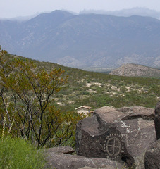
Three River Petroglyphs NM (3257)
| |
|
Petroglyphs at Three Rivers Petroglyphs, between Alamogordo and Carrizozo.
Best viewed as part of New Mexico set.
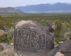
Three Rivers Petroglyphs (3245)
| |
|
About 30 miles north of Alamogordo, in what appears to be a very barren area, is Three Rivers Petroglyphs. Getting there is fairly easy, but the area was very empty of tourists, so you can enjoy it pretty much on your own. The petroglyphs date from 900 to 1400 AD, though there are clearly some markings that were made by more recent explorers through the area.
Best viewed as part of New Mexico set.

Three Rivers Petroglyphs (3250)
| |
|
|
Petroglyphs at Three Rivers Petroglyphs, between Alamogordo and Carrizozo.
Best viewed as part of New Mexico set.
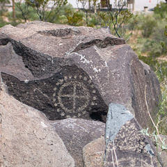
Three Rivers Petroglyphs (3256)
| |
|
Petroglyphs at Three Rivers Petroglyphs, between Alamogordo and Carrizozo.
Best viewed as part of New Mexico set.
Three Rivers Petroglyphs 3249a
| |
|
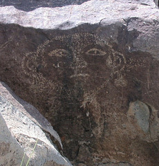
Petroglyphs at Three Rivers Petroglyphs, between Alamogordo and Carrizozo.
Best viewed as part of New Mexico set.

Three Rivers Petroglyphs 3254a
| |
|
Petroglyphs at Three Rivers Petroglyphs, between Alamogordo and Carrizozo.
Best viewed as part of New Mexico set.

US 60 3302a
| |
|
The sort of landscape that is dramatic when driving, but difficult to capture in photos. On US 60 between Socorro and Magdalena. Best viewed as part of New Mexico set.

US180 (3326)
| |
|
An abandoned steel truss bridge alongside US 180 near the road to Mogollon, New Mexico.
Jump to top
RSS feed- Latest items - Subscribe to the latest items added to this album
- ipernity © 2007-2026
- Help & Contact
|
Club news
|
About ipernity
|
History |
ipernity Club & Prices |
Guide of good conduct
Donate | Group guidelines | Privacy policy | Terms of use | Statutes | In memoria -
Facebook
X
