

Traktor 49's favorite photos
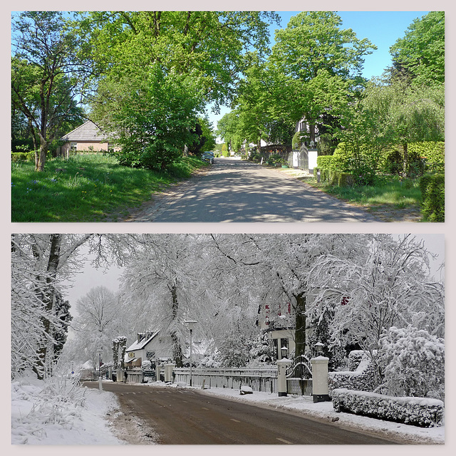

Nederland - Hoog Soeren
Hoog Soeren: quiet village during ( ↑ ) and before ( ↓ ) the corona crisis.
Even before the beginning of our era, Germanic tribes had settlements in the area where the village of Hoog Soeren is situated. The early 20th century excavated urns from burial mounds are reminders of this. Hoog Soeren is one of the oldest settlements in the Veluwe and originated on high dry parts of the Veluwe. The proximity of some fens made an existence here possible.
Early 9th century the village was mentioned as Suornom or Suornum. It had several other names before the village became in the mid 19th century its current name. This may be derived from the Old Saxon “sôr”, which means “arid” or “dry”. Not strange as Hoog Soeren is located on a height of 85 meters, a high and dry part of the Veluwe, the largest nature area in the Netherlands.
Hoog Soeren is surrounded by the woods of the Kroondomein Het Loo (Het Loo Royal Estate) and is a protected village area. It has only three paved roads with a name, all other houses along dirt roads have as address the name of the village with a number.
Until the end of the 19th century, Hoog Soeren was an agricultural community, which developed into a settlement for forest workers, foresters and gamekeepers. In the 1930’s many local people had to sell their farm and land. From that period on, a village with civilian houses gradually came into being and became a popular settlement for wealthy people from the western part of the country. A number of farms were transformed into residential houses, but many new houses were built as well. In the first half of the 19th century the area also became a tourist attraction - with some hotels and guesthouses - and an attractive place to live and stay for wealthy people.
Nowadays Hoog Soeren has about 250 permanent inhabitants, living in 100 houses. It has no school either a shop, but a lovely little village church, which was built in 1904.
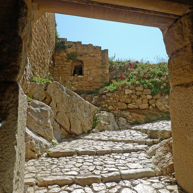
Greece - Acrocorinth
Acrocorinth was the fortified acropolis (“upper city”) of both Ancient and Medieval Corinth. It was built on a steep, rocky hill 575 meters high at the highest peak. Acrocorinth is a typical example of castle architecture built in successive phases. Three successive defensive walls lead via an equal number of gates to the interior, covering 240.000 square meters. The ruins of the temple of Aphrodite (5th-4th century BC), several Christian churches, a Byzantine underground cistern, mosques, fountains etc. still survive. The perimeter walls have a length of 3.000 meters, making it the largest fortress in the Peloponnesos.
The first phase in the history of the walls dates to the 7th-6th century BC, which was a time of prosperity for the city of Corinth. In 146 BC the walls were destroyed by the Romans. Substantial efforts at fortification were made in the Middle Byzantine period (8th-12th century). In the year of 1210 the castle was taken by the Franks.
Over the following centuries numerous repairs and improvements were made, by both the Franks and the Palaeologi, at a time when the city of Corinth seems to have moved inside the castle. Works were also carried out by the Ottoman conquerors and by the Venetians, who reinforced parts of the walls during the second Venetian occupation (1687-1715). More recently, there was a German garrison stationed there during World War II invasion of Greece from May 1941.
Nowadays Acrocorinth is not only a particularly interesting archaeological site. Most of the current towers and walls are medieval, but built on ancient foundations. Due to its location it also offers uninterrupted panoramic views across Ancient Corinth , the new coastal city of Corinth and the Corinthian Gulf.
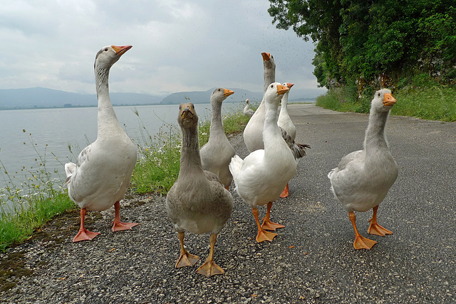
Greece - Ioannina, Nisi
Nisi (or Nissi) is a small island - 800 by 500 meters - in Lake Pamvotis nearby Ioannina. It is one of the two lake islands in Greece, which are inhabited. There is only one village - with a couple of hundreds of inhabitants - on the island which with picturesque paved alleys and a lot of tourist shops and restaurants. The island is accessible by boat from Ioannina or by a ferry from a nearby shore.
Nisi is well known for the Ali Pasha Museum and its monasteries. The first one was built at the end of the 13th century and the island was important monastic center. We visited one of them in 2018 (PiP1). A year later we went back to the island, for a lunch on the central square (PiP2). After that we made a walk along the banks of the lake, enjoying the flowers (PiP3), reed collars and lush vegetation, but a group of pretty aggressive geese (main image) almost blocked the road.
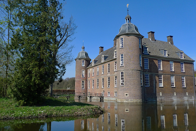
Nederland - Doetinchem, Kasteel Slangenburg
Kasteel Slangenburg (Slangenburg Castle) was founded in 1234, but first mentioned in 1354. In the 17th century the castle became the property of Frederik Johan van Baer - a Dutch officer in the military service of Willem III van Oranje - who rebuilt it in 1675 for residential purposes.
After Van Baer the Slangenburg has changed hands many times, mostly by inheritance, but twice by sale. The last sale took place in 1895 when the German timber merchant and large industrialist Arnold Passmann took over the castle and adjoining estate. In the beginning only because of the large amount of wood that could be cut there. However, when he visited his new purchase, Passmann was struck by the house and its surroundings and decided to live there every year for some months. Members of the Passmann family are buried in a private cemetery next to the moat of the castle.
After World War II all German properties were confiscated by the Dutch government, who thus acquired the castle, which stills forms part of the portfolio of the Rijksgebouwendienst (Royal Buildings Service). Nowadays the castle is used as a guesthouse by the nearby Benedictine Sint-Willibrordsabdij . This monastery was built in the 1950’s and is situated on a part of the castle's former estate.
The name Slangenburg most probably derived from a small stream Slingebeek that flows through the area.
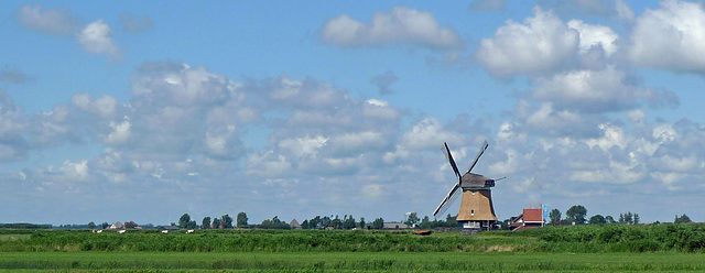
Nederland - Krommenie, De Woudaap
The exact year of construction the octagonal polder windmill De Woudaap is not known, but on 14 March 1651 a permit was granted for the embankment of the peat bog area the Woudpolder , then called De Wouden . De Woudaap must have been built in or shortly after 1651. After construction of the mill the excess water of the polder could be pumped away and the meadows could be put to better use.
In 1864, De Woudaap was given a screw instead of a scoop wheel, which increased the capacity of the mill. The polder mill was kept in operation professionally until the year 2002. With the death of the last miller in that year this came to an end. In 2008 a new electric pumping station was built, which takes care of the water management of the polder.
De Woudaap itself is nowadays put into operation on a voluntary basis. The mill is fully operational and will contribute to the drainage whenever it is possible or necessary. The mill can handle up to 70m³ of water per minute.
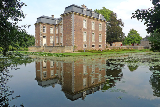
Nederland - Voerendaal, Kasteel Cortenbach
Kasteel Cortenbach (Cortenbach Castle) and its farmhouse are dating back to the 14th century. Remains of this original castle are the two round towers, which were built with a locally found stone. These towers probably were the corner towers of the outer bailey.
The current castle was built around the year 1713 as a mansion by the merchant “Herman Lamberts” from Aachen. He was lord of Cortenbach since 1682. In 1776 large parts of the castle were rebuilt again. In 1869 the last widow of the Dutch line of the “De Lamberts de Cortenbach” family died at the castle.
Kasteel Cortenbach is one of five castles in the village of Voerendaal. Since 1988 it is private property, housing the main office of a company; hence it is not open for public. The castle is a national monument.
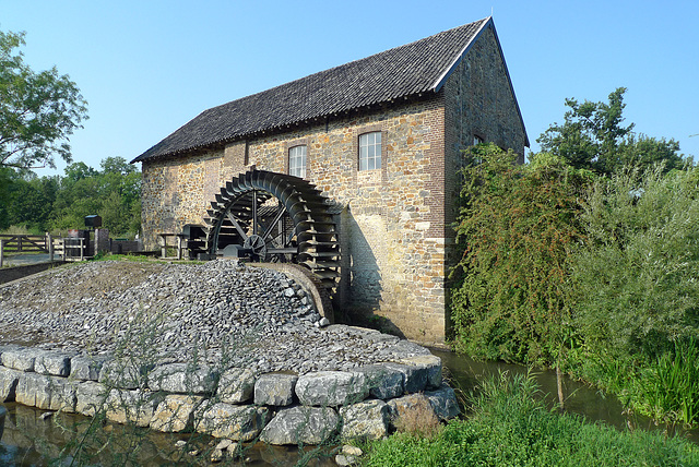
Nederland - Epen, Volmolen
One of the most well-known building in the valley of the river Geul is probably the Volmolen just outside the village of Epen. The mill was part of the broadcloth industry in Vaals. Because of the location of the mill on the Geul, there was an abundance of water available for vollen - that’s why the mill is named Volmolen - the fulling of the wool. There was not such a large amount of water in the vicinity of Vaals.
The history of the Epener mill dates back to the 17th century. In 1680 there was already talk of an oil mill. Later it is said to have been used as a bark mill. It was only in the last decades of the 18th century that it became a fulling mill.
The urine and rancid butter needed for the fulling process was discharged into the river Geul after use. So it is not strange that the Volmolen was built outside the village centre of Epen. The complex is situated between the Geul and a dug mill brook. Water is pumped up into the brook to increase the decay of the water at the waterwheel. The buildings, a mill house and a farm with attached barns, surround a courtyard. The walls of the buildings are built in various types of locally broken stone.
In 1872 the mill was converted into a flour mill. After several renovations and restorations the Volmolen was put into a flour mill in 1977. The mill is now owned by the Vereniging tot Behoud van Natuurmonumenten (Society for Preservation of Nature Monuments in the Netherlands). A foundation for the exploitation of the mill has a contract with a group of bakers for the supply of flour.
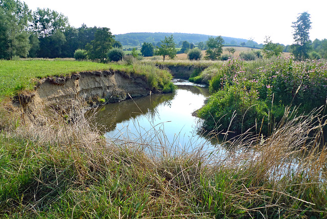
Nederland - Epen, Geuldal
The Geul is a river that has its source in Belgium, about 300 meters above sea level near the German border. It flows about 20 kilometers in Belgium before enterig the Netherlands. After a further 38 kilometers through the most southern part of the province of Limburg the Geul flows into the Meuse, north of the city of Maastricht. A drop of more than 240 meters makes it to the fastest-flowing river of the Netherlands. Along the way the river gets water from no less than one hundred and thirty side streams.
The valley of the Geul in the Netherlands is a breathtaking piece of (more or less) unspoilt nature. Areas with meadows are interspersed with wooded slopes of the ‘mountains’ of southern Limburg. The valley with the meandering Geul offers cultural highlights and architectural, like quaint villages with half-timbered (farm)houses, watermills, churches and castles.
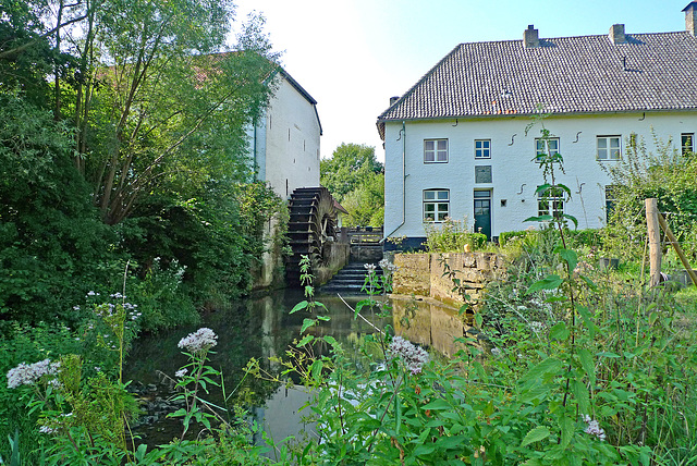
Nederland - Mechelen, Bovenste Molen
The Bovenste Molen (Upper Mill) - formerly also known as Wolfsmolen - is located at the river Geul in the hamlet of Höfke near the village of Mechelen. It is a centre mill. Downstream in the same town there is another mill, which is logically referred to as the Onderste Molen (Lower Mill).
The location at the Geul seems to be very suitable, as a water mill has been standing here for 750 years. The oldest building tracks in the present building date from the 15th century. In French times the mill was confiscated and sold publicly.
Throughout the centuries the mill has served as a paper mill, flour mill and artificial wool mill. Artificial wool was made from disintegrated rags mixed with sheep's wool. The Bovenste Molen was a banmolen (mill soke). The inhabitants of the lord's territory were only allowed to have their grain ground in this mill. This in turn, of course, provided additional income for the landlord, who could levy tax on the grain.
Since 1979 the mill is owned by the Vereniging tot Behoud van Natuurmonumenten (Society for Preservation of Nature Monuments in the Netherlands). Nowadays the mill is no longer in operation.
Jump to top
RSS feed- Latest favorites - Subscribe to the favorite docs of Traktor 49
- ipernity © 2007-2026
- Help & Contact
|
Club news
|
About ipernity
|
History |
ipernity Club & Prices |
Guide of good conduct
Donate | Group guidelines | Privacy policy | Terms of use | Statutes | In memoria -
Facebook
X
