


Patagonia

Folder: Latin America
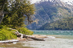
Lago Rivadavia
| |
|
|
|
Lago Rivadavia is a lake of glacial origin and part of Los Alerces National Park
es.wikipedia.org/wiki/Parque_nacional_Los_Alerces
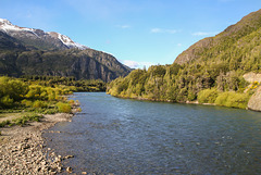
Río Futaleufú
| |
|
|
|
View east over Río Futaleufu. Just behind the bridge is the Argentinean border post followed by the Chilean Avanzada El Limite (see inset photos).
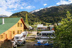
Futaleufú in spring
| |
|
|
|
View from Hotel El Barranco. Futaleufu (~2000 inhabitants) is the adminstrative capital of Palena province and a centre of white water rafting on Futaleufu river.
HFF everybody!
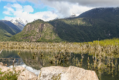
Río Futaleufú
| |
|
|
|
Río Futaleufú makes a big bend before draining into Lago Yelcho. The river in its changing course- probably caused by earthquakes- has drowned a lot of trees but vegetation is clawing its way back (see inset photos).
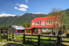
Café Rossbach - Puyuhuapi
| |
|
|
|
The village of Puyuhuapi was founded in the 1930s by families Uebel, Ludwig and Hopperdietzel from the village of Rossbach (Hranice) in Sudetenland (an area of German settlement in the Czech republic). More family members came in 1947 after WW2.
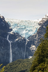
Ventisquero colgante
| |
|
|
|
Ventisquero Colgante is the main attraction of Queulat National Park. Although the park covers 1541 km² only small sections along Ruta 7 (Carretera Austral) are open to the public, the large part is undisturbed rainforest, mountains and glacier.
The hanging glacier originates from a small 80 km² icefield and can often be heard and seen calving into the lagoon below it. On our visit a large chunk broke off, sadly we were in the forest at the time and the trees were in the way of a decent photo.
The inset photos are from the eastern viewpoint
and from Laguna de los Témpanos (the footpath to the western mirador was closed).
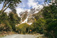
Carretera Austral
| |
|
|
|
Legendary Carretera Austral runs through Queulat National Park. After climbing Altos de Queulat in a series of hairpin bends it drops into Cisnes Valley. This photo was taken in Sector Portezuelo south of the pass.
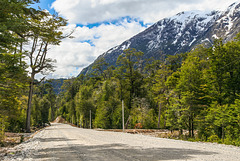
Carretera Austral
| |
|
|
|
Ruta 7 between Villa Amengual and Villa Mañihuales just south of RN Laguna Las Torres. This stretch of road has already been widened prior to being asphalted. The new rough gravel isn't exactly kind to car tyres;-)
Inset photo: mountains to the west of the road
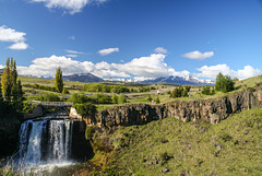
Salto del Rio Pollux
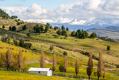
Patagonian spring
| |
|
|
|
Rural landscape near Balmaceda, south of Coyhaique. The woods which used to cover the area have been burned down to create pastures for sheep- tree stumps and logs can still be seen, also some trees that escaped;-)
HFF and happy All Fools' Day!
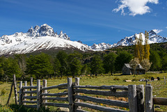
Cerro Castillo
| |
|
|
|
Cerro Castillo (2318 m) is part of Reserva Nacional Cerro Castillo which was created in 1970 to protect native species, among them the acutely endangered huemul (south andean deer).
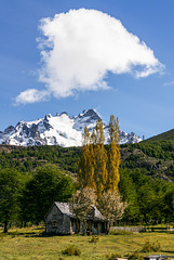
Abandoned
| |
|
|
|
Following the 1991 eruption of Cerro Hudson many farmers had to give up because virtually all their cattle and sheep suffocated under the ashes.
HFF and happy Easter everybody!
River valley
| |
|
|
|
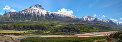
2675m high Cerro Castillo seen from Carretera Austral across Río Ibáñez valley. The basalt buttresses of Cerro Castillo are the centrepiece of Reserva Nacional Cerro Castillo.
Stitched from 2 photos originally not intended as a panorama.
Inset photos show a closer view of Cerro Castillo and some Patagonian spring flora (anemones) growing where this photo was taken.
Cerro Castillo Panorama
| |
|
|
|
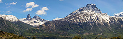
Cerro Palo (ca. 2200m) and Cerro Castillo (2675m) seen across the valley of Río Ibáñez.
Panorama stitched from 2 photos
Inset photo: Cerro Palo
Rio Ibáñez
| |
|
|
|
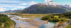
88 km long Río Ibáñez originates near Cerro Hudson and drains into Lago General Carrera. In the 1991 Hudson eruption lahars ran down the valley, clogged it up and changed the course of the river. Because of Pinatubo earlier in 1991 the not much smaller Hudson eruption received hardly any international news coverage at the time.
Panorama stitched from 2 photos.
The inset shows the drowned trees of Bosque Muerto a bit further upstream.
Paso Roballos
| |
|
|
|
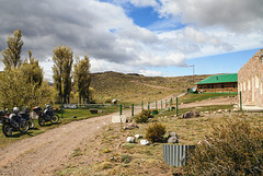
Paso Roballos is one of the most isolated border crossings between Argentina and Chile, reached by gravel roads from Cochrane through Valle Chacabuco on the Chilean side and from Bajo Caracoles on the Argentinean side. From the Chilean border post- run by Carabineros, not the Policia de Investigaciones as usual- (see first inset) you cross some 10 kms of no man's land before reaching the Argentinean border controls.
Paso Roballos ist einer der abgelegensten Grenzübergänge zwischen Argentinien und Chile, der von beiden Seiten nur über Schotterpisten erreichbar ist, auf chilenischer Seite von Cochrane aus über das Valle Chacabuco und auf argentinischer Seite von Bajo Caracoles aus. Zwischen dem chilenischen Grenzposten (erstes PiP), der anders als üblich nicht von der Policia de Investigaciones, sondern von den Carabineros kontrolliert wird, und dem argentinischen Posten liegen mehr als 10 km Niemandsland.
HHF everybody!
Lago Posadas
| |
|
|
|
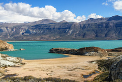
Lago Posadas is a glacial lake in the northern part of Santa Cruz province in Patagonia. It is bordered by glacial moraines and multi coloured volcanic tuffs. Only a narrow isthmus divides it from much larger and deeper Lago Pueyrredón (chil. Lago Cochrane). en.wikipedia.org/wiki/Posadas_Lake
Lago Posadas ist ein türkisfarbener Gletschersee im Norden der argentinischen Provinz Santa Cruz, der von Moränen umgeben ist. Im Osten schließen sich bunte vulkanische Tuffe an. Nach Westen ist der See nur durch einen schmalen Isthmus vom deutlich größeren und tieferen Lago Pueyreddón (in Chile: Lago Cochrane) getrennt.
Bajo Caracoles
| |
|
|
|
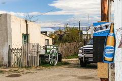
Bajo Caracoles had 33 inhabitants in the 2010 census, a hotel/shop and a filling station. It's an important stop on Ruta 40 because filling stations are far and between.
HFF!
Jump to top
RSS feed- Latest items - Subscribe to the latest items added to this album
- ipernity © 2007-2026
- Help & Contact
|
Club news
|
About ipernity
|
History |
ipernity Club & Prices |
Guide of good conduct
Donate | Group guidelines | Privacy policy | Terms of use | Statutes | In memoria -
Facebook
X
