Gudrun's photos

Fjallsárlón and Fjallsjökull
| |
|
|
|
Fjallsjökull like other glaciers has receded, creating a glacier lagoon with icebergs calving into it. On the right is Breiðamerkurjökull, both glaciers are part of Vatnajökull.

Svínafellsjökull
| |
|
|
|
Svinafellsjökull is one of the glacier tongues coming down from Öræfajökull, a subglacial volcano in the southern part of Vatnajökull. Svínafellsjökull has been retreating considerably in recent times.

Svínafellsjökull

Hundafoss
| |
|
|
|
One of the falls of Stórilækur stream in Skaftafell. Svartifoss further upstream is the famous one.

Dyrhólaey lava beach
| |
|
|
|
Cape Dyrhólaey is a former submarine volcano. The eroded tuff cone is topped by pahoehoe lava flows.

Lundis at Dyrhólaey
| |
|
|
|
Puffins (fratercula arctica) breed in large colonies, building their burrows near cliff tops.
Very few of the puffins at Dyrhólaey laid eggs in 2014 due to lack of sandeels to feed their young (a consequence of global warming) . The colonies on Vestmannaeyjar are also threatened whereas colonies in the north are still thriving.

Þorvaldseyri - in the shadow of Eyjafjallajökull
| |
|
|
|
Þorvaldseyri was one of the farms hit hardest by ashfall. At the new visitor centre a video of the eruption is shown.

Seljalandsfoss
| |
|
|
|
Seljalandsfoss lies at the foot of Eyjafjallajökull and drops 60m over the cliffs of the former coastline. One can walk behind the waterfall but depending on the wind direction you can get rather wet.

Stóra Dímon and Myrdalsjökull
| |
|
|
|
Markarfljót valley and Myrdalsjökull seen from the Ring Road. Stóra Dímon is the rock in the middle, the slopes of Eyjafjallajökull can be seen to the right.

Stóraverslón and Hofsjökull
| |
|
|
|
Looking NW from Sprengisandur (F26) highland road to Stóraverslón lakes and Hofsjökull glacier
Bárðarbunga and Háganga
| |
|
|
|
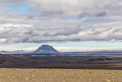
Looking NE from Sprengisandur to Bárðarbunga (left under Vatnajökull glacier) and Háganga rhyolithic cone
Syðri Háganga
| |
|
|
|
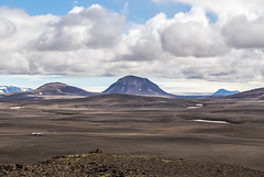
Syðri Háganga rhyolithic cone seen from the viewpoint on Kistualda, Vatnajökull in the background

Panorama Hágöngur from Kistualda
Tungnafellsjökull from Nýidalur hut
| |
|
|
|
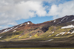
Tungnafellsjökull is a dormant palagonite volcano southwest of Bárðarbunga, near the centre of the hot spot and the triple junction.
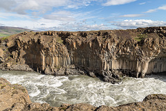
River Skjálfandafljót
| |
|
|
|
River Skjálfandafljót breaking through the basalt columns of Suðurárhraun lava field
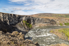
Skjálfandafljót and Bárðardalur
| |
|
|
|
Downstream from Aldeyarfoss river Skjálfandafljót makes a bend before flowing north through Bárðardalur.
Bárðardalsvegur vestri (road 842) leads through Bárðardalur. At the end of the valley this turns into highland road Sprengisandsleið (F26), suitable only for 4WD.

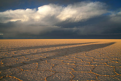
Sunset on Salar de Uyuni