

slgwv's photos

IMG_2823
| |
|
IMG_2822
| |
|
IMG_2821
| |
|
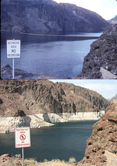
Flood vs. Drought: Lake Mead Upstream from Hoover…
| |
|
|
Looking toward the Nevada side. Top photo is from July 1983, during the record high lake level; bottom photo is during the current drought (July 2009). Note that the "No Trespassing" sign has been changed as well.
Here's a link to the upper photo alone, as well as to more information:
www.ipernity.com/doc/289859/23604893/in/album/453963
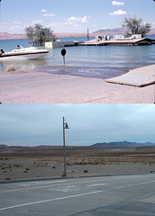
Flood vs. Drought: Overton Beach, Lake Mead, Neva…
| |
|
Top photo is from July 1983, during the record high lake level; bottom photo is during the current drought (Dec 2009). Nearly all the cultural features are different; I had to use the mountains on the skyline as the referents. Evidently the building was so damaged as to be demolished after the flood. The trees were probably removed at the same time. Here's a link to the upper photo alone:
www.ipernity.com/doc/289859/23604901/in/album/453963
with some additional information.
Btw, the site of St. Thomas
www.ipernity.com/doc/289859/23558737
is off the photos to the left--in about 100 ft of water in 1983!
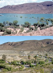
Flood vs. Drought: Echo Bay, Lake Mead, Nevada
| |
|
|
|
Top photo is from July 1983, during the record high lake level; bottom photo is during the current drought (July 2010). Note that the palm trees that were flooded, some up to their fronds, in 1983 not only survived but have grown a lot in the intervening 27 years (outlined).
Here's a link to the top photo alone:
Echo Bay, flood of 1983
with some more information.
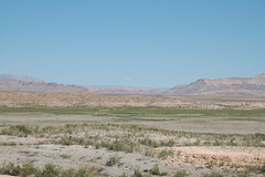
St. Thomas site
| |
|
|
|
As seen from near the trailhead, looking slightly east of due north. Note the Lake Mead high-water mark (outlined). Most of the greenery is tamarisk (salt cedar) several feet high. It looks like grass from here but it's not! Only the tallest ruin sticks up enough to be visible (outline with insert). I don't know what the building was. The elevation of the photo point is about at the high-water mark on this side. Those terraces below me are not natural but old shorelines from the reservoir.
St. Thomas is an unusual Nevada ghost town. It was a small Mormon farming community in southern Nevada that lay in the path of Lake Mead, the reservoir formed by Boulder (later Hoover) Dam. The government bought out all the property owners in the mid-1930s and the rising waters covered the site by the late '30s. The last resident, the postmaster (IIRC) rowed away on June 11, 1938 after flinging the postage canceling stamp out into the lake. Those last St. Thomas cancellations are now collectors' items. With Lake Mead's current low level due to the drought on the Colorado River system, the site of St. Thomas is exposed--old weathered concrete foundations amongst a rank growth of tamarisk. The Park Service has an interpretive trail out there. The inserts show some more foundation close-ups with some displayed artifacts. All artifacts, of course, are protected.
St. Thomas is thus an example of fall-out from a major technological project.
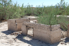
Building foundation, St. Thomas
| |
|
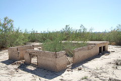
Building foundation, St. Thomas
| |
|
|
|
St. Thomas is an unusual Nevada ghost town. It was a small Mormon farming community in southern Nevada that lay in the path of Lake Mead, the reservoir formed by Boulder (later Hoover) Dam. The government bought out all the property owners in the mid-1930s and the rising waters covered the site by the late '30s. The last resident, the postmaster (IIRC) rowed away on June 11, 1938 after flinging the postage canceling stamp out into the lake. Those last St. Thomas cancellations are now collectors' items.
With Lake Mead's current low level due to the drought on the Colorado River system, the site of St. Thomas is exposed--old weathered concrete foundations amongst a rank growth of tamarisk. The Park Service has an interpretive trail out there. All artifacts, of course, are protected.
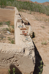
Building foundation and artifacts, St. Thomas
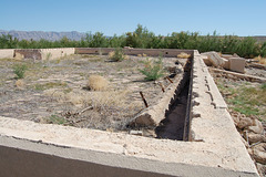
Building foundation, St. Thomas
| |
|
|
|
Note the height of the tamarisk! This is the stuff that looked like a lawn from the trailhead.
St. Thomas is an unusual Nevada ghost town. It was a small Mormon farming community in southern Nevada that lay in the path of Lake Mead, the reservoir formed by Boulder (later Hoover) Dam. The government bought out all the property owners in the mid-1930s and the rising waters covered the site by the late '30s. The last resident, the postmaster (IIRC) rowed away on June 11, 1938 after flinging the postage canceling stamp out into the lake. Those last St. Thomas cancellations are now collectors' items. With Lake Mead's current low level due to the drought on the Colorado River system, the site of St. Thomas is exposed--old weathered concrete foundations amongst a rank growth of tamarisk. The Park Service has an interpretive trail out there. All artifacts, of course, are protected.
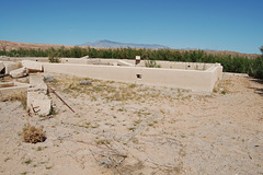
Building foundation, St. Thomas
| |
|
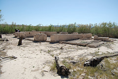
Building foundation, St. Thomas
| |
|
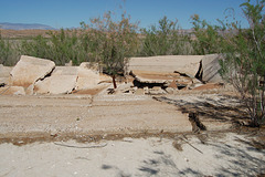
Building foundation, St. Thomas
| |
|
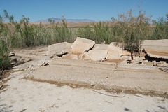
Building foundation, St. Thomas
| |
|
Possibly part of the old school. For more about St. Thomas see the enclosing photo or the album caption.
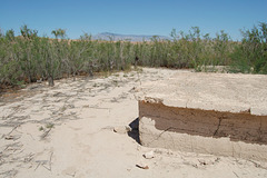
Building foundation, St. Thomas
| |
|
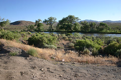
Carson River
| |
|
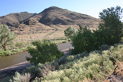
Carson River
| |
|
