

slgwv's photos
20170205 090033 001
| |
|
Winter view
| |
|
|
|
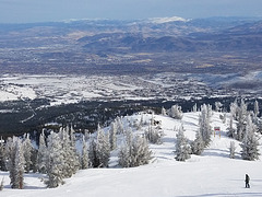
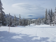
View northeasterly from the Mt. Rose Ski Area, outside Reno, Nevada. The (sub)urban areas out in the valley are the southern outskirts of Reno. The prominent highway to the left is State Route 431, the Mt. Rose Highway. With the latest storms, there's even _more_ snow here now than when I took this--although it's been warm enough the trees aren't so snow-flocked now. Taken from Upper Silver Dollar run.
20170205 085704
| |
|
20170205 100953 001
| |
|
20170205 094639 001
| |
|
20170205 094334
| |
|
IMG 1002
| |
|
IMG 1001
| |
|
|
IMG 1000
| |
|

20170213 161620 001
| |
|
|
|

The Once and Future Lake
| |
|
|
|
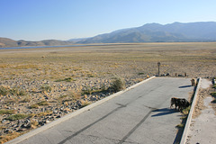
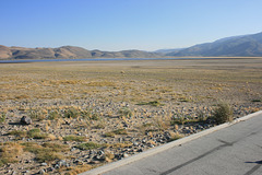
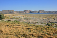
Washoe Lake, in extreme western Nevada a few miles from my house. It's a natural lake that fills a shallow basin in the middle of this valley. It had dried up completely in 2015 after several years of drought (left inset). Last season we got an average winter, which partly filled the lake, but by late September it had largely dried up again (middle inset). Now, however, it's full, with several years' worth of water even if the drought returns. Flooded trees (right inset) show how much the water's risen, and in fact it's come up another foot or so since the picture was taken.
This also illustrates my amusement at the notion that desert areas of the American west are going to become "uninhabitable" due to drying out from climate change. It's just as likely they'll become even more subject to severe flooding. An area (Lemmon Valley) in north suburban Reno, consisting of a shallow basin with a dry lake bed (playa) in the middle, is an example. Not only is the playa filled, but it's overfilled, such that houses around are flooded and likely will remain so till late spring, as there's no place for the water to drain. Now, of course the existence of the playa shows that water _sometimes_ accumulates there, but a flood on this scale hasn't happened since the houses were built!
The flooding in California this season, which has spilled over the Sierras into western Nevada and refilled Washoe Lake, results from a so-called "atmospheric river" of moisture-laden air (more poetically termed the "Pineapple Express") that originates from warm tropical water off Hawaii and flows northeast. Global warming is likely to make for stronger atmospheric rivers, and the USGS has even described a scenario in which the Pineapple Express locks in place for most of the season and turns California's Central Valley into a lake. It _has_ happened once; the governor-elect of California was rowed(!) to his inauguration in Sacramento in 1860.
In fact, the precipitation in mountainous areas in middle latitudes worldwide is subject to large year-to-year variability, and the most likely climate-change scenario is that that variability becomes even more extreme. A nuisance? Yes, especially if you've built next to a playa. But it's a long way from "uninhabitable!"
UPDATE: Sorry, I forgot to make the insets visible to "everyone". Fixed!
Winter
| |
|
|
|
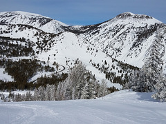
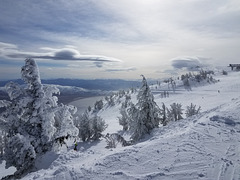
Another un-Nevada scene--summit of Slide Mountain, in the Mt. Rose Ski area, Nevada. Looking slightly east of south; the body of water is Washoe Lake, and Carson City, Nevada's capital, is in the valley beyond the low ridge. We had a drought-busting winter in 2017, which was the good news--this resort had gotten >500" (almost 13 m) of snow so far this season, which hadn't happened in a number of years. This is the sort of winter that doomed the Donner party! The bad news was that with the nearly continuous storms we didn't go skiing all of January. Still, having the water back is worth it. The skylined ski lift is Blazing Zephyr, which serves the east side (Slide Bowl) of the resort. (Yes, the name is a local joke--Mark Twain named the "Washoe Zephyr", which is a howling orographic wind that frequently comes off these mountains.)
Taken with my Android Galaxy S-7 phone--yes, I've joined the 21st century!

Plane table & alidade
| |
|
|
|
Martis Peak fire lookout, California. For finding the azimuth of a smoke sighting. Lake Tahoe is visible thru the windows. Looking more or less southwest.
Bear crossing
| |
|
|
|
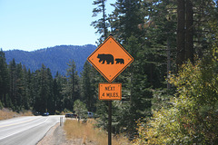
On Nevada State Route 431 (the Mount Rose highway) above Incline Village, NV, in the Tahoe Basin. Yes, there are bears here, and they can be a nuisance!
IMG 1828
| |
|
IMG 1782
| |
|
IMG 1776
| |
|
IMG 1769
| |
|
|
|
