Snake River Canyon
I.B. Perrine Bridge
Shoshone Falls
Frank
Bruneau Canyon, Idaho
Mullan Military Road
Idaho Selway Falls (#0172)
Idaho Selway River Swiftwater CCC bridge (#0160)
Kamiah ID Clearwater River (#0154)
Idaho Salmon River rafting (#0138)
Switch engine
Sawtooth Mountains
Lake Coeur d'Alene
Redfish Lake
Tree, Copper Mountains, Nevada
Mountain bike trail, Sun Valley ski area
South Fork Payette River
Big Falls
Hard rock miner
Weiser, ID 0784a
Mountain Home, ID 0684a
Bruneau, ID 0683a
Location
Lat, Lng:
You can copy the above to your favourite mapping app.
Address: unknown
You can copy the above to your favourite mapping app.
Address: unknown
See also...
Keywords
Authorizations, license
-
Visible by: Everyone -
All rights reserved
-
326 visits
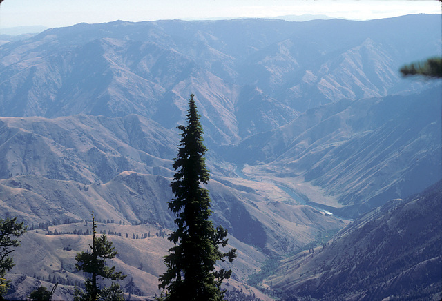
Hell's Canyon from Hat Point


Oregon side, looking toward Idaho. Snake River at the bottom of the canyon. Rush Creek rapids (IIRC) are visible to the right. An underexposed slide from 30 years ago, but it may have some historical value ;) Hell's Canyon, formed by the Snake River, a major tributary of the Columbia, is claimed to be the deepest gorge in North America, deeper than the Grand Canyon. It marks the state line between Oregon (to the west) and Idaho (to the east). In 2003 we took a commercial river trip down the Snake and were able to look back up at this point--no pic, alas!
(deleted account) has particularly liked this photo
- Keyboard shortcuts:
Jump to top
RSS feed- Latest comments - Subscribe to the comment feeds of this photo
- ipernity © 2007-2025
- Help & Contact
|
Club news
|
About ipernity
|
History |
ipernity Club & Prices |
Guide of good conduct
Donate | Group guidelines | Privacy policy | Terms of use | Statutes | In memoria -
Facebook
X

Sign-in to write a comment.