

RHH's photos
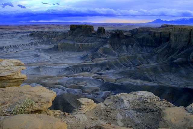

Moonscape Overlook
Moonscape Overlook or Skyline Rim is near Hanksville, Utah, and is well known for its amazing views of the desert landscape below and well-named. We were there one of the first mornings of our trip to Utah, Arizona, Nevada and California. We car-camped there and watched both the sunset and the sunrise, this photo taken in the evening and the inset the next morning.
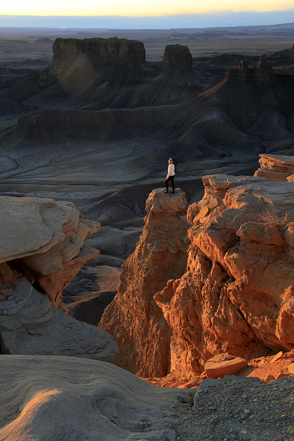
Moonscape Overlook
Taken at dawn at Moonscape Overlook in Utah (near Capitol Reef National Park) the photo shows a woman who was far more brave than my wife or I. She is standing on an isolated pinnacle above the valley floor hundreds of feet below, a pinnacle that is reached by a narrow ledge. We were at Moonscape early in our trip to Utah, Arizona, Nevada and California. We car camped there overnight and watched both sunset and sunrise, this photo taken at sunrise. One word of warning, though. The road is very rough and best reached with a high-clearance vehicle.
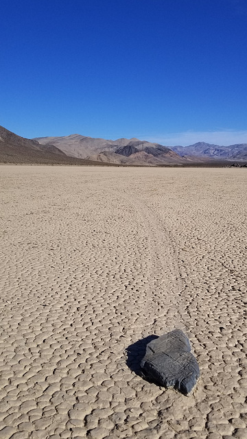
The Racetrack
We are home again after two weeks of traveling, 3675 miles (5914 km), of traveling and eight states, Washington, Idaho, Montana, Utah, Arizona, Nevada, California and Oregon. We left Death Valley early yesterday morning and arrived home late last night after driving sixteen hours, stopping only for petrol and food. We were in three National Parks, Arches, Canyonlands and Death Valley, and numerous other places, Goblin Valley and Moonscape Overlook, Monument Valley, Navaho National Monument, Pipe Spring National Monument, Antelope Canyon and Rhyolite Ghost Town.
The photo is of the Racetrack a playa (a lake bed that is dry most of the year) in Death Valley National Paek. The playa is noted for the stones that move across its surface when the playa is wet, leaving tracks behind. These tracks can be very long and often show that the stones have changed direction. For many years this was a mystery but was finally solved. The stones move through a combination of water, ice and wind. The photo shows one of these stones, about the size of my boot, and the track it has left behind in the dried and cracked mud of the playa.
The Racetrack is reached by traveling twenty-seven miles over very rough and unpaved roads in a remote part of the park. We visited the Racetrack many years ago with our van, but a four-wheel drive vehicle with high clearance is really necessary, especially since the road is even rougher now than on our previous visit. We rented a 4WD Jeep for several days and after spending time at the Racetrack for photos, went on through Lippincott Pass, an even rougher road through the mountains south of the Racetrack. We were with our oldest daughter who had never been to DVNP.
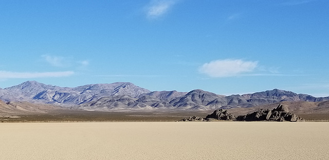
The Racetrack
This is the Racetrack in Death Valley. It is accessible only with a four wheel drive, high-clearance vehicle and is at the end of 27 miles of rough, unpaved road. It is a playa, a lakebed that is usually dry, and is known as the Racetrack because of the unusual movement of stones across the playa, the movement leaving tracks in the mud. The formation on the left of the photo is known as The Grandstand, for obvious reasons.
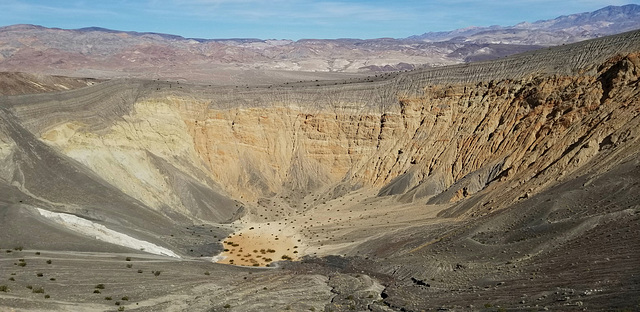
Ubehebe Crater, Death Valley
We leave for home tomorrow morning after two weeks of travelling, the last week spent in Death Valley National Park. We have 16 hours of driving ahead of us, but had a wonderful time - good weather, good company and stunning scenery. We hiked about a total of about 25 miles and spent two days exploring the backcountry in a 4WD Jeep. The photo was taken this afternoon on our last excursion and is of a volcanic crater about 2000 years old.
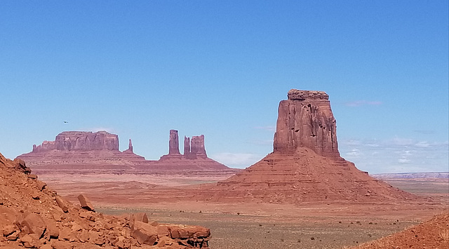
Monument Valley
Yesterday we did the 17 mile drive through Monument Valley. This is the view from the North Window. We also visited Sand Island to see the petroglyphs there and Navaho National Monument to see the Betatakin cliff dwelling there. Today we go to Antelope Canyon and then to Las Vegas to pick up our oldest daughter at the airport before driving on to Death Valley.
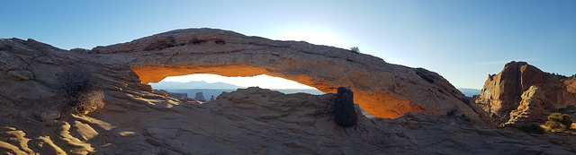
Mesa Arch, Canyonlands, at Sunrise
We are at a guest house in Blanding, Utah, and here is a photo from our trip. We spent yesterday morning in Canyonlands and did the short hike to Mesa Arch at sunrise. It was spectacular with the La Sal Mountains in the distance and the canyon of the Colorado River below. We've been in Goblin Valley State Park, to Moonscape Overlook and Factory Butte, Arches National Park and the Island in the Sky district of Canyonlands National Park. We are headed for Monument Valley today and Antelope Canyon tomorrow and then to Death Valley for a week.
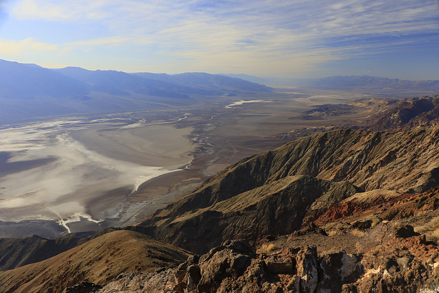
Dante's View
Please note that these are the last photos I'll be posting for several weeks. We will be away to Utah and southern California, visiting some of the Utah parks and Death Valley. I'll not be on Ipernity at all during that time. I've posted these photos from a 2021 trip to Death Valley with my wife, as a reminder of where we'll be.
The photo was taken at Dante's View in the Amargosa Range on the east side of Death Valley. The view is to the northwest over Badwater and up the valley. We'll be there again if all goes as planned the last week in February with our oldest daughter whom we will be picking up in Las Vegas before going on to Death Valley.
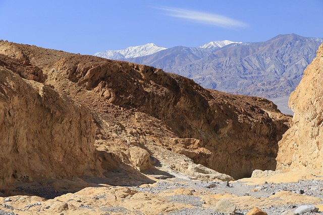
Gower Gulch
I am posting two photos of Death Valley because we are headed there very early Monday morning. We'll go first to the Moab area of Utah and visit some of the parks there, Goblin Valley, Blue Valley, Arches and Canyonlands, and then go on to pick up our oldest daughter in Las Vegas and from there to Death Valley where we'll spend a week.
The photo is from a loop hike up through Golden Canyon and back through Gower Gulch and shows the end of the trail as we exited Gower Gulch back into the valley. The Sierra Nevada is in the background across the valley. The hike is spectacular and goes to Zabriskie Point in the mountains on the east, if a side trail is followed from the top of the loop.
