Rivers, streams and canals
Greater spotted wood snake
| |
|
|
|
Spotted in our old ‘Bardsley Canal’. It was rather slow moving but you really don’t want to meet with these things close-up.
Enjoy full screen
More sightings here in Yorkshire by our friend Toz:
www.ipernity.com/doc/2405228/50177870
www.ipernity.com/doc/2405228/50182148
The Corpse Road
| |
|
|
|
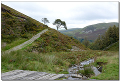
As we cross this small bridge we make a very distinctive line to that tree in the horizon. One can imagine a procession following a laden cart here.
'During the medieval period, the local population rose significantly and, consequently, so did the number of churches in the area. Keen to retain their authority and sustain revenues, senior ministers of existing parish churches made claims to burial rights over the area, thus resulting in the need for residents in outlying villages to travel a fair distance to bury their loved ones in the designated consecrated ground. Corpse roads were created to allow villagers to travel to their parish churches for this reason. One such corpse road ran from Buttermere to the church at Lamplugh, a village on the western edge of the Lake District. Part of the ancient route remains, and this walk follows it as it traverses the side of fells above Loweswater.' (https://www.thelakedistrict.org/things-to-do/walks/high-nook-tarn/)
Enjoy large
Rochdale canal: Warland Lower Lock 34
| |
|
|
|
The scene looking south along the Rochadale canal at 'The Summit' near Littleborough. Another C19 Isolation walk for us, re-visiting this canal after our last visit in January. This time we are walking to and fro the stretch from ‘The Summit’ to ‘Walsden’. As can be seen, this is a popular canal for the colourful craft seen here, besides us walkers.
Enjoy full screen
A very British canal
| |
|
|
|
A scene from under one of the many bridges over the Rochdale canal near Walsden. The cottages may have once belonged to people who worked this canal which was built very much for the industry in these parts. The post on the left is a guideway for the 'Route 66' bicycle way that passes along here.
- "The Rochdale Canal in Northern England runs for 33 miles, between Manchester and Sowerby Bridge in West Yorkshire, part of the connected system of the canals of Great Britain. In Sowerby Bridge it connects with the Calder and Hebble Navigation. In Manchester it connects with the Ashton and Bridgewater Canals. The canal was re-opened to navigation along its entire length in July 2002 and forms part of the South Pennine Ring. Its name refers to the town of Rochdale through which it passes. The Rochdale is a broad canal because its locks are wide enough to allow vessels of 14 feet width.
A revised Rochdale Canal Bill was passed in 1794 and construction began. By 1799 the canal was open between Sowerby Bridge and Todmorden and from Manchester to Rochdale. A proposed 1.6 mile tunnel between Walsden and Sladen was replaced by more locks and a higher summit level at 600 feet. The resulting shorter summit level meant that many reservoirs were required to prevent the summit level drying up and to maintain an available supply of water for the 92 locks.
The canal opened through to Manchester in 1804. This made it the first trans-Pennine canal route, as the Huddersfield, experiencing much difficulty in the Standedge Tunnel construction, did not open until 1811. The Leeds and Liverpool, with a much longer route, was not fully opened until 1816. The canal remained profitable for some time but by the twentieth century the tonnage being carried was in sharp decline. In 1937 the last boat made the through journey across the Pennines on the Rochdale Canal.
In 1952, the canal was closed apart from the short section between Castlefield and the Ashton Canal junction at Piccadilly. The Ashton was abandoned in 1962 and by 1965 the nine locks on the Rochdale through Manchester city centre were almost unusable. Enthusiastic supporters re-opened the Ashton in 1974 and the Rochdale Canal in Manchester was made good.
The Rochdale Canal Society was formed to promote the restoration of the canal and in the 1980s and 1990s small scale work began to re-open stretches of the canal between Todmorden and Sowerby Bridge. This involved restoring bridges and locks to navigable condition.
In 1996 the canal was opened to navigation once again between Sowerby Bridge and the summit level. "
Nice full screen.
Stepping stones at the Craggs
| |
|
|
|
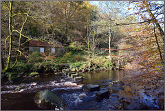
Autumn in Hardcastle Craggs can be most beautiful as well as exhilarating. Here we see one set of its stepping stones across Hebden Water. This is still a precursor of what it to come in this year of 2020 for it would not be quite like this here yet, a few weeks earlier. Memories of a wet foot as a few years ago I was crossing here and on landing on the stone across the gap I stepped back into the water. Some people don't grow up :)
Enjoy full size
Autumn beauty on the canal.
| |
|
|
|
A great week of local walks and photos brings me to a part of our Huddersfield canal that I rarely get to here at Mossley. We are lucky that the sun is bright but soft in the slight misty haze, and the leaves are still golden too. Another walker pushing a pram accompanied by his dogs and companion also enjoys the scene, and fresh air no doubt. Of course, as per usual, it’s the light that matters here for me.
Enjoy full screen
An autumn walk on the canal
| |
|
|
|
What can be more pleasant than a weekend walk along the canal on a dry sunny autumn morning? Here we are in the small town of Mossley, one of those places where new homes are springing up by the week, so a walk along the canal path with someone you love or maybe your dog is a real bonus. For me though, it would never be the same without such light and reflections that give me the feeling that someone more powerful is also accompanying us here.
As is usual with my photos, best viewed full screen
Fenced waterfall
| |
|
|
|
Seen near the village of Calderback near Carlisle. These river fences are mainly used to stop farm animals from straying into dangerous areas but there is another footbridge just beyond and so it is also possible that humans might try to enjoy the waters here too.
Enjoy full size.
HFF. Have a very safe and enjoyable weekend.
Soft mist and light on the canal.
| |
|
|
|
We are here on the Huddersfield Narrow canal just beyond Mossley on the way to Stalybridge. The sun is breaking through the mist that still lingers here over the water and it paints in even more imaginary tree trunks. We cannot move, as it will break the spell!
Full screen essential.
Whitby and the River Esk
| |
|
|
|
Whitby, a seaside, fishing town on the North Yorkshire coast. Made famous by its hilltop Abbey and the towns connections to Bram Stoker's Dracula. However the fact that Captain Cook once lived here is perhaps of more importance. This monochromatic view helps to remind us of another of its famous inhabitants, the photographer: Frank Meadow Sutcliffe. www.sutcliffe-gallery.co.uk/gallery.html
Full size screen essential
Whitby Swing Bridge in action
| |
|
|
|
After reading Rosalyn Hilborne's comment on the previous page I tried to take a look on line to see the bridge opened and was surprised of how few there were and also what poor quality ones there was of them. So I took a look in my archives and found this from 2014, when we were last there. Hope you enjoy it.
As always, deserves full size.
Lund Bridge, Wastwater
| |
|
|
|
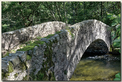
As we walk on the edge of this lake, we go into some woodland, over the ancient packhorse bridge above the River Irt. I must admit that I was lucky again with the dappled light here and it was certainly a place to dwell gazing down into this river. See Pip for the top view.
As usual best full screen.
The Wonders of Mallorca: Torrent de Pareis
| |
|
|
|
Having arrived at the foot of the Canyon de la Calabra by boat, we followed the hordes through the small cave-tunnel to reach this beautiful idyll. Looking inland, a peaceful calm behold us but the main attraction for most that come here is behind me; the view out to the open sea through the rock gateway (see PiPs). On the far bank here runs the main river that soon disappears under the pebbles to reach the sea.
Enjoy full size.
Rochdale Canal. Locks 41-42
| |
|
|
|
Another walk along the trans-Pennine Rochdael Canal gives me a view of this flight of locks. As our lockdown is relaxed there are more people walking these paths now, especially in the unusual dry warm weather. This taken between Littleborough and Summit. See Pip for another set of locks near here.
Enjoy full screen.
~ The Rochdale Canal runs for 33 miles between Manchester and Sowerby Bridge in West Yorkshire, UK. In Sowerby Bridge it connects with the Calder and Hebble Navigation. In Manchester it connects with the Ashton and Bridgewater Canals.
The canal was opened in 1799 between Sowerby Bridge and Todmorden and from Manchester to Rochdale. A proposed 1.6 mile tunnel between Walsden and Sladen was replaced by more locks and a higher summit level at 600 feet. The resulting shorter summit level meant that many reservoirs were required to prevent the summit level drying up and to maintain an available supply of water for the 92 locks. The canal opened through to Manchester in 1804. This made it the first trans-Pennine canal route, as the Huddersfield Narrow canal, experiencing much difficulty in the Standedge Tunnel construction, did not open until 1811. The Leeds and Liverpool, with a much longer route, was not fully opened until 1816.
The canal was re-opened to navigation along its entire length in July 2002 and forms part of the South Pennine Ring.
Rivers end
| |
|
|
|
Staithes Beck is a very small river indeed as it runs down the steep valley to the harbour mouth here at the picturesque village of Staithes itself. Most of the buildings here are the original ones, some centuries old but as can be plainly seen, quite renewed with new roofs etc. We still see some rope shellfish-traps on top of the old slipway which is testament to the ageless presence of its fishing industry.
Enjoy full size and have a great week.
The Trossachs – Waterfall near the Lodge.
| |
|
|
|
After having climbed the high valley of The Dukes Pass we return to the David Marshall Lodge for a coffee and cake, but en route we pass two waterfalls. This is the lower one, near the lodge. Unfortunately I cannot find a name for it.
Enjoy full size.
Devils Bridge, Kirkby Lonsdale
| |
|
|
|
A visit to this wonderful small town brings us down to the banks of the River Lune. Here we see not only the old bridge, which now only takes walkers, but also the rather attractive road bridge set in the background. This is in the county of Cumbria and also said to be the Lower lake District. See PiPs
“Spanning the River Lune to the south and east of Kirkby Lonsdale is Devil’s Bridge. This magnificent three-arched bridge, probably dates from the 12th or 13th century. ~ The bridge was later ascribed to the Devil. The story grew that the Devil appeared to an old woman and promised to build a bridge in exchange for the first soul to cross it. The woman agreed, so the Devil built the bridge. The clever old woman then threw a loaf of bread over the bridge and her dog chased it.”
More info: www.kirkbylonsdale.co.uk/discover/13341-devils-bridge
Enjoy full screen.
The River Lune
| |
|
|
|
The River Lune is one of Lancashire's most beautiful rivers. It is only 53 miles long running from its source near Newbiggin to the Irish Sea. Here we see it in almost drought conditions just above Kirkby Lonsdale in a most wonderful light.
Enjoy full screen
Jump to top
RSS feed- Latest items - Subscribe to the latest items added to this album
- ipernity © 2007-2025
- Help & Contact
|
Club news
|
About ipernity
|
History |
ipernity Club & Prices |
Guide of good conduct
Donate | Group guidelines | Privacy policy | Terms of use | Statutes | In memoria -
Facebook
X


