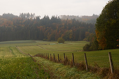
Shooting information for this photo
← Back to the photo page
Want to know more about EXIF?
Check wikipedia page about Exchangeable image file format (EXIF)
Check wikipedia page about Exchangeable image file format (EXIF)
Some of EXIF data are only available in English.
| Camera: | SONY ILCE-6300 |
|---|---|
| Exposure: | 0.004 sec. (1/250) |
| Aperture: | f/6.3 |
| Focal Length: | 41.0 mm (35 mm equivalent: 61.0 mm) |
| Flash: | Off, Did not fire |
| Exposure mode: | Aperture-priority AE |
| Max Aperture: | 4.0 |
| Resolution: | 96 x 96 dpi |
| Dimension: | 1024 x 683 pixels |
| Original Date: | 2020:10:20 09:32:26 |
| Created on: | 2020:10:20 09:32:26 |
| Modified on: | |
| Software: | Capture One 20 Macintosh |
| Copyright: | wirsberg |
| Artist | klaus versl |
| Brightness Value | 7.79453125 |
| Circle Of Confusion | 0.020 mm |
| Compression | JPEG (old-style) |
| Contrast | Normal |
| Creator | klaus versl |
| Custom Rendered | Normal |
| Date Created | 2020:10:20 09:32:26 |
| Date/Time Created | 2020:10:20 09:32:26 |
| Device Mfg Desc | IEC http://www.iec.ch |
| Device Model Desc | IEC 61966-2.1 Default RGB colour space - sRGB |
| Digital Creation Date/Time | 2020:10:20 09:32:26 |
| Digital Zoom Ratio | 1 |
| Exif Version | 0230 |
| Exposure Compensation | -1 |
| Exposure Mode | Auto |
| Field Of View | 32.9 deg |
| File Source | Digital Camera |
| Flash Compensation | 0 |
| Focal Length In 35mm Format | 61 mm |
| Hyperfocal Distance | 13.21 m |
| ISO | 100 |
| Image Size | 1024x683 |
| Legacy IPTC Digest | 680F5B06F1149EFC2741570B0B972D C9 |
| Lens | Sony FE 24-105mm F4 G OSS (SEL24105G) |
| Lens Info | 41mm f/4 |
| Lens Model | Sony FE 24-105mm F4 G OSS (SEL24105G) |
| Light Source | Daylight |
| Light Value | 13.3 |
| Metering Mode | Multi-segment |
| Recommended Exposure Index | 100 |
| Resolution Unit | inches |
| Rights | wirsberg |
| Saturation | Normal |
| Scale Factor To 35 mm Equivalent | 1.5 |
| Scene Capture Type | Standard |
| Scene Type | Directly photographed |
| Sensitivity Type | Recommended Exposure Index |
| Sharpness | Normal |
| Thumbnail Offset | 1050 |
| Title | HFF Donautal |
| White Balance | Manual |
| XMP Toolkit | XMP Core 5.5.0 |
GPS Information |
|
| GPS Latitude | 48 deg 4' 34.24" N |
| GPS Latitude Ref | North |
| GPS Longitude | 9 deg 6' 22.57" E |
| GPS Longitude Ref | East |
| GPS Position | 48 deg 4' 34.24" N, 9 deg 6' 22.57" E |
| GPS Version ID | 2.3.0.0 |
Jump to top
- ipernity © 2007-2024
- Help & Contact
|
Club news
|
About ipernity
|
History |
ipernity Club & Prices |
Guide of good conduct
Donate | Group guidelines | Privacy policy | Terms of use | Statutes | In memoria -
Facebook
Twitter
