Shooting information for this photo
← Back to the photo page
Want to know more about EXIF?
Check wikipedia page about Exchangeable image file format (EXIF)
Check wikipedia page about Exchangeable image file format (EXIF)
Some of EXIF data are only available in English.
| Camera: | OLYMPUS IMAGING CORP. u725SW,S725SW |
|---|---|
| Exposure: | 0.0025 sec. (1/400) |
| Aperture: | f/4.5 |
| Focal Length: | 6.7 mm (35 mm equivalent: 10608.2 mm) |
| Flash: | Off, Did not fire |
| Exposure mode: | Creative (Slow speed) |
| Max Aperture: | 3.5 |
| Resolution: | 314 x 314 dpi |
| Dimension: | 2764 x 2073 pixels |
| Original Date: | 2006:12:25 15:25:53 |
| Created on: | 2006:12:25 15:25:53 |
| Modified on: | 2011:06:12 18:48:13.656 |
| Software: | ACD Systems Digital Imaging |
| Copyright: | (c) Tomá Kohout, Nový Zéland na kole prosinec 2006 - únor 2007 |
| Artist | Tomá Kohout |
| Black And White Mode | Off |
| Camera ID | ¡±Á.#3Rð.brÑ..$4á%ñ.... &'()*567 |
| Camera Type | Unknown ("2..B) |
| Circle Of Confusion | 0.000 mm |
| Color Space | sRGB |
| Components Configuration | Y, Cb, Cr, - |
| Compression | Uncompressed |
| Creator | Tomáš Kohout |
| Digital Zoom | 447.2473544 |
| Exif Version | 0220 |
| Exposure Compensation | 0 |
| Field Of View | 0.2 deg |
| File Source | Digital Camera |
| Flashpix Version | 0100 |
| Focal Plane Diagonal | 0.02732666219 mm |
| Hyperfocal Distance | 525.67 m |
| ISO | 80 |
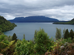
| Image Description | Poblí Rotorua - jezero a pohoøí Tarawera |
| Image Size | 2764x2073 |
| Lens Distortion Params | 1284 12577 4614 20801 24839 4977 |
| Light Source | Unknown |
| Light Value | 13.3 |
| Macro | Off |
| Metering Mode | Multi-segment |
| Photometric Interpretation | RGB |
| Planar Configuration | Chunky |
| Quality | HQ (Normal) |
| Rating | 2 |
| Resolution Unit | inches |
| Rights | (c) Tomáš Kohout, Nový Zéland na kole prosinec 2006 - únor 2007 |
| Scale Factor To 35 mm Equivalent | 1583.3 |
| Special Mode | Unknown (16777216), Sequence: 84148994, Panorama: Unknown (151521030) |
| Sub Sec Time | 656 |
| Subject | Expedice Zéland 2006-7 na kole, Nový Zéland, hory, jezera, krajina, příroda, rostliny, stroje a technika, voda |
| Thumbnail Offset | 1600 |
| User Comment | Poblíž Rotorua - jezero a pohoří Tarawera..Keywords: Expedice Zéland 2006-7 na kole;Nový Zéland;hory;jezera;krajina;p� �íroda;rostliny;stroje a technika;voda |
| XMP Toolkit | XMP Core 4.1.1 |
| Y Cb Cr Positioning | Centered |
GPS Information |
|
| GPS Altitude | 340 m Above Sea Level |
| GPS Altitude Ref | Above Sea Level |
| GPS Latitude | 38 deg 12' 13.72" S |
| GPS Latitude Ref | South |
| GPS Longitude | 176 deg 22' 33.53" E |
| GPS Longitude Ref | East |
| GPS Position | 38 deg 12' 13.72" S, 176 deg 22' 33.53" E |
Jump to top
- ipernity © 2007-2024
- Help & Contact
|
Club news
|
About ipernity
|
History |
ipernity Club & Prices |
Guide of good conduct
Donate | Group guidelines | Privacy policy | Terms of use | Statutes | In memoria -
Facebook
Twitter
