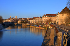
Shooting information for this photo
← Back to the photo page
Want to know more about EXIF?
Check wikipedia page about Exchangeable image file format (EXIF)
Check wikipedia page about Exchangeable image file format (EXIF)
Some of EXIF data are only available in English.
| Camera: | NIKON D90 |
|---|---|
| Exposure: | 0.01 sec. (1/100) |
| Aperture: | f/10.0 |
| Focal Length: | 31.0 mm |
| Original Date: | 2011:03:20 07:32:53 |
| Digitized Date: | 2011:03:20 07:32:53+01:00 |
| Created on: | 2011:03:20 07:32:53 |
| Copyright: | GIPE25 |
| Artist | GIPE25 |
| Authors Position | GIPE25 |
| Caption Writer | GIPE25 |
| Country | France |
| Country Code | FRA |
| Creator | GIPE25 |
| Date/Time Created | 2011:03:20 07:32:53+01:00 |
| Image Size | 4285x2845 |
| Location | Besançon |
| Rights | GIPE25 |
| State | Franche-Comté |
| Subject | besancon, Besançon, FRA, France, Franche-Comté, geo:lat=47.24253881, geo:lon=6.02568984, geotagged, doubs, franche conté, fr, europe, arbre, rivière, eau, wather, église, tour, pelotte, hdr, photomatix, nikon, d90, d 90, 16/85 mm |
| Time Zone Offset | 1 |
| XMP Toolkit | Image::ExifTool 8.58 |
GPS Information |
|
| GPS Altitude | 244 m Above Sea Level |
| GPS Altitude Ref | Above Sea Level |
| GPS Date Stamp | 2011:03:20 |
| GPS Date/Time | 2011:03:20 06:32:53Z |
| GPS Latitude | 47 deg 14' 33.14" N |
| GPS Latitude Ref | North |
| GPS Longitude | 6 deg 1' 32.48" E |
| GPS Longitude Ref | East |
| GPS Map Datum | WGS-84 |
| GPS Position | 47 deg 14' 33.14" N, 6 deg 1' 32.48" E |
| GPS Time Stamp | 06:32:53 |
| GPS Version ID | 2.2.0.0 |
Jump to top
- ipernity © 2007-2024
- Help & Contact
|
Club news
|
About ipernity
|
History |
ipernity Club & Prices |
Guide of good conduct
Donate | Group guidelines | Privacy policy | Terms of use | Statutes | In memoria -
Facebook
Twitter
