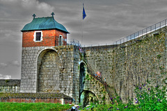
Shooting information for this photo
← Back to the photo page
Want to know more about EXIF?
Check wikipedia page about Exchangeable image file format (EXIF)
Check wikipedia page about Exchangeable image file format (EXIF)
Some of EXIF data are only available in English.
| Camera: | DMC-FZ28 |
|---|---|
| Exposure: | 0.0025 sec. (1/400) |
| Aperture: | f/4.5 |
| Focal Length: | 15.5 mm |
| Original Date: | 2009:08:14 16:49:48 |
| Digitized Date: | 2009:08:14 16:49:48+02:00 |
| Created on: | 2009:08:14 16:49:48 |
| Artist | GIPE25 |
| Authors Position | GIPE25 |
| Caption Writer | GIPE25 |
| Country | France |
| Country Code | FRA |
| Creator | GIPE25 |
| ISO | 100 |
| Image Size | 3638x2421 |
| Light Value | 13.0 |
| Location | Besançon |
| Native Digest | 36864,40960,40961,37121,37122, 40962,40963,37510,40964,36867, 36868,33434,33437,34850,34852, 34855,34856,37377,37378,37379, 37380,37381,37382,37383,37384, 37385,37386,37396,41483,41484, 41486,41487,41488,41492,41493, 41495,41728,41729,41730,41985, 41986,41987,41988,41989,41990, 41991,41992,41993,41994,41995, 41996,42016,0,2,4,5,6,7,8,9,10 ,11,12,13,14,15,16,17,18,20,22 ,23,24,25,26,27,28,30;A34C6342 A472F4E4D49107DA92F8DF66 |
| Rights | GIPE25 |
| State | Franche-Comté |
| Subject | Besançon, FRA, France, Franche-Comté, geotagged, fr, doubs, hdr, photomatix, nikon, citadelle, tour roi, vauban, d200, d 200 |
| Time Zone Offset | 2 |
| XMP Toolkit | XMP Core 4.1.1 |
GPS Information |
|
| GPS Altitude | 360 m Above Sea Level |
| GPS Altitude Ref | Above Sea Level |
| GPS Date Stamp | 2009:08:14 |
| GPS Date/Time | 2009:08:14 14:49:48Z |
| GPS Latitude | 47 deg 13' 47.82" N |
| GPS Latitude Ref | North |
| GPS Longitude | 6 deg 2' 3.77" E |
| GPS Longitude Ref | East |
| GPS Map Datum | WGS-84 |
| GPS Position | 47 deg 13' 47.82" N, 6 deg 2' 3.77" E |
| GPS Satellites | 0 |
| GPS Time Stamp | 14:49:48 |
| GPS Version ID | 2.2.0.0 |
Jump to top
- ipernity © 2007-2024
- Help & Contact
|
Club news
|
About ipernity
|
History |
ipernity Club & Prices |
Guide of good conduct
Donate | Group guidelines | Privacy policy | Terms of use | Statutes | In memoria -
Facebook
Twitter
