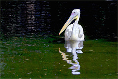
Shooting information for this photo
← Back to the photo page
Want to know more about EXIF?
Check wikipedia page about Exchangeable image file format (EXIF)
Check wikipedia page about Exchangeable image file format (EXIF)
Some of EXIF data are only available in English.
| Camera: | SONY SLT-A55V |
|---|---|
| Exposure: | 0.00125 sec. (1/800) |
| Aperture: | f/8.0 |
| Focal Length: | 120.0 mm (35 mm equivalent: 180.0 mm) |
| Flash: | Off, Did not fire |
| Exposure mode: | Manual |
| Max Aperture: | 4.5 |
| Resolution: | 300 x 300 dpi |
| Dimension: | 2048 x 1365 pixels |
| Compression: | 8 bits/pixels |
| Original Date: | 2014:05:23 12:07:20 |
| Created on: | 2014:05:23 12:07:20 |
| Software: | Aperture 3.5.1 |
| Brightness Value | 5.62 |
| Caption Writer | Frank-Michael Werner |
| Circle Of Confusion | 0.020 mm |
| Color Space | sRGB |
| Components Configuration | Y, Cb, Cr, - |
| Contrast | Normal |
| Creator | Frank-Michael Werner |
| Custom Rendered | Normal |
| Date Created | 2014:05:23 12:07:20 |
| Date/Time Created | 2014:05:23 12:07:20 |
| Description | SONY DSC |
| Device Mfg Desc | IEC http://www.iec.ch |
| Device Model Desc | IEC 61966-2.1 Default RGB colour space - sRGB |
| Digital Creation Date/Time | 2014:05:23 12:07:20 |
| Exif Version | 0230 |
| Exposure Compensation | 0 |
| Exposure Mode | Manual |
| Field Of View | 11.4 deg |
| File Source | Digital Camera |
| Flash Compensation | 0 |
| Flashpix Version | 0100 |
| Focal Length In 35mm Format | 180 mm |
| Hyperfocal Distance | 89.86 m |
| ISO | 800 |
| Image Description | SONY DSC |
| Image Size | 2048x1365 |
| Lens | 70-400mm F4-5.6 G SSM |
| Lens ID | Sony 70-400mm F4-5.6 G SSM (SAL70400G) |
| Lens Info | 70-400mm f/4-5.6 |
| Lens Model | 70-400mm F4-5.6 G SSM |
| Light Source | Unknown |
| Light Value | 12.6 |
| Metering Mode | Multi-segment |
| Photometric Interpretation | Color Filter Array |
| Rating | 3 |
| Resolution Unit | inches |
| Rights | Frank-Michael Werner, FMW51 |
| Saturation | Normal |
| Scale Factor To 35 mm Equivalent | 1.5 |
| Scene Capture Type | Standard |
| Scene Type | Directly photographed |
| Sharpness | Normal |
| Subject | 12 mittags, Dokumentation, Frühling, im Zoo, Natur, Pelikane (Pelecanidae Pelecanus), Pelikane (Pelecanidae), Querformat, Rosapelikan (Pelecanus onocrotalus), Ruderfüßer (Pelecaniformes), Sonnenschein, Sony Alpha A55, Teich, trüb, Zoo Dresden |
| Title | Pelikan |
| White Balance | Auto |
| XMP Toolkit | XMP Core 5.4.0 |
GPS Information |
|
| GPS Altitude | 108.5 m Above Sea Level |
| GPS Altitude Ref | Above Sea Level |
| GPS Date Stamp | 2014:05:23 |
| GPS Date/Time | 2014:05:23 10:06:20Z |
| GPS Differential | No Correction |
| GPS Latitude | 51 deg 2' 13.97" N |
| GPS Latitude Ref | North |
| GPS Longitude | 13 deg 45' 15.48" E |
| GPS Longitude Ref | East |
| GPS Map Datum | WGS-84 |
| GPS Measure Mode | 3-Dimensional Measurement |
| GPS Position | 51 deg 2' 13.97" N, 13 deg 45' 15.48" E |
| GPS Speed | 1.1 |
| GPS Speed Ref | km/h |
| GPS Status | Measurement Void |
| GPS Time Stamp | 10:06:20 |
| GPS Track | 125.76 |
| GPS Track Ref | True North |
| GPS Version ID | 2.3.0.0 |
Jump to top
- ipernity © 2007-2024
- Help & Contact
|
Club news
|
About ipernity
|
History |
ipernity Club & Prices |
Guide of good conduct
Donate | Group guidelines | Privacy policy | Terms of use | Statutes | In memoria -
Facebook
Twitter
