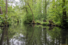
Shooting information for this photo
← Back to the photo page
Want to know more about EXIF?
Check wikipedia page about Exchangeable image file format (EXIF)
Check wikipedia page about Exchangeable image file format (EXIF)
Some of EXIF data are only available in English.
| Camera: | Canon EOS 80D |
|---|---|
| Exposure: | 0.01667 sec. (1/60) |
| Aperture: | f/8.0 |
| Focal Length: | 20.0 mm (35 mm equivalent: 129.1 mm) |
| Flash: | Off, Did not fire |
| Exposure mode: | Aperture-priority AE |
| Max Aperture: | 3.5 |
| Resolution: | 96 x 96 dpi |
| Dimension: | 1500 x 1000 pixels |
| Original Date: | 2019:05:17 14:31:27 |
| Digitized Date: | 2019:05:17 14:31:27+02:00 |
| Created on: | 2019:05:17 14:31:27 |
| Software: | PhotoScape |
| Artist | ERHARD BERNSTEIN |
| Brightness Value | 0 |
| Circle Of Confusion | 0.005 mm |
| Color Space | sRGB |
| Creator | ERHARD BERNSTEIN |
| Date Created | 2019:05:17 14:31:27+00:00 |
| Date/Time Created | 2019:05:17 14:31:27+00:00 |
| Digital Creation Date/Time | 2019:05:17 14:31:27+00:00 |
| Exif Version | 0230 |
| Exposure Compensation | -1/2 |
| Exposure Index | 0 |
| Field Of View | 15.9 deg |
| File Source | Unknown (0) |
| Focal Plane Resolution Unit | cm |
| Focal Plane X Resolution | 2688.72659 |
| Focal Plane Y Resolution | 2688.72659 |
| Hyperfocal Distance | 10.74 m |
| ISO | 400, 400 |
| Image Size | 1500x1000 |
| Light Source | Unknown |
| Light Value | 9.9 |
| Metering Mode | Spot |
| Primary Chromaticities | 0 0 0 0 0 0 |
| Reference Black White | 0 0 0 0 0 0 |
| Resolution Unit | inches |
| Scale Factor To 35 mm Equivalent | 6.5 |
| Scene Type | Unknown (0) |
| Sensing Method | Unknown (0) |
| Sub Sec Time Digitized | `. |
| Sub Sec Time Original | \. |
| Subject Distance | 0 m |
| White Point | 0 0 |
| XMP Toolkit | Image::ExifTool 11.44 |
| Y Cb Cr Coefficients | 0 0 0 |
| Y Cb Cr Positioning | Unknown (0) |
GPS Information |
|
| GPS Date Stamp | 2019:05:17 |
| GPS Date/Time | 2019:05:17 12:31:27Z |
| GPS Latitude | 51 deg 52' 6.19" N |
| GPS Latitude Ref | North |
| GPS Longitude | 13 deg 59' 42.50" E |
| GPS Longitude Ref | East |
| GPS Map Datum | WGS-84 |
| GPS Position | 51 deg 52' 6.19" N, 13 deg 59' 42.50" E |
| GPS Time Stamp | 12:31:27 |
| GPS Version ID | 2.2.0.0 |
Jump to top
- ipernity © 2007-2024
- Help & Contact
|
Club news
|
About ipernity
|
History |
ipernity Club & Prices |
Guide of good conduct
Donate | Group guidelines | Privacy policy | Terms of use | Statutes | In memoria -
Facebook
Twitter
