Sedimentary structures
Folder: Geology and Earth Science
Photos illustrating sedimentary structures such as cross-bedding, ripples, channels, unconformities, etc.
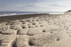
Spurn east beach bank, swales and ripples 2
| |
|
|
|
A visit to Spurn Point 25
Sand and gravel bars (possibly with a foundation of the Wolstonian age Basement Till) parallel to the coast allow the formation of elongate tidal pools, which become completely flooded by the incoming tide.
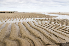
In this view the darker clayey gravel bar is in the middle distance on the left. In the foreground are large, metre-scale linguoid ripples: 'swales'. These are highly asymmetrical, with the steep lee sides facing south, indicating a predominant current direction from north to south (left to right). This is consistent with the southward longshore drift along the east of England coast
The linguoid swales in turn display centimetre-scale sand ripples on the stoss slopes. The ripples tend to be more symmetrical, indicating a current direction alternating between northward (to the left) flow on the flooding tide and southward flow (to the right) when the tide is ebbing.
In this photo the incoming tide is just beginning to flood the low swale zone.
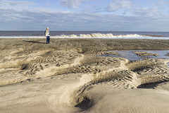
Spurn east beach bank, swales and ripples 1
| |
|
|
|
A visit to Spurn Point 24
Sand and gravel bars (possibly with a foundation of the Wolstonian age Basement Till) parallel to the coast allow the formation of elongate tidal pools, which become completely flooded by the incoming tide.
In this view the darker clayey gravel bar is in the middle distance. In the foreground are large, metre-scale linguoid ripples: 'swales'. These are highly asymmetrical, with the steep lee sides facing south, indicating a predominant current direction from north to south (left to right). This is consistent with the southward longshore drift along the east of England coast
The linguoid swales in turn display centimetre-scale sand ripples on the stoss slopes. The ripples tend to be more symmetrical, indicating a current direction alternating between northward (to the left) flow on the flooding tide and southward flow (to the right) when the tide is ebbing.
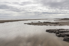
Spurn Neck view south
| |
|
A visit to Spurn Point 6
Looking southwards from Spurn Neck at low tide. Sand and clayey gravel bars parallel to the coast allow the formation of elongate tidal pools, which become completely flooded by the incoming tide.
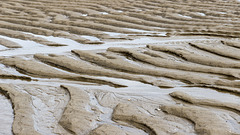
Spurn Neck sand ripples 2
| |
|
|
A visit to Spurn Point 4
Spurn Neck eastern low tide zone.
Asymmetric ripples in beach sand, presumably formed by the previous flood tide(s). The steeper, lee, side of the ripples face west (left); the gentle, stoss, sides face east (right). This indicates that these ripples were formed by water flow moving from right to left, i.e. by the incoming tide. They have clearly survived the previous ebbing tide, suggesting that the incoming tide flows faster than the ebb.
Spurn Neck sand ripples 1
| |
|
|
|
A visit to Spurn Point 3
Spurn Neck eastern low tide zone.
Asymmetric ripples in beach sand, presumably formed by the previous flood tide(s). The steeper, lee, side of the ripples face west (left); the gentle, stoss, sides face east (right). This indicates that these ripples were formed by water flow moving from right to left, i.e. by the incoming tide. They have clearly survived the previous ebbing tide, suggesting that the incoming tide flows faster than the ebb.
Swallowtree Bay anticline-syncline couplet: detail…
| |
|
Saundersfoot to Swallowtree Bay geological structures
Detail view no.5 of the asymmetric anticline-syncline couplet in Lower Coal Measures sandstones and siltstones, just south of Swallowtree Bay.
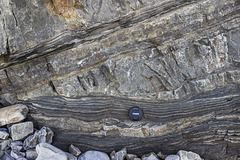
This is a view of the sandstones and laminated sandy siltstones on the southern limb of the anticline, close to beach level.
The sandstone beds show thickness variation due to channelling and erosive bases into the underlying laminated sandy siltstone beds. The latter show fine-scale rhythmic fining-up laminae, which have slightly irregular slumped bases. All these sedimentary features demonstrate that these beds are the right way up!
The lens cap is 72 mm in diameter.
The photo of the entire structure is here:
Swallowtree Bay anticline-syncline couplet: detail…
| |
|
|
Saundersfoot to Swallowtree Bay geological structures
Detail view no.4 of the asymmetric anticline-syncline couplet in Lower Coal Measures sandstones and siltstones, just south of Swallowtree Bay.
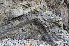
This is a view of the siltstones and sandstones in the fold axis of the anticline below the small thrust which disrupts the fold axis.
The sandstone beds show thickness variation due to channelling and erosive bases into the underlying laminated sandy siltstone beds. Apparent low-angle cross bedding in the central, darker laminated sandy siltstone bed may be partly due to dislocation and bedding plane slip at its junction with the next underlying sandstone.
I took this photo for the shapes, textures and colours as well as the geological interest, hence I omitted a scale object. The section shown is about 1.6 metres in height.
The photo of the entire structure is here:
Syncline in Lower Coal Measures sandstones: Swallo…
| |
|
Saundersfoot to Swallowtree Bay geological structures
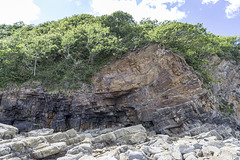
Just south of the previous photo in Swallowtree Bay, Lower Coal Measures sandstones have been folded into a broad open syncline. The sandstones display cross-bedding and erosive channel bases.
Gravel Bay - calcrete horizon in Moor Cliffs Forma…
| |
|
|
Freshwater West, Gravel Bay and East Pickard Bay
Moor Cliffs Formation in Gravel Bay.
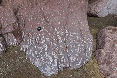
This photo shows an even closer view of a calcrete soil development in mainly reddened mudstone beds in the Moor Cliffs Formation at the western end of Gravel Bay. The white mottled patches are irregular carbonate patches.
The lens cap is 72 mm in diameter.
Background:
The Moor Cliffs Formation overlies the Freshwater East conglomerates, seen in previous photos, and spans the boundary between the Silurian and Devonian periods. It consists of red mudstones and siltstones with occasional thin sandstone beds. These were deposited on a low-reflief floodplain at the edge of an arid continental margin, the sandstones being deposited by seasonal braided streams, the muds and silts deposited in ephemeral marginal lakes. When not inundated, the muds and silts developed carbonate-rich calcrete (caliche) soil horizons along dessication cracks, burrows and early plant root systems.
Gravel Bay - Moor Cliffs Formation with calcretes…
| |
|
|
Freshwater West, Gravel Bay and East Pickard Bay
Moor Cliffs Formation in Gravel Bay.
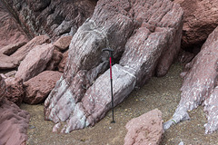
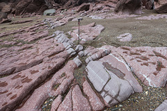
This photo shows a closer view of the mainly reddened mudstone beds in the Moor Cliffs Formation at the western end of Gravel Bay. The white mottling in the mudstones shows extensive calcrete soil horizons. The sequence is dipping to the north (right) at approx. 65°.
The walking stick is about 0.9 m long.
Background:
The Moor Cliffs Formation overlies the Freshwater East conglomerates, seen in previous photos, and spans the boundary between the Silurian and Devonian periods. It consists of red mudstones and siltstones with occasional thin sandstone beds. These were deposited on a low-reflief floodplain at the edge of an arid continental margin, the sandstones being deposited by seasonal braided streams, the muds and silts deposited in ephemeral marginal lakes. When not inundated, the muds and silts developed carbonate-rich calcrete (caliche) soil horizons along dessication cracks, burrows and early plant root systems.
Gravel Bay - Moor Cliffs Formation with calcretes…
| |
|
Freshwater West, Gravel Bay and East Pickard Bay
Moor Cliffs Formation in Gravel Bay.
This photo shows the mainly reddened mudstone beds in the Moor Cliffs Formation at the western end of Gravel Bay. The white mottling in the mudstones shows extensive calcrete soil horizons. The sequence is dipping to the north (right) at approx. 65°.
The walking stick is about 0.9 m long.
Background:
The Moor Cliffs Formation overlies the Freshwater East conglomerates, seen in previous photos, and spans the boundary between the Silurian and Devonian periods. It consists of red mudstones and siltstones with occasional thin sandstone beds. These were deposited on a low-reflief floodplain at the edge of an arid continental margin, the sandstones being deposited by seasonal braided streams, the muds and silts deposited in ephemeral marginal lakes. When not inundated, the muds and silts developed carbonate-rich calcrete (caliche) soil horizons along dessication cracks, burrows and early plant root systems.
Gravel Bay - millipede-like burrows in Moor Cliffs…
| |
|
|
Freshwater West, Gravel Bay and East Pickard Bay
Moor Cliffs Formation in Gravel Bay.
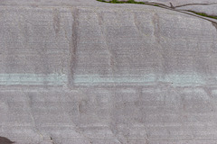
This photo shows a close-up view of the light purple sandstone bed with greenish laminae seen in the previous photo. The darker perpendicular features in the sandstone are trace-fossil Beaconites burrows. Having previously been tentatively ascribed to worm burrows or lung-fish burrows, they are now thought to have been made by primitive millipede-like animals.
The bed is approx. 50 cm thick (top to bottom) in this photo.
Background:
The Moor Cliffs Formation overlies the Freshwater East conglomerates, seen in previous photos, and spans the boundary between the Silurian and Devonian periods. It consists of red mudstones and siltstones with occasional thin sandstone beds. These were deposited on a low-reflief floodplain at the edge of an arid continental margin, the sandstones being deposited by seasonal braided streams, the muds and silts deposited in ephemeral marginal lakes. When not inundated, the muds and silts developed carbonate-rich calcrete (caliche) soil horizons along dessication cracks, burrows and early plant root systems.
Gravel Bay - Moor Cliffs Formation 2
| |
|
|
Freshwater West, Gravel Bay and East Pickard Bay
Moor Cliffs Formation in Gravel Bay.
This photo shows a closer view of the wave cut platform in the Moor Cliffs Formation at the western end of Gravel Bay. A light purple sandstone bed with greenish laminae is seen in the centre of the photo with red mudstones below (left) and above (right). The darker perpendicular features in the sandstone are trace-fossil Beaconites burrows. Having previously been tentatively ascribed to worm burrows or lung-fish burrows, they are now thought to have been made by primitive millipede-like animals.
The white mottling in the mudstones indicate extensive calcrete soil horizons. The sequence is dipping to the north (right) at approx. 60°.
The walking stick is about 0.9 m long.
Background:
The Moor Cliffs Formation overlies the Freshwater East conglomerates, seen in previous photos, and spans the boundary between the Silurian and Devonian periods. It consists of red mudstones and siltstones with occasional thin sandstone beds. These were deposited on a low-reflief floodplain at the edge of an arid continental margin, the sandstones being deposited by seasonal braided streams, the muds and silts deposited in ephemeral marginal lakes. When not inundated, the muds and silts developed carbonate-rich calcrete (caliche) soil horizons along dessication cracks, burrows and early plant root systems.
Gravel Bay - Moor Cliffs Formation 1
| |
|
Freshwater West, Gravel Bay and East Pickard Bay
Moor Cliffs Formation in Gravel Bay.
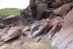
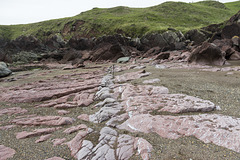
This photo shows the wave cut platform in the Moor Cliffs Formation at the western end of Gravel Bay. A light purple sandstone bed is seen in the centre of the photo with red mudstones below (left) and above (right). The white mottling towards the right is a particularly well-developed calcrete horizon. The sequence is dipping to the north (right) at approx. 60°.
The walking stick is about 0.9 m long.
Background:
The Moor Cliffs Formation overlies the Freshwater East conglomerates, seen in previous photos, and spans the boundary between the Silurian and Devonian periods. It consists of red mudstones and siltstones with occasional thin sandstone beds. These were deposited on a low-reflief floodplain at the edge of an arid continental margin, the sandstones being deposited by seasonal braided streams, the muds and silts deposited in ephemeral marginal lakes. When not inundated, the muds and silts developed carbonate-rich calcrete (caliche) soil horizons along dessication cracks, burrows and early plant root systems.
Conglomerate at Gravel Bay: close-up view 2
| |
|
|
Freshwater West, Gravel Bay and East Pickard Bay
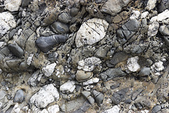
Another close-up view of a conglomerate in the Freshwater East Formation (note name) at Gravel Bay, situated at the northern end of the large Freshwater West bay in south Pembrokeshire. The view is closely adjacent to the previous photo but without the lens cap for scale, as I didn't want it to distract from the lovely textures in this rock.
The vertical dimension of the photo is about 40 cm.
The Freshwater East Formation marks the beginning of 'Old Red Sandstone' type of sediments, formerly believed to be at the base of the Devonian, but now assigned to the uppermost Silurian. The pebbles and cobbles in the conglomerates mostly consist of white vein quartz and quartzite, grey sandstones and darker sitstones. These were depositied in an alluvial fan settting on a shallow floodplain in increasingly arid conditions.
Conglomerate at Gravel Bay: close-up view 1
| |
|
Freshwater West, Gravel Bay and East Pickard Bay
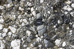
Close-up view of a conglomerate in the Freshwater East Formation (note name) at Gravel Bay, situated at the northern end of the large Freshwater West bay in south Pembrokeshire. The lens cap is 72 mm in diameter.
The Freshwater East Formation marks the beginning of 'Old Red Sandstone' type of sediments, formerly believed to be at the base of the Devonian, but now assigned to the uppermost Silurian. The pebbles and cobbles in the conglomerates mostly consist of white vein quartz and quartzite, grey sandstones and darker sitstones. These were depositied in an alluvial fan settting on a shallow floodplain in increasingly arid conditions.
Conglomerates at Gravel Bay
| |
|
|
|
Freshwater West, Gravel Bay and East Pickard Bay
Massive conglomerates and grey sandstones dipping steeply to the north (right) of the Freshwater East Formation (note name) at Gravel Bay, situated at the northern end of the large Freshwater West bay in south Pembrokeshire. The walking stick is 0.9 m long.
The Freshwater East Formation marks the beginning of 'Old Red Sandstone' type of sediments, formerly believed to be at the base of the Devonian, but now assigned to the uppermost Silurian. The pebbles and cobbles in the conglomerates mostly consist of white vein quartz and quartzite, grey sandstones and darker sitstones. These were depositied in an alluvial fan settting on a shallow floodplain in increasingly arid conditions.
The Settlands sand trees 3
| |
|
|
|
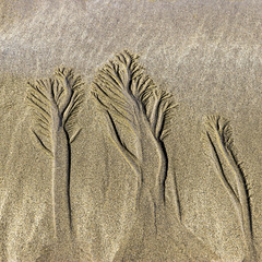
I was intrigued by the 'forests' created in the sand by the rivulets of water draining from The Settlands beach near Little Haven, Pembrokeshire.
Jump to top
RSS feed- Latest items - Subscribe to the latest items added to this album
- ipernity © 2007-2024
- Help & Contact
|
Club news
|
About ipernity
|
History |
ipernity Club & Prices |
Guide of good conduct
Donate | Group guidelines | Privacy policy | Terms of use | Statutes | In memoria -
Facebook
Twitter

