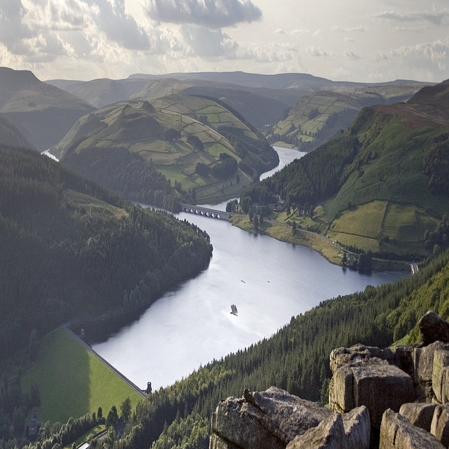
Stretched Stretton - of course, it's all exaggerat…
Burbage valley x2 vertical exaggeration.
The Goyt Syncline from Roach End (x 2 vert. exagg.…
Burbage autumn spotlight x2 vertical exaggeration
Lewes structure
Alternative White Edge 4
Alternative White Edge 2
Millstone Edge panoramic, x2 vertical exaggeration
Overdale and Bradwell x3 vertical exaggeration
Burbage panorama x3 vertical exaggeration
Stanage Edge vertical exaggeration x3
1/500 • f/4.0 • 25.0 mm • ISO 200 •
Location
See also...
See more...Keywords
Authorizations, license
-
Visible by: Everyone -
All rights reserved
-
168 visits
Ladybower x2.5 vertical exaggeration


I'm always interested in viewing landscapes in different ways and occasionally I experiment with exaggerating the vertical scale of my photos. I'm not sure of the validity of this as a photography technique or an art-form, but I do quite like the effect it produces and quite often this enhances geological and geomorphological features, and so is useful as a teaching aid.
This is a view of Ladybower Reservoir taken from Bamford Edge in the Peak District. Here, the River Derwent has cut down through the Namurian ('Millstone Grit') succession - mainly Kinderscout Grit and the Shale Grit (an unfortunate name). The hillsides plunge straight down into the water, clearly showing how these are drowned valleys. Less obvious in a normal view, but brought out by this exaggerated scale is the relative flatness of the tops of the hills, above the 'V'-shaped notch of the valleys. This indicates a much earlier uplifted erosion surface (probably Tertiary age) on which the proto-Derwent and other rivers became established. The stepped topography of the hillsides is due to the presence of alternating hard sandstones and softer shales.
This is a view of Ladybower Reservoir taken from Bamford Edge in the Peak District. Here, the River Derwent has cut down through the Namurian ('Millstone Grit') succession - mainly Kinderscout Grit and the Shale Grit (an unfortunate name). The hillsides plunge straight down into the water, clearly showing how these are drowned valleys. Less obvious in a normal view, but brought out by this exaggerated scale is the relative flatness of the tops of the hills, above the 'V'-shaped notch of the valleys. This indicates a much earlier uplifted erosion surface (probably Tertiary age) on which the proto-Derwent and other rivers became established. The stepped topography of the hillsides is due to the presence of alternating hard sandstones and softer shales.
Colin Ashcroft has particularly liked this photo
- Keyboard shortcuts:
Jump to top
RSS feed- Latest comments - Subscribe to the comment feeds of this photo
- ipernity © 2007-2024
- Help & Contact
|
Club news
|
About ipernity
|
History |
ipernity Club & Prices |
Guide of good conduct
Donate | Group guidelines | Privacy policy | Terms of use | Statutes | In memoria -
Facebook
Twitter

Sign-in to write a comment.