Location
See also...
Keywords
Authorizations, license
-
Visible by: Everyone -
All rights reserved
-
217 visits
Mynydd y Gwair and Tor Clawdd


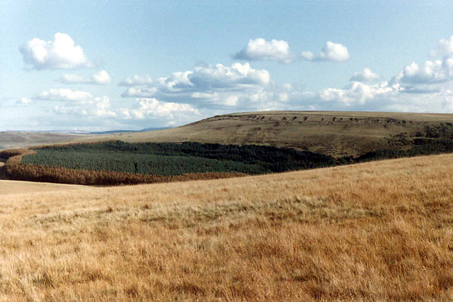
Mynydd y Gwair - an extensive moorland commons between Swansea and Ammanford.
Although the general location is mostly known as Mynydd y Gwair, this name strictly applies to an area just to the north (left) of this viewpoint. The camera location is on Mynydd Garn Fach and is looking eastwards. The rounded hill in the centre is Tor Clawdd and the pock marks just below the skyline are remains of old adit coal workings in the Graigola seam. The Upper Lliw Reservoir is just out of sight in the valley below the woodland.
This beautiful upland moorland area is only 7 miles north of Swansea city centre, but is now under threat of having an enormous windfarm sited here, with dozens of huge turbines. The planning application has yet to be approved. More details here:
www.socme.org/
- Keyboard shortcuts:
Jump to top
RSS feed- Latest comments - Subscribe to the comment feeds of this photo
- ipernity © 2007-2024
- Help & Contact
|
Club news
|
About ipernity
|
History |
ipernity Club & Prices |
Guide of good conduct
Donate | Group guidelines | Privacy policy | Terms of use | Statutes | In memoria -
Facebook
Twitter

Sign-in to write a comment.