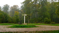
Shooting information for this photo
← Back to the photo page
Want to know more about EXIF?
Check wikipedia page about Exchangeable image file format (EXIF)
Check wikipedia page about Exchangeable image file format (EXIF)
Some of EXIF data are only available in English.
| Camera: | PENTAX K-r |
|---|---|
| Exposure: | 0.6 sec. |
| Aperture: | f/11.0 |
| Focal Length: | 35.0 mm (35 mm equivalent: 52.0 mm) |
| Flash: | Off, Did not fire |
| Exposure mode: | Shutter speed priority AE |
| Resolution: | 300 x 300 dpi |
| Dimension: | 4262 x 2397 pixels |
| Original Date: | 2018:10:07 10:18:40.0 |
| Digitized Date: | 2018:10:07 10:18:40 |
| Created on: | 2018:10:07 10:18:40.0 |
| Modified on: | 2018:10:08 16:49:27.116 |
| Software: | ACDSee Pro 9 |
| Copyright: | Philippe-Rouzet |
| Artist | Philippe-Rouzet |
| CFA Pattern | [Blue,Green][Green,Red] |
| Categories | <Categories><Category Assigned="0">Pays age<Category Assigned="1">Fore stier</Category></Cat egory><Category Assigned="0">Lieu x<Category Assigned="0">For� �t<Category Assigned="1">Retz </Category></Category ></Category></Cate gories> |
| Circle Of Confusion | 0.020 mm |
| Contrast | Normal |
| Creator | Philippe-Rouzet |
| Custom Rendered | Normal |
| Date/Time Created | 2018:10:07 10:18:40+00:00 |
| Datetime | 2018:10:07 10:18:40.000 |
| Digital Creation Date/Time | 2018:10:07 10:18:40+00:00 |
| Exposure Compensation | 0 |
| Exposure Mode | Auto |
| Field Of View | 38.2 deg |
| Flash Fired | False |
| Flash Function | False |
| Flash Mode | Off |
| Flash Red Eye Mode | False |
| Flash Return | No return detection |
| Focal Length In 35mm Format | 52 mm |
| Hyperfocal Distance | 5.51 m |
| ISO | 100 |
| Image Size | 4262x2397 |
| Label | Violet |
| Light Value | 7.7 |
| Metering Mode | Multi-segment |
| Rating | 1 |
| Resolution Unit | inches |
| Rights | Philippe-Rouzet |
| Saturation | Normal |
| Scale Factor To 35 mm Equivalent | 1.5 |
| Scene Capture Type | Standard |
| Sensing Method | One-chip color area |
| Sharpness | Normal |
| Sub Sec Time | 116 |
| Sub Sec Time Digitized | 0 |
| Sub Sec Time Original | 0 |
| Subject Distance Range | Distant |
| Tagged | False |
| White Balance | Auto |
| XMP Toolkit | XMP Core 5.1.2 |
| Y Cb Cr Positioning | Centered |
GPS Information |
|
| GPS Latitude | 49 deg 12' 12.67" N |
| GPS Latitude Ref | North |
| GPS Longitude | 2 deg 59' 2.57" E |
| GPS Longitude Ref | East |
| GPS Position | 49 deg 12' 12.67" N, 2 deg 59' 2.57" E |
| GPS Version ID | 2.3.0.0 |
Jump to top
- ipernity © 2007-2024
- Help & Contact
|
Club news
|
About ipernity
|
History |
ipernity Club & Prices |
Guide of good conduct
Donate | Group guidelines | Privacy policy | Terms of use | Statutes | In memoria -
Facebook
Twitter
