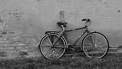
Shooting information for this photo
← Back to the photo page
Want to know more about EXIF?
Check wikipedia page about Exchangeable image file format (EXIF)
Check wikipedia page about Exchangeable image file format (EXIF)
Some of EXIF data are only available in English.
| Camera: | HUAWEI ALE-L21 |
|---|---|
| Exposure: | 0.00826 sec. (1/121) |
| Aperture: | f/2.0 |
| Focal Length: | 3.8 mm (35 mm equivalent: 27.0 mm) |
| Flash: | No Flash |
| Exposure mode: | Program AE |
| Resolution: | 72 x 72 dpi |
| Dimension: | 4160 x 2336 pixels |
| Original Date: | 2016:12:03 15:11:58.953624 |
| Digitized Date: | 2016:12:03 15:11:58+01:00 |
| Created on: | 2016:12:03 15:11:58.953624 |
| Modified on: | 2017:03:20 19:57:24.953624 |
| Software: | Adobe Photoshop CS2 Windows |
| Brightness Value | 0 |
| Circle Of Confusion | 0.004 mm |
| Color Mode | RGB |
| Color Space | Uncalibrated |
| Components Configuration | Y, Cb, Cr, - |
| Compression | JPEG (old-style) |
| Contrast | Normal |
| Custom Rendered | Custom |
| Derived From Document ID | uuid:E423D23B9E0DE7119769B3F2A D7DDF7A |
| Derived From Instance ID | uuid:E523D23B9E0DE7119769B3F2A D7DDF7A |
| Digital Zoom Ratio | 3.3 |
| Exif Version | 0210 |
| Exposure Compensation | 0 |
| Exposure Mode | Auto |
| Field Of View | 67.4 deg |
| File Source | Digital Camera |
| Flash Fired | False |
| Flash Function | False |
| Flash Mode | Unknown |
| Flash Red Eye Mode | False |
| Flash Return | No return detection |
| Flashpix Version | 0100 |
| Focal Length In 35mm Format | 27 mm |
| Format | image/jpeg |
| Gain Control | None |
| Hyperfocal Distance | 1.70 m |
| ICC Profile Name | sRGB IEC61966-2.1 |
| ISO | 100 |
| Image Size | 4160x2336 |
| Light Source | Daylight |
| Light Value | 8.9 |
| Metadata Date | 2017:03:20 19:57:24+01:00 |
| Metering Mode | Average |
| Native Digest | 256,257,258,259,262,274,277,28 4,530,531,282,283,296,301,318, 319,529,532,306,270,271,272,30 5,315,33432;C6968FCF69E887A81C 8D8D9D9858B0B4 |
| Resolution Unit | inches |
| Saturation | Normal |
| Scale Factor To 35 mm Equivalent | 7.1 |
| Scene Capture Type | Standard |
| Scene Type | Directly photographed |
| Sensing Method | One-chip color area |
| Sharpness | Normal |
| Sub Sec Time | 953624 |
| Sub Sec Time Digitized | 953624 |
| Sub Sec Time Original | 953624 |
| Subject Distance Range | Unknown |
| Thumbnail Offset | 1244 |
| User Comment | Hisilicon Balong |
| White Balance | Auto |
| XMP Toolkit | 3.1.1-111 |
| Y Cb Cr Positioning | Centered |
GPS Information |
|
| GPS Altitude | 0 m Above Sea Level |
| GPS Altitude Ref | Below Sea Level |
| GPS Date Stamp | 2016:12:03 |
| GPS Date/Time | 2016:12:03 14:11:58Z |
| GPS Latitude | 41 deg 39' 9.27" N |
| GPS Latitude Ref | North |
| GPS Longitude | 4 deg 42' 45.35" W |
| GPS Longitude Ref | West |
| GPS Position | 41 deg 39' 9.27" N, 4 deg 42' 45.35" W |
| GPS Processing Method | NETWORK |
| GPS Time Stamp | 14:11:58 |
| GPS Version ID | 2.2.0.0 |
Jump to top
- ipernity © 2007-2024
- Help & Contact
|
Club news
|
About ipernity
|
History |
ipernity Club & Prices |
Guide of good conduct
Donate | Group guidelines | Privacy policy | Terms of use | Statutes | In memoria -
Facebook
Twitter
