Jaap van 't Veen's photos
Greece - Ioannina, Fethiye Mosque
| |
|
|
|
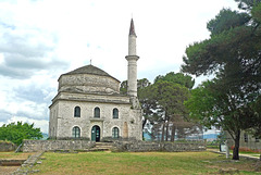
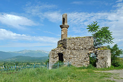
The Fethiye Mosque is located in Its Kale , the inner castle in the walled city of ancient Ioannina. It was built immediately after the conquest by the Ottomans in 1430, near the ruins of an early 13th-century Byzantine church. Originally it was a wooden structure, which was replaced in 1611 by a stone building.
The mosque was extensively remodeled in 1795 by Ali Pasha, an Albanian born cruel despot, who made it the main mosque of his palace. The tomb of Ali Pasha and his family is located before the mosque, protected by a solid metal fence.
The mosque has a square plan, with a minaret at the western corner. The prayer hall, covered with a hemispherical dome, has a wooden balcony supported on stone columns. Interior decoration is preserved and the mihrab is particularly striking.
Nowadays the mosque is part of the Byzantine Museum and can be visited.
Greece - Monastery of Panagia Molyvdoskepastos
| |
|
|
|
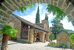
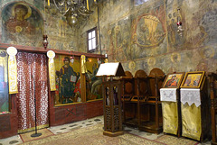
The history of the Monastery of Molyvdoskepastos goes back in the Byzantine era and was originally built in the 7th century. It is one of the oldest monasteries in Greece. Its founder was the Byzantine emperor Constantine IV Pogonatos. The monastery was renovated in the 14th century by Andronikos Komnenos Doukas Palaiologos. The monastery owes its name from the lead roof it once had: i>molivdoskepasti means “with a roof of lead”. The lead was stolen by Turks to make bullets and was then replaced by slates.
The katholikon (main church) belongs to a complex architectural style and was built in three phases. The original church with three vaults and a dome, was the first to built (11th and 12th century). The middle cross vaulted section was added at the end of the 13th century and in the beginning of the 14th century. Finally, an open narthex was added in the year of 1521 by the inhabitants of a nearby village. The interior of the church is decorated with splendid wall and ceiling paintings of the 14th and 16th centuries. The iconostasis is carved, probably dating back to the 15th century with remarkable icons.
After 1913 the monastery remained without monks, its properties were encroached and its holy artifacts and relics were stolen. In 1943, when the area was bombarded by the Nazis, it was almost razed to the ground. In 1988 the monastery was manned once more by the present day brotherhood.
From the outside the monastery looks (a little bit) like a fortress, due to its walls and gatehouse. It is located about 20 km from the town of Konitsa, some hundred meters away from the Aoos River and the border with Albania.
Greece - Ioannina
| |
|
|
|
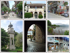
The region of Ioannina has been popoulated by Greeks since the Mycenaean era. However the city of Ioannina - often called Yannena - was formally founded by the Byzantine Emperor Justinian in the 6th century AD.
Ioannina flourished following the Fourth Crusade, when many wealthy Byzantine families fled to the city in the early 13th century following the sack of Constantinople. It was part of the Despotate of Epirus from 1358 to 1416, before surrendering to the Ottomans in 1430. Between 1430 and 1868 the city was the administrative center of the Pashalik of Yanina. In the period between the 18th and 19th centuries, the city was a major center of the modern Greek Enlightenment. Ioannina became again part of Greece in 1913 following the Balkan Wars.
The City has a longstanding tradition in commerce and handicraft activities dating back in the 17th century, where merchants from Ioannina traded with important European commercial centers, such as Venice and Livorno, and established commercial and banking houses. During the 18th century, every author of the Greek world, was either from Ioannina or was a graduate of one of the city's schools, and the city created the reputation of being number one City in education.
Ioannina is situated on the western shore of Lake Pamvotis. Nowadays it is the capital and largest city of the region of Epirus with a population of more than 100.000 people. The city has a wealth of attractions and museums with most attractions. The main sight is the “castle” located in the center of the town, this was the heart of the Despotate of Epirus, and the Ottoman vilayet. The (historic) centre of Ioannina offers small traditional shops and houses, and many souvenir shops.
Greece - Kipi, Plakidas Bridge
| |
|
|
|
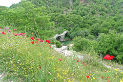
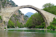
The Plakidas Bridge (Γεφύρι Πλακίδα) is crossing the Voidomatis River close to the village of Kipi on a site belonging to the village of Koukouli. The stone bridge has three semi-circular arches. The central arch has a span of 13,50 meters and a height of 7,60 meters. The bridge is 64 meters long and 3,20 meters wide.
Plakidas Bridge retained its original triple-arched form despite being almost completely reconstructed over the years.
The first bridge on this location was wooden and built in 1814. A short time later, but unknown when, an abbot from the nearby monastery in Vitsa paid 20.000 “piaster” for the bridge to be rebuilt in stone. The monastery of Profitis Ilias maintained a watermill at this point and the construction of the bridge was done to replace the older bridge, in order to make the passage safer.
Repairs were carried out in 1866 and were paid by Alexios Plakidas. This act is recorded in an old register of “contributors and benefactors to the community and church of Koukouli village”.
Alexios brother and nephew were also contributors. Since that time the Plakidas family has not stopped generous amounts of money to repair the bridge. This explains the bridge’s name, although its official name is Kalogeriko Bridge; which means “Bridge of the abbot”.
Greece - Kipi, Mylos Bridge
| |
|
|
|
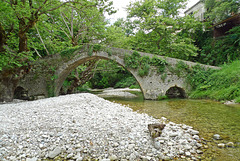
The Mylos Bridge (Γεφύρι Μύλου) is located nearby the village of Kipi and crosses the River Bayiotiokos. The villagers used to cross this bridge to get to the local watermill (hence the name: mylos = mill in Greek) and their gardens on the opposite side of the river, or to travel to Ioannina.
Mylos Bridge has three arches. The two largest stand in the river bed and are almost equal in size; the smallest is a flood arch. Looking from left to right the dimensions of each arch are (span and height): 9.60/4.30 meters, 8.30/3,75 meters and 3.90/1.60 meters. The walkway is 41 meters long and 2.30 meters wide. It rises and falls twice, peaking in height over the keystones of the largest arches. The path is protected by vertical arcade stones.
A plaque built into the masonry over the central pier tells that the bridge was completed in June 1748.
Greece - Vikos Gorge
| |
|
|
|
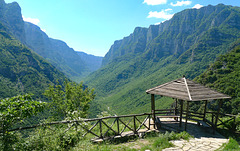
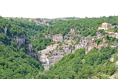
The Vikos Gorge is located in the mountainous area of Epirus and is part of the Vikos-Aoos National Park. It is an extremely spectacular gorge due to its steep walls, rising to a height of more than 1.200 meters in several places. In fact, it is the second deepest gorge in the world, after the Grand Canyon in the USA. TheVoidomatis River crosses the Vikos Gorge and gives beautiful natural sceneries.
Although the Vikos Gorge has been called the 'deepest' gorge on earth (since 1997 it has been listed by Guinness World Records as the deepest canyon), it is not entirely true, as a special measurement method has been used that excludes other deeper places. Does not take away from the fact that the gorge is a downright natural wonder. The gorge was created because the river Voidomatis was given millions of years to erode it.
The gorge is named after the village of Vikos, where it ends. The starting point is about 600 meters after the mountain village of Monodendri. Its overall length exceeds 30km; its depth varies. In Monodendri it reaches 600 meters and is its the narrowest point and in Vikos village it reaches 1.200 meters. Vikos Gorge is nicknamed the “Grand Canyon of Greece”.
Greece - Vrosina, bridge
| |
|
|
|
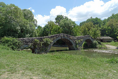
Some pictures of the stone single-arched stone bridge in Vrosina. Its construction was funded by the Makralexis Monastery The bridge crosses the river Zaloggitikos just before it flows into the Kalamas.
I estimate the bridge is dating back to the end of the 19th century, like a lot of other stone bridges in Epirus. But to be honest I couldn’t find much information about the bridge. Even two friendly and helpful Vrosina-women were not able to find important information about its history on the internet.
Greece - Molyvdoskepastos, Church of the Holy Apos…
| |
|
|
|
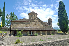
The Church of the Holy Apostles is located just outside the small village of Molyvdoskepastos - known as Depalitsa until 1929. According to the text of the founding inscription, it was built in 1537 and the hagiographies were added in 1645. The church belongs to the cross inscribed architectural type, with a twelve-side dome, a narthes to the west and a later portico to the south. The interior shows remarkable frescoes.
The church used to be the seat of the Archbishop of Pogoniani until 1857. Next to the church is a viewpoint, from where there is a fine view of the area of the Greek-Albanian border and of the confluence of the rivers Aoos and Sarandaporos, the waters of the two rivers then cross the Albanian lands and flow into the Adriatic sea (PiP3).
Greece - Konitsa, Suleiman Mosque
| |
|
|
|
The Suleiman Mosque is the only surviving mosque in Konitsa. It is a building that Sultan Suleiman the Magnificent founded on his return from a campaign in Albania after 1536. It remains in a dilapidated state, after it was abandoned by the Muslim inhabitants of Konitsa, who left during the exchange of populations in 1925. It consists of a prayer area and the minaret which is built into the southwest corner of the prayer area.
On the same archaelogical site one will find also a hexagonal mausoleum of one room (PiP4) and the former Muslim school of Konitsa. According to an inscription on the lintel the school is dating back to 1869 (PiP5).
Greece - Konitsa Bridge
| |
|
|
|
The Konitsa or Aoos Bridge was built by architect and stone-master Zioga Frontzou. The construction – done by 80 craftsmen - was completed in 1870, after the first attempt collapsed a year earlier.. The bridge - built to replace an older wooden bridge that stoof on the same place - helped to improve communication and transport between the local population in the area. The construction of the bridge was a difficult and expensive undertaking and a miracle of its time. The bridge - professionally and aesthetically designed - was not only financed by the rich, but also by the ordinary people who shared the idea of the bridge.
The single-span stone arch bridge has a width of 36,80 meters and a height of almost 18 meters. The cobbled walkway - just 2,70 meters wide - has a length of 61,50 meters. The Konitsa Bridge is one of the largest stone bridges in Epirus (and even the Balkan).
It’s not only the bridge, but also the location with the Aoos river flowing under the arch and an incredible view into the Aoos Gorge with the natural beauty of the green mountains of the Northern Pindos National Park in the background.
Konitsa Bridge is built on the narrowest point of the Aoos gorge with some good rocks on both sides of the river. Therefore a one arch of big radius could steadily cover the distance, avoiding bigger and more expensive constructions. Under the arch hangs a little bell, which warned crossing people for strong winds. The bell was lost, but replaced in 1975.
Greece - Konitsa
| |
|
|
|
Konitsa, located near the Albanian border, is built amphitheatrically-shaped on a mountain slope of the Pindos mountain range from where it overlooks the valley where the river Aoos meets the river Voidomatis.
The town of Konitsa is recorded for the first time under its modern name in the “Chronicle of Ioannina” of 1380. The chronicle mentioned that the defences of the castle of Konitsa were strengthened by the local Despot of Epirus, due to an imminent attack. In 15th century Konitsa came under Ottoman rule. The town was the administrative centre of a kaza (Ottoman district), which according to the Ottoman General Census of 1881/82 had a total population of 16.570.
In 1924 Konitsa was a small town that consisted of a total of 800 dwellings, 200 of which were considered Albanian or Turkish. As a result of the population exchange agreement of 1923 between Greece and Turkey, roughly two-thirds of Konitsa's Muslims, were considered "Turks by origin" and left for Turkey in 1925. Another part moved to Albania. They were replaced with around 1,000 Greeks from Cappadocia.
There are different theories regarding the etymology of the name. The first states that the city takes its name from an ancient Epirote city named “Knossos”, which was located near modern-day Konitsa. Another theory states that the name is Slavic, from Koni (horse) and Tza (land). According to a third theory, the name comes from a local lord named Konis , who allegedly built a castle in the city.
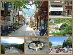
Nowadays Konitsa is known to be one of the most beautiful villages of Greece. The well preserved stone houses harmoniously coexist with the cobblestone streets, the lush vegetation and gardens. The heart of the town is the main square with its cafes and terraces.
Greece - Agia Varvara, Saint Paisios tree church
| |
|
|
|
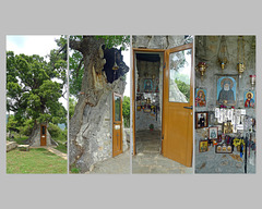
Nearby the hamlet of Agia Varvara one can find a unique tiny church, build in the trunk of a 300 year huge oak tree. This tree church is dedicated to Saint Paisios. It is believed that Saint Paisios, one of the most beloved figures in the Orthodox Church, passed through the area in his youth, going to nearby villages to carry out carpentry work and repairs in local houses.
The blessed tree had suffered severe destruction and fire, resulting in deteriorating condition. With each passing year, its condition worsened and there was a fear it might collapse. However , thanks to a local villager, the weak tree was internally shielded with local stone. A miracle happened and the tree has turned green again.
On the outside, there is a small bell, while on the inside, which only holds two people, there is a recess where the visitor can light his candle, a candelabrum, an icon of Christ, an icon of the Virgin Mary and in the center the icon of Saint Paisios.
Greece - Agia Anna, Tsouka waterfall
| |
|
|
|
The Tsouka waterfall is the only waterfall that has been created by the Stenorema brook, whose waters flow into the Aliakmon River. The waterfall - also called Agia Anna waterfall - is about 20 meters high and has a pond at its base. It is the largest of the regional unit of Kastoria.
We wanted to visit the waterfall from the Zoodochos Pigi church, which stands on the top of the cliff. Unfortunately, the path was closed due to restoration works on the church.
Greece - Kastoria, Monastery Panagia Mavriotissa
| |
|
|
|
The monastery Panagia Mavriotissa was founded in 1082/83 by Byzantine Emperor Alexios I Komnenos to commemorate the victory over the Normans and the recapture of Kastoria.
It is referred to in documents dating back to the 13th century as the monastery of Panagia Mesonisiotissa (= in the middle of the island). In the second half of the 17th century the name changed to Panagia Mavriotissa, because the inhabitants of the village of Mavrovo (nowadays ‘Mavrochori’) ensured that it remained in good condition.
The monastery played an important role in the history of the area, but remained closed for many years. It was reopened in 1998. Only a few buildings from the original monastery have survived. The church has a spacious narthex on the west side, which was added later. The interior is decorated with murals dating from the beginning of the 13th century. The icons on the outside date from the period 1259 - 1264.
The murals and drawings were damaged - all eyes of saints were removed - during Ottoman period. Some of these old frescoes were restored in the 13th century, while the outer wall of the narthex was decorated with new ones.
Greece - Lake Kremasta
| |
|
|
|
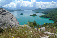
Lake Kremasta (or Lake Kremaston) is the largest artificial lake in Greece. It was formed as a result of the construction of Kremaston hydroelectric dam between 1961 and 1965. The water that is accumulated in the lake is about 3.8 cubic kilometers. The creation affected the lives of the residents as 15 villages would be found under the lake and that forced them to leave their homes and properties. Unfortunately the same goes for many historical bridges and churches.
The lake is continuously supplied by Acheloos, Agrafiotis, Tavropos and Trikeriotis rivers. The water of the lake penetrates along the beds of the four rivers and forms a lot of fjords and small islands. The artificial lake with its turquoise waters offers an incomparable Greek landscape.
Greece - Kastoria, (post)-Byzantine churches
| |
|
|
|
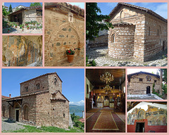
Kastoria is well-known for its churches. It is also calles “city of 100 churches”. The amount of Byzantine and post-Byzantine churches proves the richness of the city through the different ages. Kastoria originally had 72 Byzantine and medieval churches, of which 54 have survived. Some of them have been restored and provide useful insight into trends in late Byzantine styles of architecture and fresco painting.
Many of the churches are small structures, as they were built as private churches by wealthy fur traders or the katholika of small monasteries. They are either aisleless churches or three-aisled basilicas. Their façades often show rich masonry with decorative letters, geometrical patterns, bands of dentils and occasional sun motifs. The churches also have outstanding fresco decorations with diverse iconographic programmes, showing their donors’ and painters’.
Greece - Kastoria, Doltso
| |
|
|
|
In Ottoman times, Kastoria attracted a mass of people from all over the Balkans and beyond, resulting in a diverse, multi-ethnic community. The different ethnic communities, Bulgarian, Turkish, Greek and Jewish, were centred around separate neighbourhoods or 'quarters'. Two old lakeside Greek neighbourhoods "Doltso" and "Apozari" are among the best-preserved and last remaining traditional quarters of the city.
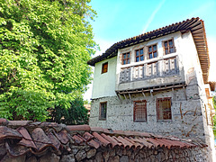
Especially “Doltso” - with its cobbled alleys and streets - is characterised by historic traditional mansions so called archontika - and houses, built between the 17th and 19th centuries by wealthy Kastorian furriers. During this time, the processing and exporting of animal furs created wealth in Kastoria.
Some of these mansions nowadays houses museums and hotels.
Greece - Kastoria
| |
|
|
|
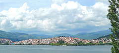
Kastoria is partly built on a narrow peninsula jutting into Lake Orestiada at an altitude of about 620 meters. The small city is tucked away in the mountains of Macedonia. The place was first mentioned in the 1st century AD of a town near a lake called Celerum, a town which was captured by the Romans during their war against Phillip V of Macedonoa in 200 BC.
The name Kastoria was first referred to in the late 10th century, when it was held by Bulgaria during the Byzantine-Bulgarian wars. Most probably Kastoria derives from the Greek word kástoras , meaning beaver.
Trade in the fur was traditionally an important element of Kastoria’s economy. The trade in beaver skins, which began over a thousand years ago, gave rise to the town’s chief industry. When the beavers from the lake ran out, the town imported furs. Nowadays the fur trade has almost stopped.
Kastoria is well known for its many Byzantine churches and monasteries. From the 72 Byzantine and medieval churches there are still more than fifty in and around the city. Many of them have frescoes that are in very good shape. One of the most beautiful and interesting is Monastery Panagia Mavriotissa, located on the shores of Lake Orestiada.
Lake Orestiada (or Lake Kastoria), the promenade and forests offer a perfect shelter for all kind of bird species. The lake is home for 200 different species, among them some rare and endangered ones. The most typical species are cormorants, pelicans, herons, swans, wild ducks and herons. Lake and surrounding wetlands also house frogs and Greek turtles.
Jump to top
- ipernity © 2007-2024
- Help & Contact
|
Club news
|
About ipernity
|
History |
ipernity Club & Prices |
Guide of good conduct
Donate | Group guidelines | Privacy policy | Terms of use | Statutes | In memoria -
Facebook
Twitter

