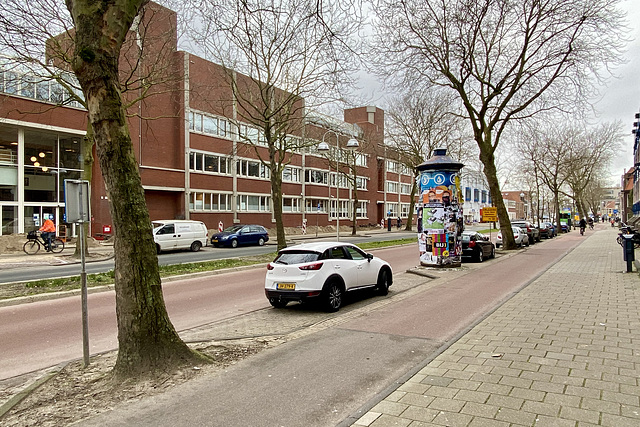
Langegracht
Progress
Langegracht
Langegracht
Langegracht
Langegracht
Croissant
View of the Marekerk
Former Orphanage
Entrance to the Oranjepark
Do not place bicycles here
Adult voyage
Sint Stevenshofje
Geen fietsen op de markt
Jacob van Rijndorpplaats
Work on the City Hall
Counting the votes
Queueing to vote
Cat
Gate
Counting the votes
Door of the polling station
Klein Curium
Langegracht
Langegracht
Ticket for the Ravenna mosaics
James Watt studies the Newcomen steam engine
Alternate pollarding
Snowdrops
Tank
Ticket for the Turin public transport
George Stephenson when he was young
Tank
New wooden plank shop
Bicycle
Ticket for the Galleria Nazionale delle Marche
Ticket for the Oratorio di San Giovanni Battista
Pressure gauge
Appenzeller
Open horeca winkels normaal
High trees
Refuse
Stamp of the International Court of Justice
Telegraph room
Stamp of the International Court of Justice
1/122 • f/2.4 • 1.5 mm • ISO 25 •
Apple iPhone 11 Pro Max
iPhone 11 Pro Max back triple camera 1.54mm f/2.4
EXIF - See more detailsLocation
See also...
Keywords
Authorizations, license
-
Visible by: Everyone -
All rights reserved
-
39 visits
Langegracht


The Langegracht (Long Canal) started as part of the expansion of Leiden in 1611. It became an industrial area, with clothing factories, a power station, gas works, distillery and a incinerator. There were some houses, most of the slum type. In the 1960s and 70s the factories closed. In 1964 the canal was filled in and it was turned into a four-lane car road, part of the so-called City Ring, a car route through Leiden. Leiden was not very accessible by car, certainly not if you wanted to drive north-south. The factories have been replaced by modern buildings and some new building projects have been planned to replace those modern buildings. The design of the Langegracht will be changed from the end of March 2021: narrower car lanes, bigger green area inbetween, new road surfaces etc.
- Keyboard shortcuts:
Jump to top
RSS feed- Latest comments - Subscribe to the comment feeds of this photo
- ipernity © 2007-2024
- Help & Contact
|
Club news
|
About ipernity
|
History |
ipernity Club & Prices |
Guide of good conduct
Donate | Group guidelines | Privacy policy | Terms of use | Statutes | In memoria -
Facebook
Twitter

Sign-in to write a comment.