Leon_Vienna's photos
Manitoulin Island, Pavement Alvar at Misery Bay -…
| |
|
|
|
Back to my my photo archive HDD - Canada 2007 series can go on.
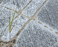
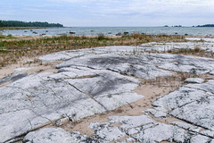
A closer look at the compact and leveled limestone on Manitoulin Island with its structural cracks and glacial scratches. Hard life there ...
More about Alvars:
english - en.wikipedia.org/wiki/Alvar
deutsch - de.wikipedia.org/wiki/Alvar_(Landform)
Two further sites about Canadian Alvars worth seeing, you'll find here - very nicely written and garnished with most beautiful images:
- floraofohio.blogspot.com/2017/04/the-bruce-peninsula-part-vi-alvar.html (all seven parts about Bruce Peninsula are worth to look at - in my opinion ... and not even mentioning the rest of this interesting site)
- www.meanderphotography.ca/Alvar
Bodensee - Abendstimmung
| |
|
|
|
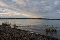
Evening mood at Lake Constance, Germany.
Some days off - external HDD forgotten home, Canada of 2007 has to wait. One or another actuell Lake Constance image as comfort.
Manitoulin Island, Pavement Alvar with Glacial Str…
| |
|
|
|
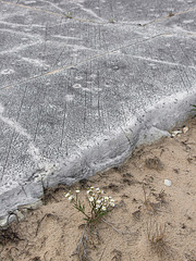
Alvar - leveled and massiv limestone, planed by ice age glacier. Non to little soil development during last few thousand years create an envirement for very specialized plant communities.
Those stronger cracks have to do with the structure of the limestone, the finer scratches origin from glacial movements during the last ice age.
More about Alvars:
english - en.wikipedia.org/wiki/Alvar
deutsch - de.wikipedia.org/wiki/Alvar_(Landform)
Two further sites about Canadian Alvars worth seeing, you'll find here - very nicely written and garnished with most beautiful images:
- floraofohio.blogspot.com/2017/04/the-bruce-peninsula-part-vi-alvar.html (all seven parts about Bruce Peninsula are worth to look at - in my opinion ... and not even mentioning the rest of this interesting site)
- www.meanderphotography.ca/Alvar
Manitoulin Island, Pavement Limestone, Misery Bay…
| |
|
|
|
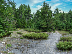
Compact and leveled limestone bedrock creats a biological environment known as Alvar. According german wikipedia one more criterion shall be that the limestone rock was more or less planed by the ice of the ice age. Often scratches of those glacier works can be seen on the surface of the "pavement".
More about Alvars:
english - en.wikipedia.org/wiki/Alvar
deutsch - de.wikipedia.org/wiki/Alvar_(Landform)
Two further sites about Canadian Alvars worth seeing, you'll find here - very nicely written and garnished with most beautiful images:
- floraofohio.blogspot.com/2017/04/the-bruce-peninsula-part-vi-alvar.html (all seven parts about Bruce Peninsula are worth to look at - in my opinion ... and not mentioning the rest of this interesting site)
- www.meanderphotography.ca/Alvar
Oh, and by the way: the sky was brought by Skylum's Luminar AI. On my original JPG it was dazzling white ... I experiment with it, but whenever skies or light mood is effected with it, I tag it with "Luminar AI".
Manitoulin Island, Misery Bay - 2007
| |
|
|
|
Compact and leveled limestone bedrock creats a biological environment known as Alvar. According german wikipedia one more criterion shall be that the limestone rock was more or less planed by the ice of the ice age. Often scratches of those glacier works can be seen on the surface of the "pavement".
More about Alvars:
english - en.wikipedia.org/wiki/Alvar
deutsch - de.wikipedia.org/wiki/Alvar_(Landform)
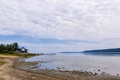
Manitoulin Island, West Bay, Lake Huron - 2007
Manitoulin Island, Niagara Escarpment-Panorama ca.…
| |
|
|
|
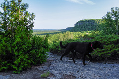
Almost the whole thing, without doggie or someone else.
Central direction should be almost north-east, toward the small town of Little Current which might be situated behind the slope in the centre of image - two hights of the eastern part of La Cloche Mountains are seen as well (pip3). In the left part North Channel of Lake Huron is visible (pip1), a bit further right the western part of La Cloche (pip2). The waters on the right half isn't any of the Great Lakes, but Lake Manitou (pip4), the world's largest freshwater lake on the world's largest island in the world's largest freshwater lake (taking Lake Huron and Lake Michigan as one, what they obviousely are) ... more about that here: en.wikipedia.org/wiki/Lake_Manitou and here: en.wikipedia.org/wiki/Manitoulin_Island
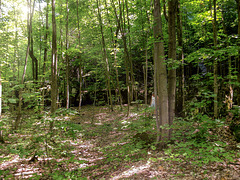
Manitoulin Island, In the Green - 2007
| |
|
|
|
Manitoulin Island, Niagara esc... someone always s…
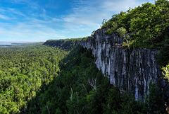
Manitoulin Island, Niagara Escarpment (3xPiP)
| |
|
|
|
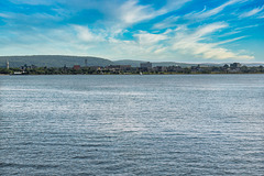
Lake Nipissing, North Bay Lakeside - 2007
| |
|
|
|
Die Hügel hinter der Stadt sind eher Stufe, denn Hügel. Eine Stufe auf den uralten Granit des kanadischen Schildes. Dort oben geht es mit nur flachem Relief eher eben weiter ( siehe hier ). Gleich hinter der Stadt liegt der Trout Lake, der über den Mattawa und Ottawa River nach Südosten zum Sankt Lorenz Strom entwässert, während der Nipissing über den French River nach Westen zu den Großen Seen eine Verbindung hat. Eigentlich liegt die Stadt selbst genau auf der Wasserscheide und auf der einzigen (von Stromschnellen abgesehen), nur wenige hundert Meter langen Portage-Strecke für Kanus zwischen Atlantik und Oberer See. Die Geländestufe im Bild zeigt in etwa den Beginn und Verlauf des Wasserweges Richtung Osten.
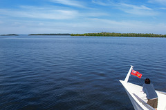
Lake Nipissing, Manitou Islands Cruise - 2007 (2x…
| |
|
|
|
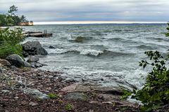
Lake Nipissing, Rough Waters - 2007
| |
|
|
|
Lake Nipissing, The Bay around the Corner - 2007 (…
| |
|
|
|
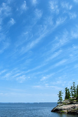
Lake Nipissing, Sky & Clouds - 2007
| |
|
|
|
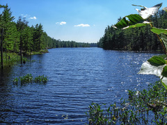
French River, Unnamed Lake Nearby - 2007
| |
|
|
|
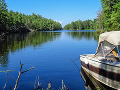
French River, Hidden Bay - 2007
| |
|
|
|
The French River (French: Rivière des Français, Ojibwe: Wemitigoj-Sibi) is a river in Central Ontario, Canada. It flows 110 kilometres (68 mi) from Lake Nipissing west to Georgian Bay ... The French River flows through typical Canadian Shield country, in many places exposing rugged glaciated rock but also through heavily forested areas on the upper portion. The mouth of the river contains countless islands and numerous channels which vary from narrow, enclosed steep-walled gorges, falls and rapids, to broad expanses of open water.
Together with the Ottawa and Mattawa Rivers, the French River formed part of the water highway from Montreal to Lake Superior in the days of the fur trade. It remained a major canoe route until about 1820. Around 1855, the Grand Trunk Railway of Canada provided newfound access to the area and the Georgian Bay. This led to increased exploration and interest for fishing and logging during the era of the Industrial Revolution. After the Great Chicago Fire in 1871, there was a boom in logging along with the creation of Lumber barons in the Great Lakes. The French River was "ripe for the picking with its seemingly inexhaustible supply of timber and proximity to the American markets".
en.wikipedia.org/wiki/French_River_(Ontario)
Exploring French River, Rocky - 2007 (7 PiPs)
| |
|
|
|
The French River (French: Rivière des Français, Ojibwe: Wemitigoj-Sibi) is a river in Central Ontario, Canada. It flows 110 kilometres (68 mi) from Lake Nipissing west to Georgian Bay ... The French River flows through typical Canadian Shield country, in many places exposing rugged glaciated rock but also through heavily forested areas on the upper portion. The mouth of the river contains countless islands and numerous channels which vary from narrow, enclosed steep-walled gorges, falls and rapids, to broad expanses of open water.
Together with the Ottawa and Mattawa Rivers, the French River formed part of the water highway from Montreal to Lake Superior in the days of the fur trade. It remained a major canoe route until about 1820. Around 1855, the Grand Trunk Railway of Canada provided newfound access to the area and the Georgian Bay. This led to increased exploration and interest for fishing and logging during the era of the Industrial Revolution. After the Great Chicago Fire in 1871, there was a boom in logging along with the creation of Lumber barons in the Great Lakes. The French River was "ripe for the picking with its seemingly inexhaustible supply of timber and proximity to the American markets".
en.wikipedia.org/wiki/French_River_(Ontario)

