Scottish Lochs
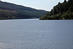
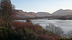
Loch Lubnaig 7th September 2019.(mapping Approx)
| |
|
|
|
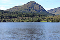
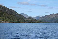
Loch Lubnaig (Loch Lùbnaig in Gaelic) is a small freshwater loch near Callander in the Stirling council area, Scottish Highlands. It lies in the former county of Perthshire. It is part of the Loch Lomond & Trossachs National Park
The loch nestles in the space between Ben Ledi and Ben Vorlich. Fed by the River Balvaig from the north and drained by the Garbh Uisge to the south, Loch Lubnaig offers fishing from the shore while canoes can be rented at the north end. Alternatively, two car parking areas on the east shore offer perfect, albeit sometimes busy, canoe launching points.
The route of the former Callander and Oban Railway runs along the west shore of the loch. This route has now been converted to a part of the National Cycle Network's 'Route 7' allowing cyclists and walkers to travel the 9 miles between Callander and Strathyre.
The name is derived from the Gaelic Lùbnaig, meaning crooked. Like many lochs of the Highlands, the name is almost identical to its Gaelic version.
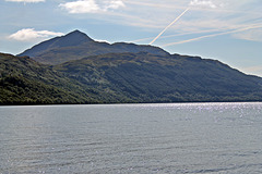
Ben Lomond 974 metres (3,196 ft) across Loch Lomon…
| |
|
|
|
Ben Lomond (Scottish Gaelic: Beinn Laomainn, 'Beacon Mountain'), 974 metres (3,196 ft), is a mountain in the Scottish Highlands. Situated on the eastern shore of Loch Lomond, it is the most southerly of the Munros. Ben Lomond lies within the Ben Lomond National Memorial Park and the Loch Lomond and The Trossachs National Park, property of the National Trust for Scotland.
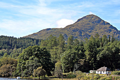
Beinn Narnain 926 metres (3038ft) from Loch Lomond…
| |
|
Beinn Narnain (sometimes anglicised as Ben Narnain) is a mountain in the southern Highlands of Scotland, near Arrochar. It forms part of a group of hills known (unofficially) as the Arrochar Alps, and is a Munro. The name Beinn Narnain means "hill of notches", and describes the mountain's notched profile.
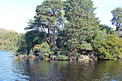
Inveruglas Island, Loch Lomond from a Cruise Boat…
| |
|
|
|
Inveruglas Isle (Scottish Gaelic: "Innis Inbhir Dhughlais") is a small uninhabited island within Loch Lomond, and lies off the shore at Inveruglas opposite Inversnaid at the north end of the loch. It is opposite the Loch Sloy power station.
The name Inbhir Dhu(bh)ghlais means "mouth of the black stream"; Inveruglas Isle is therefore, quite literally, the island at the mouth of the black stream.
The island houses the ruins of a castle which was once home to the chiefs of the Clan MacFarlane, destroyed in the seventeenth century by Oliver Cromwell's Roundhead troops
Remains of the Clan MacFarlane Castle Inveruglas I…
| |
|
|
|
The island is dominated by the remains of the castle which is a rectangular tower with different sized round towers at the NE and SW corners. Once the stronghold of the MacFarlanes it was destroyed by soldiers loyal to Cromwell during the Commonwealth of 1649 to 1660 (perhaps c.1654). A sword and set of keys were found in the ruins some years ago.
The towers are later additions to the main tower block and appear to represent a later strengthening of the defences. The standing walls are built entirely of sandstone and are very obviously burnt. The castle stands no higher than the first floor and it is apparent that its destruction in the mid 17th century was comprehensive.
Sloy Power Station,Inveruglas from a cruise boat o…
| |
|
|
|
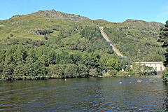
The Sloy/Awe Hydro-Electric Scheme is a hydro-electric facility situated between Loch Sloy and Inveruglas on the west bank of Loch Lomond in Scotland.
The scheme was conceived by the Edinburgh architects Tarbolton & Ochterlony. Following Matthew Ochterlony's death in 1946, the scheme was progressed alone by Harold Tarbolton.
Construction began in May 1945, under the auspices of the North of Scotland Hydro-Electric Board and was completed in 1949. The official opening ceremony took place on 18 October 1950 and was attended by Queen Elizabeth. Historic Scotland has designated the modernist power-station building and the dam as listed buildings of categories A and B respectively.
Twenty-one men lost their lives during the construction.The labour force also included some German prisoners-of-war.
The facility is operated by Scottish and Southern Energy, and is normally in standby mode, ready to generate electricity to meet sudden peaks in demand. It can reach full-capacity within 5 minutes from a standing start.
The Munro Beinn Narnain 3038ft from a cruise boat…
| |
|
|
|
Looking towards Ardlui, Loch Lomond 7th September…
| |
|
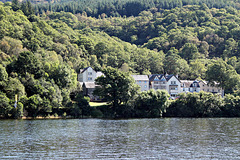
Inversnaid Hotel, Loch Lomond 7th September 2019.
| |
|
|
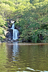
Arklet Fall`s,from a cruise boat on Loch Lomond 7t…
| |
|
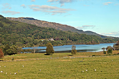
Loch Achray, Trossachs from The Loch Akray Hotel 7…
| |
|
|
Loch Achray is a small freshwater loch 11 kilometres west of Callander in Stirling district, Scotland.
The loch lies between Loch Katrine and Loch Venachar in the heart of the Trossachs and has an average depth of 11 metres. The south side of the loch is wooded and well served by woodland tracks and forest roads. The loch is popular with anglers who fish for brown trout. Loch Achray is well known for its sheltered location, giving rise to placid waters offering magnificent reflections of the woodland to the south, the mountains and forests to the north and the majestic crags of Ben Venue to the west.
Loch Achray was for a time the home of James "Beg" Stewart (c1410-1470) of Baldorran, the son of James Mor Stewart (known as "James the Fat"), who fled into exile in Ireland when his father Murdoch Stewart, Duke of Albany was executed for treason by James I of Scotland in 1425. James the Fat would never return to Scotland, and he was unable to inherit the Albany estates, but James "Beag" Stewart was able to secure a royal pardon and return to Scotland. He is the ancestor of the Stewarts of Ardvorlich on Lochearnside, whose family history is recounted by Sir Walter Scott in A Legend of Montrose.
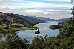
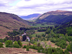
Queens View,Loch Tummel,Perth & Kinross 8th Septem…
| |
|
|
|
Kilchurn Castle from The Loch Awe Hotel 31st Decem…
| |
|
|
|
Kilchurn Castle (/kəlˈxuːrn/) is a ruined structure on a rocky peninsula at the northeastern end of Loch Awe, in Argyll and Bute, Scotland. It was first constructed in the mid-15th century as the base of the Campbells of Glenorchy, who extended both the castle and their territory in the area over the next 150 years. After the Campbells became Earls of Breadalbane and moved to Taymouth Castle, Kilchurn fell out of use and was in ruins by 1770. It is now in the care of Historic Environment Scotland and is open to the public in summer.
The Campbells of Glenorchy were the most powerful cadet branch of the Clan Campbell, and over two centuries from the 1430s came to dominate the central Highlands. The building of several castles, of which Kilchurn was the first, was a key part of their territorial expansion during this period.Sir Colin Campbell, 1st of Glenorchy (died 1475), was a younger son of Duncan Campbell, 1st Lord Campbell, ancestor of the Earls of Argyll. Sir Colin was granted Glen Orchy and other lands by his father in 1432, and afterwards established Kilchurn around 1450.The first castle comprised the five-storey tower house, with a courtyard defended by an outer wall. At the time Kilchurn was on a small island scarcely larger than the castle itself, and would have been accessed via an underwater or low-lying causeway.
Sir Colin's son, Sir Duncan Campbell of Glenorchy, built the 'laich hall' - a single-storey dining hall built along the inside of the south curtain. Sir Duncan was one of the many Scottish nobles killed at the Battle of Flodden in 1513. During the second half of the 16th century, another Sir Colin Campbell, the 6th Laird (1499–1583), further improved the castle's accommodation by adding some chambers to the north of the tower house, and remodelling the parapet. This included the introduction of the circular corner turrets adorned by corbels.[6] Sir Colin also constructed Balloch Castle (now Taymouth Castle) by Loch Tay, to consolidate the Campbell's territorial gains in Perthshire, which had been achieved largely at the expense of their former allies, the Clan MacGregor of Glenstrae.
Sir Duncan Campbell, (c.1550–1631), known as "Black Duncan", represented Argyll in the Scottish Parliament and was created a baronet, of Glenorchy in the County of Perth, in the Baronetage of Nova Scotia in 1625. Sir Duncan had the south range of the castle rebuilt and enlarged in 1614, and constructed a new range incorporating a chapel in the south-east part of the courtyard.The ambitious Black Duncan also began construction of Finlarig Castle at the west end of Loch Tay, and improved farmland around Finlarig, Kilchurn and Balloch Castles.
In 1681 Sir John Campbell, 5th Baronet, was created Earl of Breadalbane and Holland. He took advantage of the turbulence of the times, negotiating with Jacobite rebels at the same time as serving William III. In the 1690s he promoted a scheme to pacify the Highlands, and as part of this he began conversion of Kilchurn into a modern barracks, capable of housing 200 troops. His main addition was the three-storey L-shaped block along the north side. In 1714, on the death of Queen Anne, Breadalbane held a conference of Jacobites at Kilchurn, and he subsequently joined the Earl of Mar's Jacobite rising of 1715. Following the failure of the rising he returned home to find pro-government members of his household had turned Kinchurn and Finlarig over to Alexander Campbell of Fonab, to whom Breadalbane was obliged to surrender in February 1716. He remained under house arrest at Taymouth until his death the next year.[8] Kilchurn was also used as a government garrison during the 1745 Jacobite rising.The Campbells attempted, unsuccessfully, to sell Kilchurn to the government after they moved in 1740 to the reconstructed Taymouth Castle.
In 1760, the castle was badly damaged by lightning and was completely abandoned; the remains of a turret of a tower, still resting upside-down in the centre of the courtyard, attest to the violence of the storm. The castle was unroofed by 1770.[9] J M W Turner painted the castle on one of his tours of Scotland in the early 19th century.In 1817 the water level in Loch Awe was altered, so that the castle now stands on a long peninsula. MacGibbon and Ross surveyed the castle in about 1887, after which restoration works appear to have altered some of the castle's original features.
The ruin is now in the care of Historic Environment Scotland, and is open to the public during the summer. Access is either by boat from Lochawe pier, or on foot from the A85 near Dalmally. The access is under the railway viaduct that crosses Loch Awe, and access is sometimes restricted by higher-than-usual levels of water in the loch, which turn the site into a temporary island. The castle is a scheduled monument.
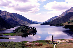
Loch Sheil at Glen Finnan
| |
|
|
|
Strath More to Loch Broom from The Corrieshellach…
| |
|
|
|
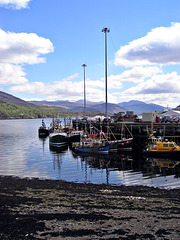
Ullapool,Loch Broom May 2004
| |
|
|
|
Baosbheinn across Gairloch Bay,Ross-shire May 2004
| |
|
|
|
Baosbheinn which is made up of Torridon Sandstone reaches a height of 875 metres (2,871 feet) making it the 56th highest Corbett and the 277th highest Marilyn. It is a long elongated mountain with a NW-SE orientation, its summit ridge is impressive, barely dropping below the 700 m (2,300 ft) contour in its 3 kilometres (1.9 miles) length. Its SW slopes drops away steeply and rockily towards Loch a’ Ghobhainn while its NE slopes are less precipitous, throwing out a series of spurs which produces three craggy corries. Strong hill walkers can climb Baosbheinn with the adjacent Corbett of Beinn an Eoin which stands across Loch na h-Oidhche and gives a demanding circular walk of 21 km (13 mi) which takes between six and nine hours.
The translation of Baosbheinn from the Scottish Gaelic language is usually given by guidebooks as “Wizard’s hill” this comes from the word baobh but strictly speaking this translates as a hag or bitch. Buidsear or fiosaiche is the usual word for a wizard. Scholars have put forward alternatives, one of these is beidhis-fjall from the Old Norse language which translates as hunting hill, with the Norse fjall later changed to the Gaelic bheinn . Local residents of Wester Ross refer to the hill as “mountain of the face”, this is explained by the fact that when viewed from Gairloch in the morning light, the hill resembles the appearance of a human head. This is supported by older spellings of the name which use derivations of bathais which translates as face or forehead. In conclusion, although the translated name is usually given as Wizard's Hill, the alternatives of Hill of the Face, Hunting Hill or Hill of the Hag (or Wicked Person) may have stronger supporting evidence.
Beinn Airigh Charr and Loch Maree from the A832 Ro…
| |
|
|
|
Beinn Airigh Charr (792 m) is a mountain in the Northwest Highlands of Scotland. It lies in Wester Ross, on the northern side of Loch Maree, near to the village of Poolewe
The mountain is north of the wild Torridon Hills, and offers magnificent views from its summit
Jump to top
RSS feed- Latest items - Subscribe to the latest items added to this album
- ipernity © 2007-2024
- Help & Contact
|
Club news
|
About ipernity
|
History |
ipernity Club & Prices |
Guide of good conduct
Donate | Group guidelines | Privacy policy | Terms of use | Statutes | In memoria -
Facebook
Twitter

