Waterfalls
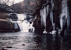
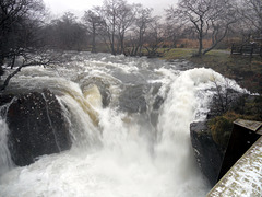
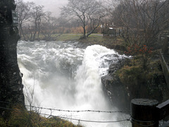
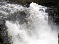
Kisdon Force,Swaledale
| |
|
|
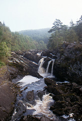
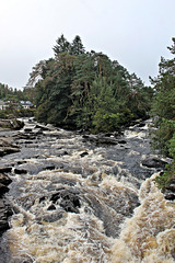
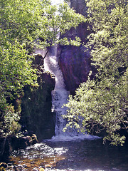
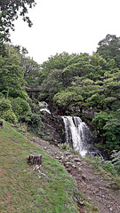
Kisdon Force is a series of waterfalls on the River Swale in Swaledale, England. The falls are situated at grid reference NY898010 within the Yorkshire Dales National Park in the county of North Yorkshire, 500 metres downstream from the small hamlet of Keld.
Kisdon Force is one of several waterfalls on the Swale in the Keld area, the others being East Gill Force, Catrake Force and Wain Wath Force. All occur where the river cuts a gorge through the Carboniferous limestone between the hills of Kisdon and Rogan's Seat. The falls in this area are termed forces after the Norse word fors or foss, which means "waterfall". Both upper and lower Kisdon Force can be negotiated by canoeists, although a high degree of skill and experience is needed. The upper falls are rated Grade IV, while the lower falls are rated more difficult at Grade V.
The falls drop 10 metres (33 ft) over two cascades and are surrounded by Kisdon Force Woods, a Site of Special Scientific Interest covering an area of 38 hectares, which consists of mixed broad-leaved woodland with ash, wych elm and rowan trees dominating. In the springtime Primula vulgaris grows profusely in the area. The falls can be easily visited by a riverside path from Keld; however, care should be taken, as the stones around the falls are often wet and slippery. Visitor numbers to the falls are swelled by walkers along the Pennine Way, a long-distance footpath that passes the falls on its way north.
Lower Falls,River Nevis Glen Nevis 31st December 2…
| |
|
|
|
Lower Falls River Nevis,Glen Nevis 31st December 2…
| |
|
|
|
Lower Falls,River Nevis Glen Nevis 31st December 2…
| |
|
|
|
Yellowstone Lower Falls 308ft from Artist Point,Ye…
| |
|
|
|
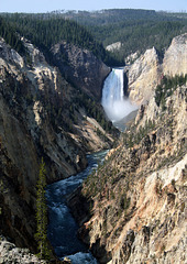
Yellowstone Falls consist of two major waterfalls on the Yellowstone River, within Yellowstone National Park, Wyoming, United States. As the Yellowstone river flows north from Yellowstone Lake, it leaves the Hayden Valley and plunges first over Upper Yellowstone Falls and then a quarter mile (400 m) downstream over Lower Yellowstone Falls, at which point it then enters the Grand Canyon of the Yellowstone, which is up to 1,000 feet (304 m) deep.
Cascading from the 590,000 year old Canyon Rhyolite lava flow, Lower Yellowstone Falls is the largest volume waterfall in the Rocky Mountains of the United States.These falls (44°43′05″N 110°29′46″W) are 308 feet (94 m) high, or nearly twice as high as Niagara Falls. The volume of water flowing over Lower Yellowstone Falls can vary from 680 cu ft/s (19 m3/s) in the autumn, to 8,400 cu ft/s (240 m3/s) at peak runoff in late springtime.[citation needed] The flow rate of Lower Yellowstone Falls is much less than that of Niagara Falls, as the Yellowstone River is only 70 feet (21 m) at the point at which it goes over the lower falls, whereas the Niagara River is 2,600 feet (790 m) in width as it approaches the crest line of Horseshoe Falls.
White Water,River Orchy 22nd May 1989
| |
|
|
|
Glen Nevis Lower Falls 18th April 2017
| |
|
|
|
The Red Burn, Ben Nevis 10th May 1993.
| |
|
|
|
The Fall`s of Rogie 24th September 1998.
| |
|
|
|
Rogie Falls (Gaelic: Eas Rothagaidh) are a series of waterfalls on the Black Water, a river in Ross-shire in the Highlands of Scotland. The falls are about 2 km north-west of the village of Contin, next to the A835 road. They are a popular tourist attraction, with several forest walks.
Rogie Falls and footbridge
The bridge will support a maximum of five persons at one time, with a narrow and sharp set of steps at its end. Access to the bridge requires limited ability with footpaths being well kept, however not wheelchair accessible by any stretch. Photography from the bridge is possible although either evening time when fewer people are around and using the bridge or in sunnier conditions when shorter exposure times are possible, due to the high degree of wobble.
As of December 2011, some building work is being performed on the far side of the waterfall which limits access to the top side of the waterfall; it is not possible to use the temporary walkways to obtain a better view, although it is possible to reach all areas with some creative walking.
Water cascades ,Grains Gill,Lake District 19th Apr…
| |
|
|
|
The Avich Falls near Dalavich,Argyll 22nd May 1989…
| |
|
|
|
The River Avich flows about 1 mile (1.6 km) down the steep glacial valley of Loch Awe from Loch Avich and the falls are near the foot of the gully. There are several falls but the main one is of three cascades crossing open rocks. The falls are in the Inverliever Forest of the Barnaline estate, one of the first Forestry Commission estates in Scotland.
Arklet Fall`s,from a cruise boat on Loch Lomond 7t…
| |
|
Fall`s of Dochart at Killin, Perthshire 8th Septem…
| |
|
|
The Falls of Dochart are a cascade of waterfalls situated on the River Dochart at Killin in Stirling (formally in Perthshire), Scotland, near the western end of Loch Tay. The Bridge of Dochart, first constructed in 1760, crosses the river at Killin offering a view of the falls as they cascade over the rocks and around the island of Inchbuie, which is the ancient burial place of the MacNab clan.
Waterfalls in The Flowerdale Glen Gairloch Ross-sh…
| |
|
|
|
The Flowerdale Glen was given its English name by the MacKenzies of Gairloch (the owners of the estate) after its impressive displays of wild flowers.
Water Falls at Letterewe May 2004
| |
|
|
|
Highland Waterfall
| |
|
|
|
Ardessie Falls
| |
|
|
|
Arklet Falls,Loch Lomond
| |
|
|
|
Jump to top
RSS feed- Latest items - Subscribe to the latest items added to this album
- ipernity © 2007-2024
- Help & Contact
|
Club news
|
About ipernity
|
History |
ipernity Club & Prices |
Guide of good conduct
Donate | Group guidelines | Privacy policy | Terms of use | Statutes | In memoria -
Facebook
Twitter

