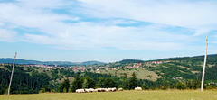
Shooting information for this photo
← Back to the photo page
Want to know more about EXIF?
Check wikipedia page about Exchangeable image file format (EXIF)
Check wikipedia page about Exchangeable image file format (EXIF)
Some of EXIF data are only available in English.
| Camera: | Xiaomi M2003J15SC |
|---|---|
| Exposure: | 0.00025 sec. (1/4032) |
| Aperture: | f/1.8 |
| Focal Length: | 4.7 mm (35 mm equivalent: 28.0 mm) |
| Flash: | Off, Did not fire |
| Exposure mode: | Not Defined |
| Resolution: | 72 x 72 dpi |
| Dimension: | 3984 x 1840 pixels |
| Original Date: | 2021:09:08 14:40:11.42 |
| Created on: | 2021:09:08 14:40:11.42 |
| Modified on: | 2021:09:10 16:55:47.42 |
| Software: | MediaTek Camera Application |
| Artist | Picasa |
| Brightness Value | 0 |
| Circle Of Confusion | 0.005 mm |
| Color Space | sRGB |
| Components Configuration | Y, Cb, Cr, - |
| Compression | JPEG (old-style) |
| Creator | Picasa |
| Digital Zoom Ratio | 1.75 |
| Exif Version | 0220 |
| Exposure Compensation | 0 |
| Exposure Mode | Auto |
| Field Of View | 65.5 deg |
| Flashpix Version | 0100 |
| Focal Length In 35mm Format | 28 mm |
| Hyperfocal Distance | 2.44 m |
| ISO | 101 |
| Image Size | 3984x1840 |
| Interoperability Index | R98 - DCF basic file (sRGB) |
| Interoperability Version | 0100 |
| Light Source | Other |
| Light Value | 13.6 |
| Metering Mode | Center-weighted average |
| Recommended Exposure Index | 0 |
| Related Image Height | 1840 |
| Related Image Width | 3984 |
| Resolution Unit | inches |
| Scale Factor To 35 mm Equivalent | 6.0 |
| Scene Capture Type | Standard |
| Sensitivity Type | Unknown |
| Sub Sec Time | 42 |
| Sub Sec Time Digitized | 42 |
| Sub Sec Time Original | 42 |
| Thumbnail Offset | 4128 |
| White Balance | Auto |
| XMP Toolkit | XMP Core 5.1.2 |
| Y Cb Cr Positioning | Co-sited |
GPS Information |
|
| GPS Altitude | 910 m Above Sea Level |
| GPS Altitude Ref | Above Sea Level |
| GPS Date Stamp | 2021:09:08 |
| GPS Date/Time | 2021:09:08 12:40:07Z |
| GPS Latitude | 44 deg 27' 50.22" N |
| GPS Latitude Ref | North |
| GPS Longitude | 17 deg 22' 50.85" E |
| GPS Longitude Ref | East |
| GPS Position | 44 deg 27' 50.22" N, 17 deg 22' 50.85" E |
| GPS Processing Method | GPS |
| GPS Time Stamp | 12:40:07 |
| GPS Version ID | 2.2.0.0 |
Jump to top
- ipernity © 2007-2024
- Help & Contact
|
Club news
|
About ipernity
|
History |
ipernity Club & Prices |
Guide of good conduct
Donate | Group guidelines | Privacy policy | Terms of use | Statutes | In memoria -
Facebook
Twitter
