Shooting information for this photo
← Back to the photo page
Want to know more about EXIF?
Check wikipedia page about Exchangeable image file format (EXIF)
Check wikipedia page about Exchangeable image file format (EXIF)
Some of EXIF data are only available in English.
| Original Date: | 2007:09:21 10:05:00 |
|---|---|
| Digitized Date: | 2007:09:21 10:05:00+02:00 |
| Created on: | 2007:09:21 10:05:00 |
| Copyright: | jeybee68 |
| About | uuid:faf5bdd5-ba3d-11da-ad31-d 33d75182f1b |
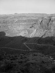
| Description | Landschaftsschutzgebiet auf Gran Canaria |
| Image Size | 2112x2816 |
| Rights | jeybee68 |
| Title | Degollada de La Yegua |
| XMP Toolkit | Image::ExifTool 10.46 |
| XP Comment | Landschaftsschutzgebiet auf Gran Canaria |
| XP Title | 21.09.2007 10.05 |
GPS Information |
|
| GPS Altitude | 470 m Above Sea Level |
| GPS Altitude Ref | Above Sea Level |
| GPS Date Stamp | 2017:03:15 |
| GPS Date/Time | 2017:03:15 23:33:14Z |
| GPS Latitude | 27 deg 49' 9.64" N |
| GPS Latitude Ref | North |
| GPS Longitude | 15 deg 34' 45.92" W |
| GPS Longitude Ref | West |
| GPS Map Datum | WGS-84 |
| GPS Position | 27 deg 49' 9.64" N, 15 deg 34' 45.92" W |
| GPS Time Stamp | 23:33:14 |
| GPS Version ID | 2.2.0.0 |
Jump to top
- ipernity © 2007-2024
- Help & Contact
|
Club news
|
About ipernity
|
History |
ipernity Club & Prices |
Guide of good conduct
Donate | Group guidelines | Privacy policy | Terms of use | Statutes | In memoria -
Facebook
Twitter
