

tiabunna's photos with the keyword: Minolta Rokkor 50mm 1:1.4
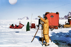
Away!
| 22 Feb 2021 |
|
|
|
From an old slide. That's me, launching a weather balloon in the Prince Charles Mountains back in 1966. On the tripod I have a theodolite for taking measurements of the balloon's position, allowing me to calculate the upper winds in the area. The PiP shows me taking temperature readings from instruments mounted on the main living caravan - the coldest we experienced on the trip was -39C, accompanied by about 60km/hr winds. The rounded van in the PiP is the second living caravan
Unfortunately, Pauline's health is not good, so I expect to be largely absent from ipernity in the coming weeks. I shall drop by when there is an opportunity and maybe even post an occasional image. Best wishes, everyone.
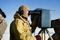
Surveying southward
| 17 Feb 2021 |
|
|
|
My colleague Ken using a Tellurometer for survey work on Mt Lacey, in the Prince Charles Mountains. Obsolete now due to satellites and GPS, back in 1966 the Tellurometers were the best way to measure distance between two points. With two on separate mountains firing a microwave beam to each other, it was possible to measure distances to within a few centimeters. When this was taken, we were in contact with a surveying field party further to the south. Temperatures were about -12 C at this stage.
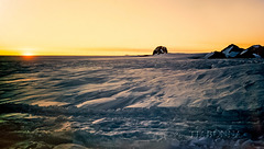
Midnight Sun
| 16 Feb 2021 |
|
|
|
Taken at about midnight after we arrived at our final stop for the tractor trains, with the sun still shining due south of us over the ridge running across "Weasel Gap". The name was given to the gap by the only previous expedition to this area, ten years earlier, when they passed through the gap with their light (WW2 vintage) Weasel vehicle.
The area was too badly crevassed for our heavy tractor trains to safely go further, though our survey field party travelled further south with light Snowtrac vehicles. Our tractor trains were stopped just to the left of this image (see PiP).
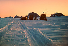
Final stop for the main tractor trains
| 16 Feb 2021 |
|
|
|
Taken near midnight, not long after our tractor trains arrived at our main southerly campsite at the northern "Athos" range of the Prince Charles Mountains. The large mountain behind the vans is Mt Bechervaise. To the right is Mt Lacey, where I spent many days helping with the survey of the area. Weasel Gap, shown in my other image (PiP) is immediately to the right of this image. We were here for about three weeks, partly working on the survey and partly held down by bad weather.
On Peak 7
| 10 Feb 2021 |
|
|
|
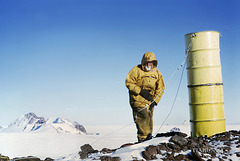
Copied from an old colour slide. My workmate and a partly installed survey marker (two fuel drums welded together) on "Peak 7" on our surveying trip inland in Antarctica, November 1966. This site was part of the mountains ahead in my previous image.
To quote from my 1966 diary "Arrived at the top and what a view. As far as the eye could see to the south was just mountains, mountains and more mountains! The nearest ones were about 15 miles away, the next lot about 30, and we estimated mountains some 100 miles distant were visible..." OK, this photo was taken in a slightly different direction (the nearest mountains about 2-3 miles / 4-5 km distant), but it gives the idea and shows the two drum survey trig point marker being erected. The guy wires were tightened soon after taking this photo.
We were fortunate here that it was possible to drive our motorised toboggan on a snow slope almost to the top of the peak: that meant that the drums, rock drill and survey equipment, battery etc did not need to be carried far.
Late evening running
| 07 Feb 2021 |
|
|
|
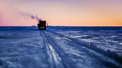
Continuing my updates of old copied Antarctic slides. Because we'd been delayed so much by bad weather, we continued late into the Antarctic evening (see also PiP). Here we're heading toward the Stinear Nunataks (the mountains ahead), our next major base and survey point. These images also give a good representation of Sastrugi, the name for the wind-carved snow surface of the plateau. It made travelling in the caravans a test of sea-sickness resistance. :-) View large.
Rolling past Depot Peak
| 06 Feb 2021 |
|
|
|
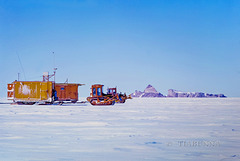
Back to my updates of old copied Antarctic slides. We were delayed for some days near Mt Twintops (previous image in series) by bad weather. We also had done our major climbing onto the Antarctic plateau at that point (to about 1500M above sea level), so we left one dozer there and reassembled everything into two trains of sleds. After a day's travel, again we were stopped by weather. Then at last, we had clear weather and good travelling. The D4 tractors rattled along at about walking speed and, with several fuel stops, we made a little over 25 miles (40 km) on our best day. Given the right conditions, such as this, walking alongside was enjoyable. Best viewed large.
Blizz'd in
| 30 Jan 2021 |
|
|
|
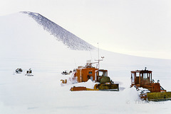
An updated copy from an old 1966 slide. We did our surveying work at Mt Twintops, but then we were shut down for several days by a blizzard (generally just called a "blizz") with strong winds and zero visibility from drifting snow. This was taken in near whiteout conditions at the end, when the wind and snow had eased and we were preparing to move again.
The central bulldozer is hooked to a preheater to warm the engine before being started. The preheater is the orange box containing a small engine running a fan and petrol heater and connected by the large curly pipe to the tent arrangement covering the bulldozer's engine,. Before moving, of course, it also was necessary to dig out all the sleds and other equipment buried in snow drifts. Best viewed large.
Spring Tripping
| 26 Jan 2021 |
|
|
|
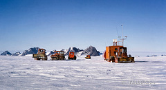
An updated copy from an old 1966 slide. The major field trip away from the station was the Spring Trip, here seen at its first stop. The trip was to the northern Prince Charles Mountains and involved seven of us surveying previously unvisited mountains, some 300 km inland - we were away for four months. Everything was moved in caravan trains, drawn by D4 bulldozers.
On the right, the large box is the living caravan for three of us, also serving as the meteorology office, surveyor's office, radio shack, kitchen and mess. Behind it is the smaller rounded living caravan for the other four on the trip. The left hand D4 is pulling two Snowtracs on sleds, while the distant third train is the mechanical workshop, plus fuel and other equipment.
Only a short distance inland, the blue ice seen at the edge of the Antarctic plateau gives way to compacted snow, carved by the wind into waves known as "sastrugi", as seen here. View large.
Snowtrac on the slope
| 19 Jan 2021 |
|
|
|
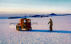
Copied from an old 1966 slide. Snowtrac vehicle fitted with experimental sounding equipment (the booms either side) for measuring the ice thickness. View looking north over Mawson (below the brow of the ice, just right of the vehicle) and showing the relative steepness of the climb to the plateau. Also on skis our glaciologist, who was able to use them like skates on the hard blue ice!
Trendy skier and Porsche
| 18 Jan 2021 |
|
|
|
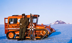
Copied from an old slide. One of my colleagues reclining on a Snowtrac vehicle on the edge of the Antarctic plateau, near Mt Henderson just outside Mawson station. The surface is hard snow-free blue ice. As would be expected, how else would a trendy skier travel except in a Porsche-powered vehicle? The Snowtracs had Porsche industrial engines. :-) This one was fitted with sounding equipment for glaciology measurements, Best viewed large.
Skiing at Fischer Nunatak
| 12 Jan 2021 |
|
|
|
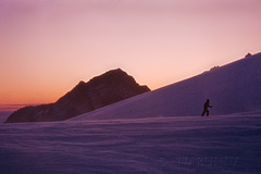
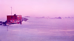
Copied from an old slide. The coastal plateau near the coast around Mawson typically is hard glassy blue ice and not really suited to skiing, but not far inland an area at Fischer Nunatak had suitable snow surfaces, so a field hut had been placed there. Needless to say, there were none of the lifts etc that make skiing somewhat less demanding in "civilised" ski fields!
I had some rolls of 'high speed" Ektachrome (160 ASA) which we developed while at Mawson (under some difficulty). The results were reasonable but gritty due to water shortages limiting washing. See also my comment below about the developing process. This has now been 'digitally cleaned'.
Field hut at Fischer Nunatak
| 12 Jan 2021 |
|
|
|
Copied from an old slide. The coastal plateau near the coast around Mawson typically is hard glassy blue ice and not really suited to skiing, but not far inland an area at Fischer Nunatak had suitable snow surfaces, so a field hut had been placed there. Taken near sunset during a skiing excursion in the Snowtrac vehicle, with the North Masson and David ranges in the background and Mt Hordern far away to the right.
This is from some rolls of 'high speed" Ektachrome (160 ASA/ISO) which we developed while at Mawson. The results were reasonable but gritty due to water shortages limiting washing. This has now been 'digitally cleaned' to some extent.
To Rumdoodle by VW
| 09 Jan 2021 |
|
|
|
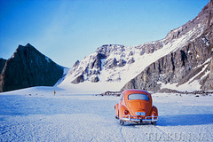
Copied from an old slide taken in 1966. Several old caravans had been permanently tied down at points away from Mawson for recreational trips: one such is the small orange dot in the distance beyond the VW (registration plate "Antarctica 3"). Another shot in the PiP.
This was taken at a peak in the North Masson Range, known as "Rumdoodle" - now the official name for the area. The name came from a very popular (and still available) satirical book on Himalayan expeditions "The Ascent of Rumdoodle", which was often echoed by reality in the Antarctic. Details are here en.wikipedia.org/wiki/The_Ascent_of_Rum_Doodle
Dog team passing iceberg
| 07 Jan 2021 |
|
|
|
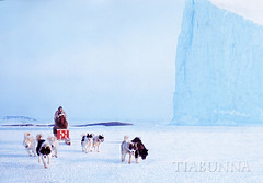
From one of the gritty "home developed" Ektachrome slides taken in 1966, this one cleaned up in post processing. Out on the sea ice among the islands near Mawson, for a practice run with the dog teams - here passing an iceberg. Another (more gritty) image in the PiP.
Meet Orhog
| 03 Jan 2021 |
|
|
|
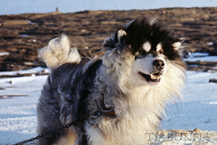
Copied from an old slide taken in 1966, at Mawson Antarctica. We still had dog teams and this was our lead sled dog, who went by the name of Orhog. He was quite a character and also enjoyed posing for the cameras. All the huskies were removed in later years, when new international agreements banned imported animals in Antarctica.
Some blatant advertising. For the 50th anniversary of our expedition, I wrote a book which is available online as either a hard cover or inexpensive .pdf download. It covers the material I've shown here plus a lot more narrative and images (also some previously untold stories). If you visit the link I've given, you can view a preview by clicking on the book cover, then click on the diagonal arrow at top right to enlarge, then just click the image to flip the pages.
Through Mawson after an early snowfall
| 02 Jan 2021 |
|
|
|
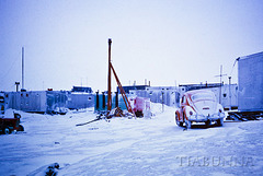
From an old slide. Mawson was established in 1954 and is the oldest permanently occupied station in Antarctica, seen here in 1966. Almost all these buildings have since been demolished, replaced by vast new structures. This view is looking back through the main part of the station. This also shows the VW "Beetle" with the registration (not visible here) "Antarctica 3".
Some blatant advertising. For the 50th anniversary of our expedition, I wrote a book which is available online as either a hard cover or inexpensive .pdf download. It covers the material I've shown here plus a lot more narrative and images (also some previously untold stories). If you visit the link I've given, you can view a preview by clicking on the book cover, then click on the diagonal arrow at top right to enlarge, then just click the image to flip the pages.
Pancake ice
| 30 Dec 2020 |
|
|
|
From an old slide, copied too small and now re-posted.
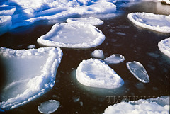
Not long after our arrival at Mawson station in Antarctica, sea ice began to form. The earliest stage was pancake ice, when the surface water develops into a slurry of ice crystals which agglomerate into small floes which bump into each other, causing raised edges.
Jump to top
RSS feed- tiabunna's latest photos with "Minolta Rokkor 50mm 1:1.4" - Photos
- ipernity © 2007-2026
- Help & Contact
|
Club news
|
About ipernity
|
History |
ipernity Club & Prices |
Guide of good conduct
Donate | Group guidelines | Privacy policy | Terms of use | Statutes | In memoria -
Facebook
X
