

tiabunna's photos with the keyword: sastrugi
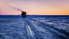
Late evening running
| 07 Feb 2021 |
|
|
|
Continuing my updates of old copied Antarctic slides. Because we'd been delayed so much by bad weather, we continued late into the Antarctic evening (see also PiP). Here we're heading toward the Stinear Nunataks (the mountains ahead), our next major base and survey point. These images also give a good representation of Sastrugi, the name for the wind-carved snow surface of the plateau. It made travelling in the caravans a test of sea-sickness resistance. :-) View large.
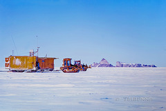
Rolling past Depot Peak
| 06 Feb 2021 |
|
|
|
Back to my updates of old copied Antarctic slides. We were delayed for some days near Mt Twintops (previous image in series) by bad weather. We also had done our major climbing onto the Antarctic plateau at that point (to about 1500M above sea level), so we left one dozer there and reassembled everything into two trains of sleds. After a day's travel, again we were stopped by weather. Then at last, we had clear weather and good travelling. The D4 tractors rattled along at about walking speed and, with several fuel stops, we made a little over 25 miles (40 km) on our best day. Given the right conditions, such as this, walking alongside was enjoyable. Best viewed large.
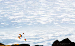
From Mt Twintops
| 27 Jan 2021 |
|
|
|
An updated copy from an old 1966 slide. I was assisting with the surveying from this peak (mainly lugging equipment uphill). Here looking down on our tractors, caravans, and the tracks they left as we arrived (view large and they are easier to find). The "cloud" effect is from light on sastrugi (ridged snow), the blurred black foreground was from the rocks close to me. This was our first major camp on the field trip and, having climbed the steepest part of the rise onto the plateau, we depoted one of the bulldozers here, continuing with just two.
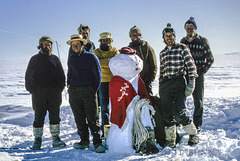
Ghost of Christmas (long) past
| 23 Dec 2016 |
|
|
|
From an old slide and being reposted with a better copy. This is the "Spring Trippers" group photo on Christmas Eve, 50 years ago (1966). We were on a four month mapping trip, at this stage some 200km inland from Mawson station, Antarctica.
Merry Christmas, everyone. Here's a song to go with the season.
Digging out #1
| 21 Sep 2012 |
|
|
|
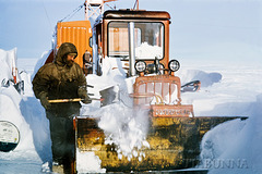
From an old slide. A few days of blizzards left huge amounts of drift piled against, through and around the tractors and caravan trains. Here is the start of the process of digging out the tractors from the huge amounts of snow that accumulated every time we had a blizzard - typically twice weekly on our return trip.
Digging out #2
| 21 Sep 2012 |
|
|
|
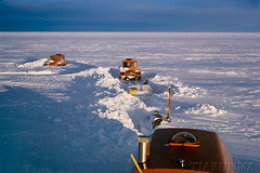
From an old slide. Blizzards, usually lasting several days, left huge amounts of drift piled against, over and around our tractors and caravan trains. Clearing it typically took at least a day, sometimes two. Here, late in a long day's digging, much of the sledges and linking cables have been cleared of snow.
Merry 66 Xmas
| 24 Sep 2012 |
|
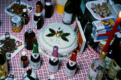
From an old slide. About as white as Christmas can get - while we had our celebrations, another blizzard developed and was filling the air outside with whirling snow. Our chef, back in Mawson, had prepared the cake for us prior to departure.
VW "Antarctica 3" heading across sastrugi
| 06 Sep 2012 |
|
|
|
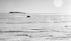
From an old negative. On the first day of the Spring Trip inland from Mawson, the station's VW followed the tractor trains for several miles. Here it is crossing through reasonably small sastrugi.
Weather closing in
| 19 Sep 2012 |
|
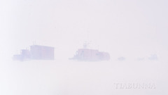
From an old slide. This looks like fog - it isn't, it's drifting snow blowing past at about 30 knots, with visibility steadily becoming worse. In full blizzard conditions visibility can drop to five metres or less. This already is "whiteout" though, with light bouncing between the white sky and surface: so shadows disappear, distances become almost impossible to estimate, and you fall over unseen sastrugi (with no shadows there's nothing to define it). Time to head indoors and wait for things to improve.
Moving again
| 19 Sep 2012 |
|
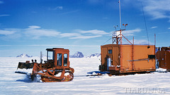
From an old slide. Finally our work at the Prince Charles Mountains was done and, after a delay caused by bad weather, we were on our way northwards.
Midnight sun through Weasel Gap
| 09 Sep 2013 |
|
|
|
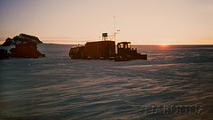
From an old slide. Recently arrived tractor trains at what became our depot, about 1500 metres high on the Antarctic plateau, looking due south at midnight in the northern Prince Charles Mtns.
To see the location of this photo, go to "Location" at right, click on "Antarctica" and change the view to Satellite. Taken with Minolta SR1, Auto Rokkor-PF 1.4/58mm.
Arrival at PCM Nov 1966
| 11 Sep 2012 |
|
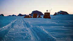
We reached the Prince Charles Mountains late at night, with a snowtrac ahead as a scout vehicle searching for crevasses. These are more prevalent near mountains, the old adage being "if you can see mountains, you're too close". Sure enough, about eight km before reaching the mountains the vehicles began to hit "slots", so that was our limit with the heavy D4s and their trains and became our camp for three weeks. I spent much of my time on the mountain at the right, assisting with the survey.
Blizzard aftermath #2
| 21 Sep 2012 |
|
|
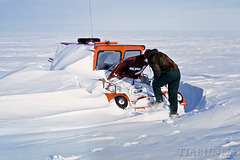
From an old slide. Totally "drifted in". A few days of blizzards left huge amounts of drift piled through and around the tractors and caravan trains. Not only is this SnowTrac filled with snow, but it is perched on a sledge that has been totally buried, as have the cables linking it to the next sledge, itself equally buried...
North past nunataks
| 19 Sep 2012 |
|
|
|
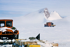
From an old slide. After leaving the Prince Charles Mountains we still had some small mountains to include in the survey, which took us past groups of small hills known as nunataks.
Mt Bechervaise
| 15 Sep 2012 |
|
|
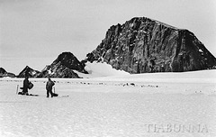
From an old negative. This was the largest mountain near our camp site in the Prince Charles Mountains, rising about 450 metres above the surrounding plateau ice (itself over 1500M thick here). Also seen on the left of the panorama shot from Mt Lacey.
Trig point on Peak 7
| 02 Sep 2012 |
|
|
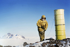
From an old slide. To quote from my 1966 diary "Arrived at the top and what a view. As far as the eye could see to the south was just mountains, mountains and more mountains! The nearest ones were about 15 miles away, the next lot about 30, and we estimated mountains some 100 miles distant were visible..." OK, this photo was taken in a slightly different direction, but it gives the idea and shows the two drum survey trig point marker being erected. I wonder if it's still there.
To see the location of this photo, click on "Antarctica" under "Location" to the right and change to satellite view. Kodachrome slide, Minolta SR1, Auto Rokkor-PF 58/1.4 .
Travelling past sunset
| 02 Sep 2012 |
|
|
|
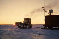
From an old slide. Heading for Peak 7, about 170 miles south of Mawson, Antarctica. Sunset was about 2230 and the sun then travelled along just below the horizon, so we made the most of the good weather and travelled late into the night. Minolta SR1, Auto Rokkor_PF 58/1.4 .
Rolling past Depot Peak
| 31 Aug 2012 |
|
|
|
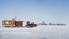
Clear weather and good travelling. With frequent fuel stops, we made a little over 25 miles (40 km) on our best day: the D4 tractors rattled along at about walking speed. Given the right conditions, such as this, walking alongside was enjoyable.
Jump to top
RSS feed- tiabunna's latest photos with "sastrugi" - Photos
- ipernity © 2007-2026
- Help & Contact
|
Club news
|
About ipernity
|
History |
ipernity Club & Prices |
Guide of good conduct
Donate | Group guidelines | Privacy policy | Terms of use | Statutes | In memoria -
Facebook
X
