

Ron's Log's photos with the keyword: chiriaco summit
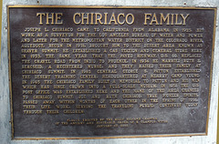
Chiriaco Plaque (4391)
| 14 Jun 2013 |
|
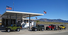
Jeeps at Chiriaco Summit (2037)
| 02 Apr 2012 |
|

Mail Boxes (1473)

Mail Box (1474)
| 26 Feb 2008 |
|
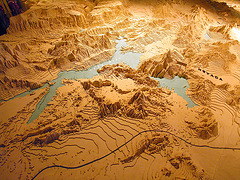
The Big Map - Lake Mead (6983)
| 10 Feb 2008 |
|
Focusing on Lake Mead and Hoover Dam.
"The Big Map" is a relief map of southern California and nearby parts of Arizona and Nevada built by the Metropolitan Water District in the 1920s as part of its campaign for approval of the Colorado River Aqueduct. It was later used by Patton as it covered the same area as his Desert Training Center in World War II. It is now the property of the Patton Museum in Chiriaco Summit, California, where it is on public display.
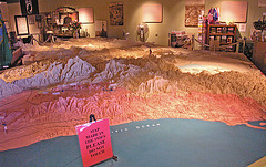
The Big Map (6986)
| 10 Feb 2008 |
|
The view from the Pacific across Los Angeles.
"The Big Map" is a relief map of southern California and nearby parts of Arizona and Nevada built by the Metropolitan Water District in the 1920s as part of its campaign for approval of the Colorado River Aqueduct. It was later used by Patton as it covered the same area as his Desert Training Center in World War II. It is now the property of the Patton Museum in Chiriaco Summit, California, where it is on public display.
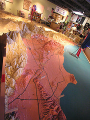
The Big Map (6985)
| 10 Feb 2008 |
|
UPdated to show current, major highways.
"The Big Map" is a relief map of southern California and nearby parts of Arizona and Nevada built by the Metropolitan Water District in the 1920s as part of its campaign for approval of the Colorado River Aqueduct. It was later used by Patton as it covered the same area as his Desert Training Center in World War II. It is now the property of the Patton Museum in Chiriaco Summit, California, where it is on public display.
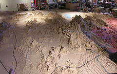
The Big Map (6984)
| 10 Feb 2008 |
|
We're hovering over Las Vegas, facing southwest.
"The Big Map" is a relief map of southern California and nearby parts of Arizona and Nevada built by the Metropolitan Water District in the 1920s as part of its campaign for approval of the Colorado River Aqueduct. It was later used by Patton as it covered the same area as his Desert Training Center in World War II. It is now the property of the Patton Museum in Chiriaco Summit, California, where it is on public display.
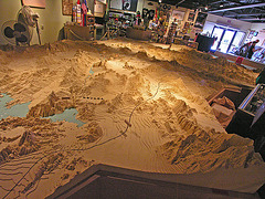
The Big Map (6982)
| 10 Feb 2008 |
|
That's Lake Mead on the left. We're looking south on the map.
"The Big Map" is a relief map of southern California and nearby parts of Arizona and Nevada built by the Metropolitan Water District in the 1920s as part of its campaign for approval of the Colorado River Aqueduct. It was later used by Patton as it covered the same area as his Desert Training Center in World War II. It is now the property of the Patton Museum in Chiriaco Summit, California, where it is on public display.
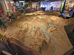
The Big Map (6981)
| 10 Feb 2008 |
|
Lake Mead is in the foreground.
"The Big Map" is a relief map of southern California and nearby parts of Arizona and Nevada built by the Metropolitan Water District in the 1920s as part of its campaign for approval of the Colorado River Aqueduct. It was later used by Patton as it covered the same area as his Desert Training Center in World War II. It is now the property of the Patton Museum in Chiriaco Summit, California, where it is on public display.
The Big Map (6977)
| 10 Feb 2008 |
|
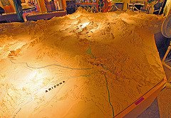
Looking northwest from Arizona, the Colorado River Aqueduct can be seen running from the middle of the photo to the left, toward L.A.
"The Big Map" is a relief map of southern California and nearby parts of Arizona and Nevada built by the Metropolitan Water District in the 1920s as part of its campaign for approval of the Colorado River Aqueduct. It was later used by Patton as it covered the same area as his Desert Training Center in World War II. It is now the property of the Patton Museum in Chiriaco Summit, California, where it is on public display.
The Big Map (6976)
| 10 Feb 2008 |
|
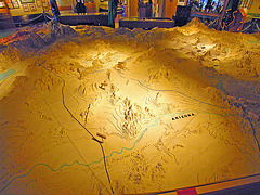
We're looking along I-10 running from Arizona toward I-10.
"The Big Map" is a relief map of southern California and nearby parts of Arizona and Nevada built by the Metropolitan Water District in the 1920s as part of its campaign for approval of the Colorado River Aqueduct. It was later used by Patton as it covered the same area as his Desert Training Center in World War II. It is now the property of the Patton Museum in Chiriaco Summit, California, where it is on public display.
The Big Map (6975)
| 10 Feb 2008 |
|
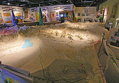
We're above Mexico and you can see the Coachella Canal running along the eastern side of the Salton Sea.
"The Big Map" is a relief map of southern California and nearby parts of Arizona and Nevada built by the Metropolitan Water District in the 1920s as part of its campaign for approval of the Colorado River Aqueduct. It was later used by Patton as it covered the same area as his Desert Training Center in World War II. It is now the property of the Patton Museum in Chiriaco Summit, California, where it is on public display.
The Big Map (6974)
| 10 Feb 2008 |
|
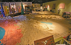
We're sort of over San Diego here, looking northeast toward Las Vegas at the other end of the map.
"The Big Map" is a relief map of southern California and nearby parts of Arizona and Nevada built by the Metropolitan Water District in the 1920s as part of its campaign for approval of the Colorado River Aqueduct. It was later used by Patton as it covered the same area as his Desert Training Center in World War II. It is now the property of the Patton Museum in Chiriaco Summit, California, where it is on public display.
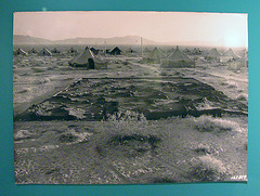
Relief Map (6980)
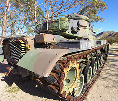
Patton Museum Tank (6988)
| 10 Feb 2008 |
|
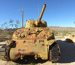
Patton Museum Tank (6987)
| 10 Feb 2008 |
|
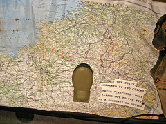
Patton Museum Cricket (9051)
| 10 Feb 2008 |
|
Jump to top
RSS feed- Ron's Log's latest photos with "chiriaco summit" - Photos
- ipernity © 2007-2026
- Help & Contact
|
Club news
|
About ipernity
|
History |
ipernity Club & Prices |
Guide of good conduct
Donate | Group guidelines | Privacy policy | Terms of use | Statutes | In memoria -
Facebook
X
