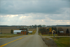
Joel Dinda's photos with the keyword: farmland
A Splendid Sky
The Endless Sky
Wisconsin
Jeffers Petroglyphs Historic Site
| 14 Nov 2013 |
|
Since I mentioned southern Minnesota in my comments earlier today, I decided to see what I'd actually done the last time I was there.
I think these pix show what I meant about "wide-open" landscapes, and demonstrate that I did indeed find ways to capture the depth. Without something to suggest the scale, these photos don't have much to offer....
==========
Jeffers Petroglyphs is a place with exposed rock in the Minnesota plains. Local Native Americans treated (and still treat) this as a sacred place, and prehistoric Natives carved pictures in the rocks.
Minnesota Farmland
| 14 Nov 2013 |
|
Since I mentioned southern Minnesota in my comments earlier today, I decided to see what I'd actually done the last time I was there.
I think these pix show what I meant about "wide-open" landscapes, and demonstrate that I did indeed find ways to capture the depth. Without something to suggest the scale, these photos don't have much to offer....
==========
Photo taken from the grounds of St. John's Lutheran Church, Bismarck, where my sister was pastor for several years.
Saturday Sunrise
Winchell and Union Drain
| 09 Jun 2014 |
|
And surrounding farmlands, of course. The drain itself is marked by the trees and underbrush but is not directly visible from this location.
Some of the creeks around here have really stupid names.
View from Saginaw Highway
| 09 Jun 2014 |
|
|
I needed a break from the garden photographs....
These trees mark Freyer Creek.
Winter Wheat
Cornrows
| 09 Jun 2014 |
|
|
|
If there was a specific photo I was looking for this morning, this was it.
Thornapple Valley
| 11 Dec 2013 |
|
|
When you reach the east end of Needmore Highway you likely turn south, and are rewarded with this view.
This was generally the highlight of my drive to work, but I'd admired the view long before I moved to Mulliken. A couple miles out--just beyond the more distant farmyards--Otto Road dips yet again, down to the river. When I was a serious bicyclist my most strenuous workouts involved those climbs. Nowadays I mostly avoid hills, which is pretty easy around here.
You could turn north, but Otto and Needmore both jog, and the left turn's a bit off the line. A north turn takes you to the RC plane airport .
==========
The 366 Snaps pix were attempts to capture the falling snow in an image; most failed.
==========
This photograph is a non-outtake from my 2012 photo-a-day project, 366 Snaps .
Number of project photos taken: 19
Title of " roll :" Snow in the Banana Republic [ a comment on Michigan's then-newly-signed "RTW" law, about which I'm still angry ]
Other photos taken on 12/11/2012: Two "Sky Shots," one of which is displayed above.
Shed, Musgrove Highway
| 31 Oct 2013 |
|
|
I'd travelled west from Sebewa on Musgrove before, but don't think I'd ever gone past Sunfield Road. I found farms that were flat, and nearly as wide-open as southern Minnesota....
==========
This photograph is an outtake from my 2012 photo-a-day project, 366 Snaps .
366 Snaps project discussion and stats for October 31 .
Barn, Musgrove Highway
| 31 Oct 2013 |
|
|
I'd travelled west from Sebewa on Musgrove before, but don't think I'd ever gone past Sunfield Road. I found farms that were flat, and nearly as wide-open as southern Minnesota....
==========
This photograph is an outtake from my 2012 photo-a-day project, 366 Snaps .
366 Snaps project discussion and stats for October 31 .
Jump to top
RSS feed- Joel Dinda's latest photos with "farmland" - Photos
- ipernity © 2007-2026
- Help & Contact
|
Club news
|
About ipernity
|
History |
ipernity Club & Prices |
Guide of good conduct
Donate | Group guidelines | Privacy policy | Terms of use | Statutes | In memoria -
Facebook
X


