

Earthwatcher's photos with the keyword: 'Millstone Grit Series'
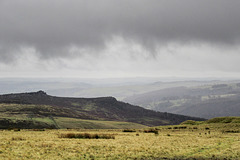
Rain over Millstone Edge and the Derwent valley
| 14 Jan 2021 |
|
|
|
A wet and blustery day, with rain and low clouds driven on a strong westerly wind, scudding over the gritstone edges at the eastern side of the Peak District National Park.
The prominent escarpment edge in the centre is Millstone Edge, comprised of the Chatsworth Grit (Namurian age), partly quarried in the past for millstones and grindstones, hence its name. Now popular with climbers. The rocky tor on the left is Over Owler Tor.
Not really a day to be out and about on the moors. I took this from the shelter of my car!
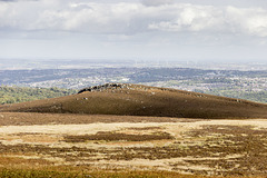
View north to Houndkirk Hill from Houndkirk Road
| 12 Oct 2020 |
|
|
A walk on Houndkirk Moor 24
A cool morning with frequent showers, clearing to sunshine by the afternoon.
Looking northwards to Houndkirk Hill from the Houndkirk Road. In the distance are the green-clad tower blocks in the Gleadless Valley on the south-east side of Sheffield, and the wind turbines of the Penny Hill windfarm south of Rotherham.
The clear afternoon light brings out the shadow detail of the scarp edge of Houndkirk Hill, composed of Namurian age ('Millstone Grit Series') Chatsworth Grit.
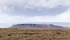
View WNW to Higger Tor from Houndkirk Road
| 12 Oct 2020 |
|
|
A walk on Houndkirk Moor 23
A cool morning with frequent showers, clearing to sunshine by the afternoon.
The southern portion of the Houndkirk Road offers fine views to the south and west into the heart of the Peak District. In the middle distance is the flat top of Higger Tor with its fringing crags of Namurian age ('Millstone Grit Series') Chatsworth Grit.
On the distant skyline is the high plateau of Kinder Scout, 12 miles distant.
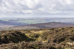
View west to Over Owler Tor from Houndkirk Road
| 12 Oct 2020 |
|
|
A walk on Houndkirk Moor 22
A cool morning with frequent showers, clearing to sunshine by the afternoon.
The southern portion of the Houndkirk Road offers fine views to the south and west into the heart of the Peak District. In the middle distance are the gritstone tors of Mother Cap Stone, just left of centre, and Over Owler Tor, to the right. Like Houndkirk Hill and Houndkirk Edge, these are composed of Namurian age ('Millstone Grit Series') Chatsworth Grit.
On the distant skyline are the high moorlands of the Derbyshire-Staffordshire border, beyond Buxton.
View north-east over Houndkirk Moor from the shelt…
| 12 Oct 2020 |
|
|
|
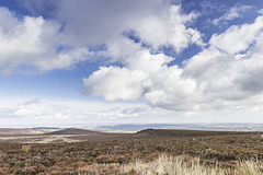
A walk on Houndkirk Moor 19
A cool morning with frequent showers, clearing to sunshine by afternoon.
A view north-east from the stone shelter in the previous photo, over the wide expanse of Houndkirk Moor. To the left of centre in the middle distance is Houndkirk Hill. The rocks to the right of centre form Houndkirk Edge. The straight scarp edge marks the line of a fault which runs along the foot of the scarp in a NE-SW direction.
Both scarps are composed of Namurian age ('Millstone Grit Series') Chatsworth Grit
Summit rocks of Houndkirk Edge looking NE to Hound…
| 12 Oct 2020 |
|
|
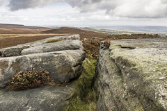
A walk on Houndkirk Moor 17
A cool morning with frequent showers, clearing to sunshine by afternoon.
Looking north-east from the suummit rocks of Houndkirk Edge (not named as such on the Ordnance Survey maps). Houndkirk Hill is just left of centre, with Sheffield city centre in the far distance. Ladty Canning's Plantation is on the far left skyline.
The rocks are Namurian age ('Millstone Grit Series') Chatsworth Grit.
Summit of Houndkirk Hill looking NNE
| 12 Oct 2020 |
|
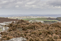
A walk on Houndkirk Moor 15
A cool morning with frequent showers, clearing to sunshine by afternoon.
Another view from the summit of Houndkirk Hill, looking NNE. The rocks are Namurian age ('Millstone Grit Series') Chatsworth Grit. The sunlit houses are at Crosspool, on the west side of Sheffield; the Crosspool television tranmitter is prominent just to the right of centre.
Eggborough power station, 32 miles distant, is visible on the skyline left of centre; Drax power station, 37 miles distant, is just visible on the skyline towards the right.
Summit of Houndkirk Hill looking NE
| 12 Oct 2020 |
|
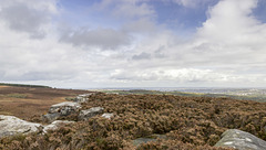
A walk on Houndkirk Moor 12
A cool morning with frequent showers, clearing to sunshine by afternoon.
A north-easterly view from the from the summit of Houndkirk Hill. The rocks are Namurian-age ('Millstone Grit Series') Chatsworth Grit. The eastern side slopes gently down towards the A625 Hathersage Road and Dore beyond.
Sheffield is visible in the far distance.
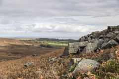
View north-east from Houndkirk Hill escarpment
| 12 Oct 2020 |
|
A walk on Houndkirk Moor 11
A cool morning with frequent showers, clearing to sunshine by afternoon.
A north-easterly view from the north-west facing escarpment of Houndkirk Hill. The rocks are Namurian-age ('Millstone Grit Series') Chatsworth Grit.
The woodland strip in shadow, in the centre, is the Bole Hill Plantation on the north side of the Limb Valley. Sheffield city centre is visible in the far distance; Rotherham and Doncaster even further beyond.
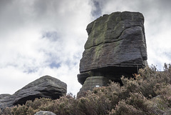
Summit rocks of Houndkirk Hill 2
| 12 Oct 2020 |
|
|
A walk on Houndkirk Moor 10
A cool morning with frequent showers, clearing to sunshine by afternoon.
A closer view of the edge tor summit rocks on the north-west facing escarpment of Houndkirk Hill. The rocks are Namurian-age ('Millstone Grit Series') Chatsworth Grit.
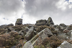
Summit rocks of Houndkirk Hill 1
| 12 Oct 2020 |
|
A walk on Houndkirk Moor 9
A cool morning with frequent showers, clearing to sunshine by afternoon.
A closer view of the summit rocks on the north-west facing escarpment of Houndkirk Hill. The rocks are Namurian-age ('Millstone Grit Series') Chatsworth Grit.
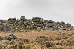
Scarp edge of Houndkirk Hill
| 12 Oct 2020 |
|
|
|
A walk on Houndkirk Moor 8
A cool morning with frequent showers, clearing to sunshine by afternoon.
Approaching the summit rocks on the north-west facing escarpment of Houndkirk Hill. The rocks are Namurian-age ('Millstone Grit Series') Chatsworth Grit.
Path to Houndkirk Hill
| 12 Oct 2020 |
|
A walk on Houndkirk Moor 5
A cool morning with frequent showers, clearing to sunshine by afternoon.
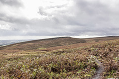
Houndkirk Hill (elevation 389 m) is a compact feature with a prominent scarp edge facing north west. The scarp edge is an outcrop of Namurian age ('Millstone Grit Series') Chatsworth Grit.
The distant scarp edge on the right skyline is informally known as Houndkirk Edge, although not named on the Ordnance Survey maps. It is composed of a lower stratigraphic bed of Chatsworth Grit.
Houndkirk Hill north-west escarpment
| 12 Oct 2020 |
|
A walk on Houndkirk Moor 4
A cool morning with frequent showers, clearing to sunshine by afternoon.
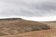
Houndkirk Hill (elevation 389 m) is a compact feature with a prominent scarp edge facing north west. The scarp edge is an outcrop of Namurian age ('Millstone Grit Series') Chatsworth Grit.
Druidston Haven: Cliff Section 6 interpretation
| 08 Jul 2020 |
|
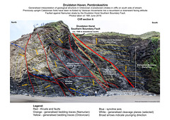
Druidston Haven geology: Cliff Section 6 interpretation
Interpretation No.6 of a series of six photos and interpretations to illustrate the geology of Druidston Haven, Pembrokeshire.
The cliffs of Druidston Haven mostly consist of Ordovician (Caradocian) age shales with some thin sandstones. During the Caledonian orgogeny at the end of the Silurian period, these were deformed into a series of mostly upright open folds. These were then re-folded by Variscan movements at the end of Carboniferous, to become largely recumbent (near horizontal) or partly inverted, facing down towards the south.
The Ordovician rocks form a horst - a ridge or block of strata faulted against younger rocks on either side. The Druidston Horst is bounded by the South Druidston Boundary Fault at the south end of the Haven, and the North Druidston Boundary Fault at the north end. This photo shows the southern end of the horst, terminated by the Southern Boundary Fault; a significant structure with a throw (displacement) of at least 1500 metres to the south, bringing Namurian 'Millstone Grit Series' (upper Carboniferous) rocks into contact with the Ordovician shales.
Druidston Haven: Cliff Section 6
| 08 Jul 2020 |
|
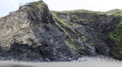
Druidston Haven geology: Cliff Section 6
Photo No.6 of a series of six photos and interpretations to illustrate the geology of Druidston Haven, Pembrokeshire.
The cliffs of Druidston Haven mostly consist of Ordovician (Caradocian) age shales with some thin sandstones. During the Caledonian orgogeny at the end of the Silurian period, these were deformed into a series of mostly upright open folds. These were then re-folded by Variscan movements at the end of Carboniferous, to become largely recumbent (near horizontal) or partly inverted, facing down towards the south.
The Ordovician rocks form a horst - a ridge or block of strata faulted against younger rocks on either side. The Druidston Horst is bounded by the South Druidston Boundary Fault at the south end of the Haven, and the North Druidston Boundary Fault at the north end. This photo shows the southern end of the horst, terminated by the Southern Boundary Fault; a significant structure with a throw (displacement) of at least 1500 metres to the south, bringing Namurian 'Millstone Grit Series' (upper Carboniferous) rocks into contact with the Ordovician shales.
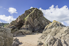
Monkstone Point folds 1
| 02 Apr 2019 |
|
Coastal traverse and geology from Waterwynch to Saundersfoot, Pembrokeshire
At Monkstone Point, grey, channel-fill sandstones of the Namurian age 'Millstone Grit Series' have been folded into a complex anticline with subsidiary folds, thrusts, and bedding plane slips which accommodate the 'space problem' in the core of the main anticline.
These sandstones are probably the equivalent of the prominent overturned sandstone ribs at Trevayne Point at the south end of Monkstone Bay.
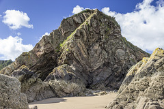
Monkstone Point folds 2
| 02 Apr 2019 |
|
Coastal traverse and geology from Waterwynch to Saundersfoot, Pembrokeshire
At Monkstone Point, grey, channel-fill sandstones of the Namurian age 'Millstone Grit Series' have been folded into a complex anticline with subsidiary folds, thrusts, and bedding plane slips which accommodate the 'space problem' in the core of the main anticline.
These sandstones are probably the equivalent of the prominent overturned sandstone ribs at Trevayne Point at the south end of Monkstone Bay.
Jump to top
RSS feed- Earthwatcher's latest photos with "'Millstone Grit Series'" - Photos
- ipernity © 2007-2026
- Help & Contact
|
Club news
|
About ipernity
|
History |
ipernity Club & Prices |
Guide of good conduct
Donate | Group guidelines | Privacy policy | Terms of use | Statutes | In memoria -
Facebook
X
