


Central Australia

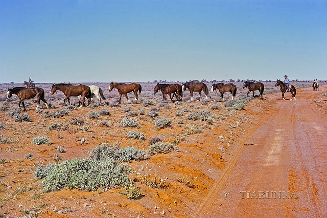

Stockmen mustering
From an old slide taken in 1971. Heading up the Oodnadatta Track we met this group of stockmen going out (with their spare horses) to commence mustering (possibly several weeks) on Anna Creek Station. Anna Creek (23,677 km2 (9,142 sq mi) is the world's largest cattle station, 7 times larger than the largest US ranch and larger than countries such as Slovenia and Israel. The number of cattle varies with the conditions (drought etc) but typically is between 10-20,000.
As this work is now mechanised with aircraft and motorcycles, this has become a historic image!
Translations to US English: stockmen = cowboys, station = ranch, mustering = rounding up.
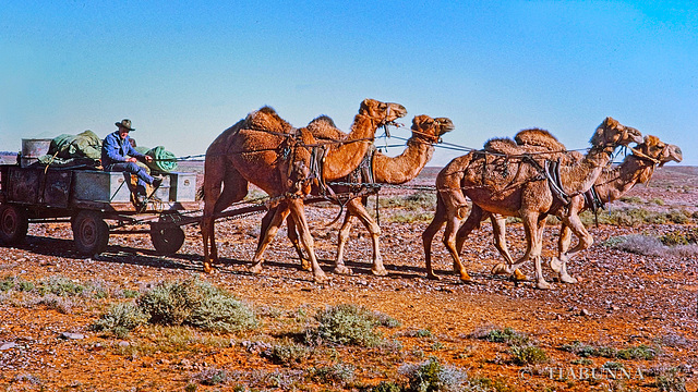
Supplies for stockmen
Copied (also PiP) from slides taken June 1971 on the Oodnadatta Track - see the notes with my previous image for more detail. Shortly after seeing the stockmen going out mustering, we were surprised to meet this camel-drawn wagon following with their supplies and camping gear. Camels had been used here extensively in the past in desert areas, but even in 1971 this was rare.
Noting that the driver is on a (very basic) bench, I'll wish everyone a Happy Bench Monday and a good week to follow.
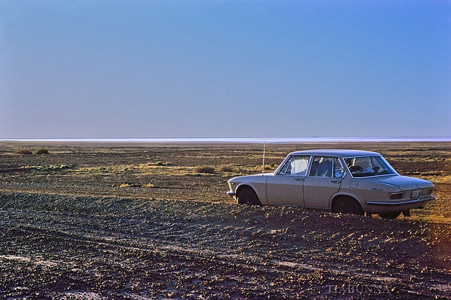
Outback - way back
My Mazda 1500 near Lake Eyre (the salt pans in the distance) on the Oodnadatta Track, way back in 1971. It seems that a large 4WD is now the usual vehicle in this area, but this was just a normal car (hub caps removed) and with a 1 year old child in the back seat. Copied from a slide.
I'm just back from my more recent trip and yet to work through my images. Coming soon.
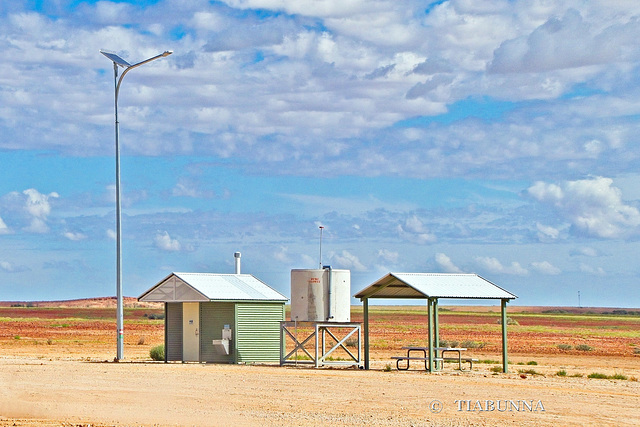
Roadside bench
Taken out on the plains of western Queensland, somewhere between Betoota and Birdsville. This area is now under vast flooding - about 1 million sq km, link to map from "The Guardian" : four times the size of the United Kingdom, larger than France and Germany combined, and larger than Texas. This is the largest flood in this area on record and follows an extreme weather event with many places having more than their annual total rainfall in four days. Because the area is so large and flat, the floods are likely to take months to flow away inland to Kati Thanda–Lake Eyre..
Update: Thanks to my ipernity friend PAM_J, here's another link with a photo of some of the flooding.
Well, at least it was dry when this was taken, so Happy Bench Monday, everyone.
Outrage
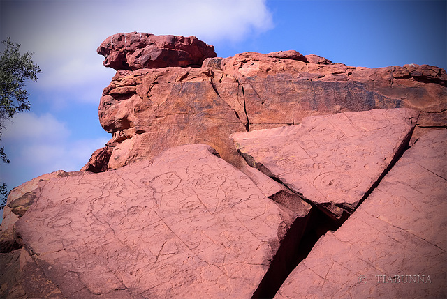
Around Australia are many sites sacred to the Aboriginal people, usually meaning the details cannot be divulged to outsiders, including the "white fellers" whose ancestors arrived only in recent centuries. This site of ancient rock carvings (petroglyphs) goes by the name of Ewaninga and is in the Northern Territory. While the age and significance are secret to the Elder men of the Arrernte People, it has been estimated at between 30-40,000 years. The site is accessible for visits and is part of a Conservation Reserve run by the NT Parks and Wildlife Service.
I (and most Australians) have been horrified and outraged in recent days to read that a major mining company in Western Australia, in the course of ripping out iron ore, has destroyed two caves containing sacred sites , with archaeological evidence showing occupation going back 46,000 years. They should have been World Heritage protected. The mining company's response could be summarised as "Oops, nobody told us it was important".
Not only do Black Lives Matter, so does Black Heritage!
The Breakaways
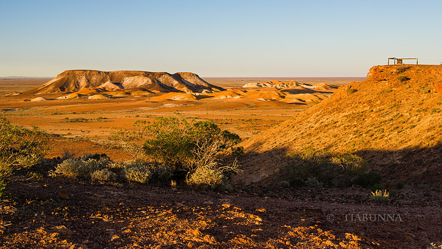
Out in central Australia, between Coober Pedy and Oodnadatta, are some very eroded hills, known as "The Breakaways". They are relics of what the general land surface was some many millions of years ago before erosion took most of it away. These remain because there is some harder rock at the top. Spectacular but very bare country - no place to be caught without water in the summer months.
Definitely one to view large, possibly while contemplating the latest (bleak) news on the status of the IMA bid for ipernity www.ipernity.com/group/2260604/discuss/186918 .
07 Aug 2010
12 favorites
6 comments
More of the Breakaways
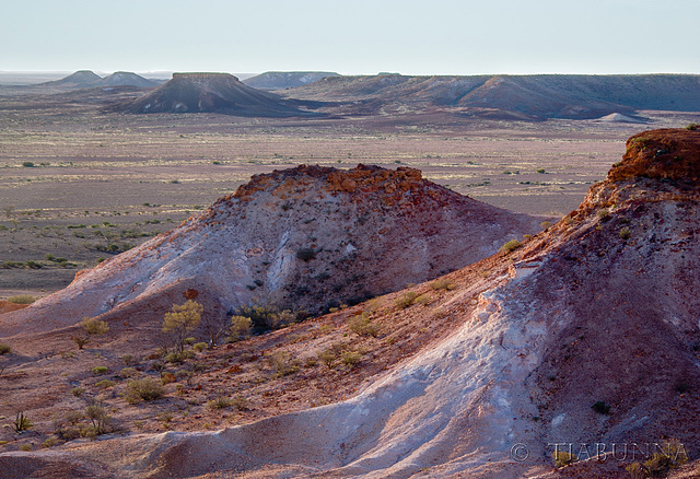
Out in central Australia, between Coober Pedy and Oodnadatta, are some very eroded hills, known as "The Breakaways". They are relics of what the general land surface was some many millions of years ago before erosion took most of it away. These remain because there is some harder rock at the top. Spectacular but very bare country - no place to be caught without water in the summer months.
Out at Kata Tjuta
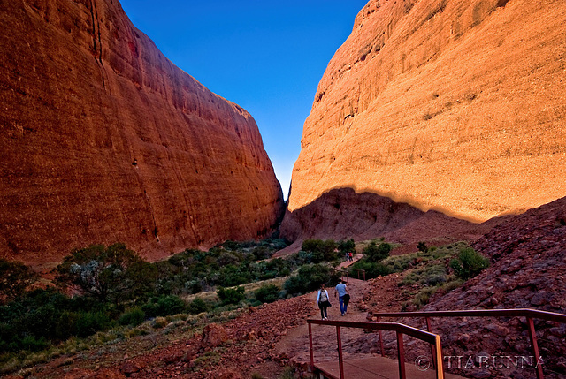
One from the archives. Kata Tjuta is the Aboriginal and now accepted name for a complex which I and most other Australians formerly knew as "The Olgas", after the colonial name for a peak in the area. When travel is not confined by Covid, this is a popular tourist area. One to view large.
Wishing everyone a very Happy Fence Friday and a safe and enjoyable weekend.

In the gorge
Following on from my previous image, this is a small waterhole alongside the tourist walking trail in Walpa Gorge, part of Kata Tjuta in Central Australia. Best viewed large.
Jump to top
RSS feed- Latest items - Subscribe to the latest items added to this album
- ipernity © 2007-2026
- Help & Contact
|
Club news
|
About ipernity
|
History |
ipernity Club & Prices |
Guide of good conduct
Donate | Group guidelines | Privacy policy | Terms of use | Statutes | In memoria -
Facebook
X
