Local Backroads
I live in a small town in mid-Michigan. This album consists of photographs taken near, but not in, Mulliken.
Horse, with Stable
| |
|
|
|
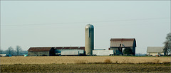
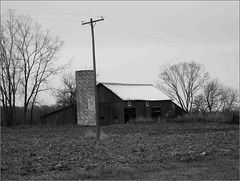
Both Grace and McWhorter Highways are near the local Amish colony, which perhaps explains the unexpectedly large number of stables I found on this excursion. Or perhaps it's just a little colony of horse people....
This stable's on McWhorter.
==========
This photograph is an outtake from my 2012 photo-a-day project, 366 Snaps .
366 Snaps project discussion and stats for November 22 .
Hoytville
| |
|
|
|
Two views of Hoytville. These are an example of my shoot-reframe-refocus-shoot photography habit.
==========
This photograph is an outtake from my 2012 photo-a-day project, 366 Snaps .
366 Snaps project discussion and stats for November 22 .
Hoytville
| |
|
|
Two views of Hoytville. These are an example of my shoot-reframe-refocus-shoot photography habit.
Here, too, are two versions of the same photo. The only difference between this and the 366 Snaps photo is the processing.
==========
This photograph is a non-outtake from my 2012 photo-a-day project, 366 Snaps .
366 Snaps project discussion and stats for November 22 .
Tree, Gates Road
| |
|
|
Two crops--and two ways of processing-- the same photograph . I planned this one as a sharp-edged, no nonsense "print." The other's more "moody."
And this one's quite crooked. I rather like it that way.
==========
This photograph is an outtake from my 2012 photo-a-day project, 366 Snaps .
366 Snaps project discussion and stats for November 22 .
Tree, Gates Road
| |
|
|
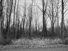
Two crops--and two ways of processing-- the same photograph . I was trying for "moody" on this version; on the other I wanted a sharp, no-nonsense "print."
==========
This photograph is an outtake from my 2012 photo-a-day project, 366 Snaps .
366 Snaps project discussion and stats for November 22 .
McWhorter Highway
| |
|
|
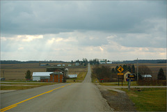
As with Grace Highway , I'd managed not to travel McWhorter despite living near it for over two decades.
So here's one of my foggy landscapes....
==========
This photograph is an outtake from my 2012 photo-a-day project, 366 Snaps .
366 Snaps project discussion and stats for November 22 .
Grace Highway
| |
|
|
|
Last November 22 was Thanksgiving. Since Mulliken's Thriftway would be opening late, I headed to Marko's in Sunfield for my morning RC Cola fix.
On the way out I took Grace Highway, a nearby road I'd never travelled before. I came back via McWhorter, another nearby road I'd previously managed to ignore. I took a few pix, of course....
==========
When the road that's become M-43 was first built, a swamp at the township line forced a roadbuilding detour. Thus Grace Road, down the middle of Roxand Township's section 7. And thus the twisty section on Dow. The swamp's still there, but they've long since built the road across it. And Grace remains.
Anyhoo, I was driving along last Thanksgiving, listening to Kyle Cantrell and IIIrd Tyme Out on SiriusXM, driving down this unfamiliar road. The road's a skinny little thing from pretty much nowhere on the east end; its west end's at Centennial Acres Golf Course.
On Centennial Acres, on Thanksgiving morn, I found a golfer out on the links. Din't get his photo, though....
Here's an 1873 Eaton County map that shows the swamp detour--it's near the top of the map, right at the Roxand/Sunfield township line.
==========
The 366 Snaps photo was of Hoytville. I'll talk about that a bit more in one of the other outtakes .
==========
This photograph is an outtake from my 2012 photo-a-day project, 366 Snaps .
Number of project photos taken: 19
Title of " roll :" A Foggy Morning
Other photos taken on 11/22/2012: I took the FujiFilm along to my aunt's in Schoolcraft, still getting familiar with a camera I'd not used in years. I'm counting one of those pix among these outtakes .
Farm, Velte Road
Barn
| |
|
|
Somewhere in Barry County, Michigan.
==========
This photograph is an outtake from my 2012 photo-a-day project, 366 Snaps .
366 Snaps project discussion and stats for November 27 .
Barn, Jordan @ M43 & M66
| |
|
|
This barn was my secondary objective for the day's 366 Snaps photo. The farm's about a dozen miles from my house and I pass it regularly. It's a nice barn, and that's my full justification for the photograph.
While this is actually my normal view of the place, my wandering route home from Kalamazoo brought me here by a route I'd never before taken. Photography can bring variety to your life.
==========
This photograph is an outtake from my 2012 photo-a-day project, 366 Snaps .
366 Snaps project discussion and stats for November 27 .
Barn, Eaton Highway
| |
|
I mentioned in this morning's commentary that I got some good pix a year ago along Eaton Highway. This is one of those.
House, Mulliken Road
| |
|
|
This house belonged to Sabrina Nickel in 1895. Like the George Potter house at the end of my street, it likely predates the village of Mulliken. Actually, this house is just outside Hoytville, but it was the next farm over from Potter's when the village moved.
I eventually posted a similar photograph to 366 Snaps on December 22. And there's another version in the Outtakes queue . I'll try to remember to point you back here when it shows up.
==========
Last March 28 was a busy day. I took a few flower pix around the yard, then went on what can only be called a scouting trip around the local backroads, looking for potential photographs. Then I dug out my old FujiFilm F200--destined to be my April camera--and played with it a bit (this perhaps proves I can learn from mistakes). And I took the Nikon 1 and the F200 to a ballgame.
==========
I briefly discuss the 366 Snaps photo in the day's other outtake.
==========
This photograph is an outtake from my 2012 photo-a-day project, 366 Snaps .
Number of project photos taken: 24
Title of " roll :" Local Farmyards, mostly
Other photos taken on 3/28/2012: As noted above, I played around with the F200. About 60 photos worth of play, in two or three sessions. Here's the best of that set . I also gave the V1 a workout at the ballpark-- judge for yourself .
Tree, Mt Hope Highway
| |
|
|
Just trying to capture the fog, and the lonely tree, across from the woodlot . Like the last few days' photos, this one's washed out; unlike those, the effect was intentional.
That matters.
The JPEG conversion's left unfortunate artifacts in the sky, as it sometimes does. AARGH!
==========
This photograph is an outtake from my 2012 photo-a-day project, 366 Snaps .
366 Snaps project discussion and stats for December 3 .
Loucks School Road
| |
|
|
There's something about this photo.
In the not-so-distant past Loucks School was still a school ....
==========
This photograph is an outtake from my 2012 photo-a-day project, 366 Snaps .
366 Snaps project discussion and stats for December 3 .
Woodlot, Mt Hope Highway
| |
|
|
|
Most of the local farms have woodlots, but the bulk of 'em are far off the roads. This one's a personal favorite just because of its roadside location.
==========
This photograph is an outtake from my 2012 photo-a-day project, 366 Snaps .
366 Snaps project discussion and stats for December 3 .
House, with Willow
| |
|
|
|
This house is one of my regular photographic subjects. I discussed that on March 28 , and don't see any need to repeat the comments here.
==========
A year ago I spent about half an hour wandering the local backroads, shooting pretty much random photos in hopes that one would work for 366 Snaps . A clue about my method for the day is that the image shown above and the 366 Snaps photo of Hoytville were taken just a few feet apart, but the timestamps are separated by over 20 minutes (and 23 photographs). I was trying to capture the morning fog, and trying to master the FujiFilm camera I'd forgotten how to use. I had some success at both.
==========
Henry Hoyt, a Civil War veteran from Connecticut with a medical degree, settled at the corner of the roads now called Mulliken and Saginaw in 1867. He'd previously practiced medicine somewhere in Ohio for a couple years.
Hoyt abandoned the medical practice around 1870 and opened a store, presumably that shown in the 366 Snaps photo. In 1880 Hoyt became the postmaster and the Post Office began calling the location Hoytville.
There was already a settlement at the corner when Hoyt arrived, which was known as Centre. In 1888 Mulliken--a bit over a mile north of Hoytville--acquired its own post office, and began to dominate (hah!) the local landscape (a feeble domination, that). But it's misleading to claim Hoytville died as Mulliken grew, since the hamlet today's not all that different from its 1880 prime.
Most of this information courtesy of Samuel Durant's 1880 county history . I've been unable to locate any later references to Dr. Hoyt.
==========
The 366 Snaps photo drew interesting comments on Flickr , primarily because the details are washed out. In this case, the "high key" effect was semi-intentional.
==========
This photograph is an outtake from my 2012 photo-a-day project, 366 Snaps .
Number of project photos taken: 35
Title of " roll :" In a Fog Again
Other photos taken on 12/3/2012: none.
Barn, St. Joe & Mulliken
| |
|
|
My favorite of the local barns, a couple miles due south of my house. While there's nothing really special about the structure, I've always thought it attractive and often find it in my day's photographic haul.
==========
Early in the 366 Snaps project I mostly photographed in the house, the yard, and the village, with occasional excursions to Grand Ledge and Portland for a bit of variety. Around mid-year the unplanned routine of Kalamazoo trips added some geographic diversity, but not enough. So I added the local backroads to the mix.
About half the time I'd trace one of my regular bicycle routes. I have four such courses, and all four are represented here in the project. A year ago I followed what I call my Boyer loop, after one of the local roads--except I reversed the usual ride.
Backwards is useful. The world looks different when you turn things around.
==========
Many local fields are bordered by lines of trees intended as windbreaks. The windbreak photo I posted to 366 Snaps is on Boyer, north of Needmore road. I played a lot in Bibble with that photo, and found two other variants in the outtakes folder. While I've elected not to share those, it's often fun to experiment a bit with your processing tools. Another way, I suppose, of turning things around....
==========
This photograph is an outtake from my 2012 photo-a-day project, 366 Snaps .
Number of project photos taken: 31
Title of " roll :" Around Roxand
Other photos taken on 12/9/2012: none.
Thornapple Valley
| |
|
|
When you reach the east end of Needmore Highway you likely turn south, and are rewarded with this view.
This was generally the highlight of my drive to work, but I'd admired the view long before I moved to Mulliken. A couple miles out--just beyond the more distant farmyards--Otto Road dips yet again, down to the river. When I was a serious bicyclist my most strenuous workouts involved those climbs. Nowadays I mostly avoid hills, which is pretty easy around here.
You could turn north, but Otto and Needmore both jog, and the left turn's a bit off the line. A north turn takes you to the RC plane airport .
==========
The 366 Snaps pix were attempts to capture the falling snow in an image; most failed.
==========
This photograph is a non-outtake from my 2012 photo-a-day project, 366 Snaps .
Number of project photos taken: 19
Title of " roll :" Snow in the Banana Republic [ a comment on Michigan's then-newly-signed "RTW" law, about which I'm still angry ]
Other photos taken on 12/11/2012: Two "Sky Shots," one of which is displayed above.
Jump to top
RSS feed- Latest items - Subscribe to the latest items added to this album
- ipernity © 2007-2024
- Help & Contact
|
Club news
|
About ipernity
|
History |
ipernity Club & Prices |
Guide of good conduct
Donate | Group guidelines | Privacy policy | Terms of use | Statutes | In memoria -
Facebook
Twitter


