


April 2016

Photos taken in April 2016
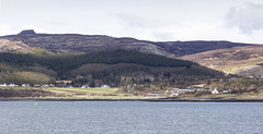
Inverarish and Dùn Caan
| |
|
The village of Inverarish is the largest settlement on Raasay. The two terraces of cottages were originally built to house workers at the nearby former ironstone mine.
Dùn Caan (444m), the highest point on Raasay, overlooks the scene.
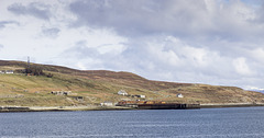
Raasay old ferry pier
| |
|
The old ferry terminal and quay at East Suisnish on the island of Raasay. The quay was formerly used to transport processed iron ore from the iron mine near Inverarish. The buildings and ruins behind the pier are the remains of the iron ore processing plant.
The present-day ferry terminal, opened in 2011, is at Clachan, 2 km to the NNE.
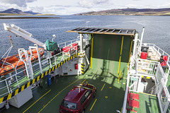
On the ferry to Raasay
| |
|
On board the Caledonian MacBrayne ferry MV Hallaig , en route to Raasay from Sconser
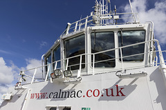
MV Hallaig bridge
| |
|
Bridge of the Caledonian MacBrayne ferry MV Hallaig , en route to Raasay from Sconser
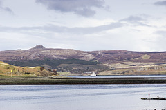
Raasay and ferry from Sconser
| |
|
View to the island of Raasay from the ferry terminal at Sconser on the island of Skye. The Caledonian MacBrayne ferry MV Hallaig is approaching Sconser. The prominent flat-topped summit on the skyline is Dùn Caan (444m), the highest point on Raasay.

Loch Sligachan and Raasay from Sconser
| |
|
View over Loch Sligachan to the island of Raasay from the ferry terminal at Sconser on the island of Skye. The prominent flat-topped summit on the skyline is Dùn Caan (444m), the highest point on Raasay.
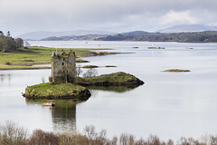
Castle Stalker
| |
|
|
The classic view of Castle Stalker taken from the viewpoint at West Dallens.
Lots of information here:
www.castlestalker.com
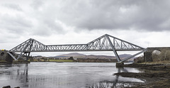
Connel Bridge
| |
|
The Connel Bridge near Oban spans Loch Etive, a sea loch extending some 30 km inland. Formerly a railway bridge, it now carries the A828 road northwards towards Ballachulish.
The turbulent water is due to the strong tidal flow over shallows in the loch bed, creating the white water Falls of Lora when the current is strong. Unfortunately it was near slack water at the time of taking the photo, and the falls were not particularly evident.
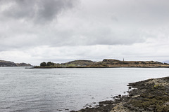
Kerrera from Port Mòr
| |
|
The northern end of the island of Kerrera viewed from Port Mòr near Oban. The flat area around the shoreline of the island is a raised beach/wave-cut platform.
The obelisk is a memorial to David Hutcheson who set up a regular steamer service to the Hebrides in 1835. This service was the forerunner of the Caledonian MacBrayne ferries of today.
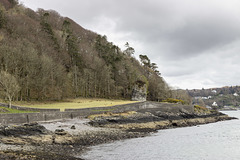
Port Mòr sea stack and raised beach
| |
|
A southerly view from Port Mòr looking towards Oban.
The flat area between the woodland and the shore is a raised beach, with the old (Pleistocene) cliff line behind, comprised of Devonian conglomerates. The prominent rock just right of centre is a remnant 'fossil' sea stack.
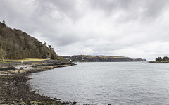
Port Mòr and Oban
| |
|
A southerly view from Port Mòr looking towards Oban.
The flat area between the woodland and the shore is a raised beach, with the old (Pleistocene) cliff line behind, comprised of Devonian conglomerates. The prominent rock at the foot of the old cliff is a remnant 'fossil' sea stack.

Firth of Lorne from Ganavan Bay
| |
|
View west from Ganavan Bay, near Oban, over the Firth of Lorne to the island of Mull (left of centre). The low strip of land to the right of centre is Lismore Island, with the mountains of the Morven peninsula on the sky line.
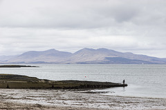
Mull from Ganavan Bay
| |
|
View west from Ganavan Bay, near Oban, over the Firth of Lorne to the island of Mull.
Jump to top
RSS feed- Latest items - Subscribe to the latest items added to this album
- ipernity © 2007-2026
- Help & Contact
|
Club news
|
About ipernity
|
History |
ipernity Club & Prices |
Guide of good conduct
Donate | Group guidelines | Privacy policy | Terms of use | Statutes | In memoria -
Facebook
X
