


Sheffield

Folder: Sheffield and environs
Photos taken in and around within the Sheffield. This includes rural, urban and industrial locations within the city boundary.
In the north and west, the city boundary extends well into the moorlands of the Peak District National Park.
In the north and west, the city boundary extends well into the moorlands of the Peak District National Park.
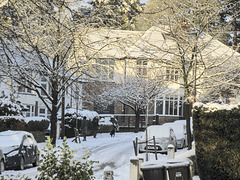
Snowy Whirlow street
| |
|
|
|
It snowed the previous afternoon and we woke up to a winter wonderland with clear blue skies and a temperature of -7°C
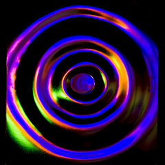
Fairy lights bullseye
| |
|
|
|
We bought some LED fairy lights to brighten up our porch over the Christmas-New Year period and provide much needed cheer.
I noticed they made rather a nice pattern of concentric coloured light rings when viewed through the bullseye glass of an internal partition door.
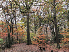
Autumn in Ecclesall Woods 3
| |
|
|
|
A damp misty autumn day in Ecclesall Woods, south-west Sheffield.
I am fortunate to have these beautiful woods so near my home.
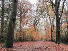
Autumn in Ecclesall Woods 2
| |
|
|
A damp misty autumn day in Ecclesall Woods, south-west Sheffield.
I am fortunate to have these beautiful woods so near my home.
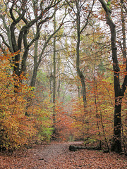
Autumn in Ecclesall Woods 1
| |
|
|
A damp misty autumn day in Ecclesall Woods, south-west Sheffield.
I am fortunate to have these beautiful woods so near my home.
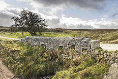
Thieves Bridge over Redcar Brook 2
| |
|
|
|
A walk on Houndkirk Moor 28
A cool morning with frequent showers, clearing to sunshine by the afternoon.
The Thieves Bridge carries the Houndkirk Road over the Redcar Brook. The brook rises on Burbage Moor, west of the Houndkirk Road. East of the road, it flows in a steep-sided clough towards Dore, eventually becoming the Oldhay Brook which in turn becomes the River Sheaf at Totley.
The grassy area in the middle distance is the former site of Oxdale Lodge/Badger House.
More about the Oxdale Lodge/Badger House here:
www.picturesheffield.com/frontend.php?keywords=Ref_No_increment;EQUALS;v00443&pos=2&action=zoom
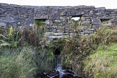
Thieves Bridge over Redcar Brook 1
| |
|
|
A walk on Houndkirk Moor 27
A cool morning with frequent showers, clearing to sunshine by the afternoon.
The Thieves Bridge, adjacent to the former site of Oxdale Lodge/Badger House, carries the Houndkirk Road over the Redcar Brook. The brook rises on Burbage Moor, west of the Houndkirk Road. East of the road, it flows in a steep-sided clough towards Dore, eventually becoming the Oldhay Brook which in turn becomes the River Sheaf at Totley.
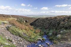
Redcar Brook clough view to ESE
| |
|
|
A walk on Houndkirk Moor 26
A cool morning with frequent showers, clearing to sunshine by the afternoon.
The Redcar Brook rises on Burbage Moor, west of the Houndkirk Road. East of the road, it flows in a steep-sided clough towards Dore, eventually becoming the Oldhay Brook which in turn becomes the River Sheaf at Totley.
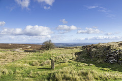
Site of Badger House (Oxdale Lodge) next to Houndk…
| |
|
|
|
A walk on Houndkirk Moor 25
A cool morning with frequent showers, clearing to sunshine by the afternoon.
This is the site of the old Oxdale Lodge, later named the Badger House, by the side of the Houndkirk Road adjacent to Thieves Bridge. A brief history is described in the Sheffield City Council image archives:
"1898 Map referred to as Oxdale Lodge; 1922 Badgers House Information from Sheffield Clarion Ramblers Handbooks Ref. 914.274, 1938-9 page 40; 1957-8 Pages 60 & 61 "Oxdale Lodge once called Badgers Houses, near Thieves Bridge on the old discarded 1757 Act Sheffield - Buxton Road below Ringinglow & Fox House. Destroyed by Sheffield Corporation in 1936." "Badger House was referred to in 1925 & 1945 SCR Handbook. They were later called Oxdale Lodge but were built by the inheritors of Joseph Badger who bought the 90 1/2 acres allotment 102 in Dore enclosure award of 14/4/1822 as far as the Oxstones". Once a single property used as a roadside pub later made in to two cottages.There was a stone slab skittle alley on the site. A cutlery worker once lived in one of them.A gamekeeper lived in one for many years. After the road from Sheffield to Fox House was opened this Houndkirk Road was not used for through traffic."
www.picturesheffield.com/frontend.php?keywords=Ref_No_increment;EQUALS;v00443&pos=2&action=zoom
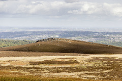
View north to Houndkirk Hill from Houndkirk Road
| |
|
|
A walk on Houndkirk Moor 24
A cool morning with frequent showers, clearing to sunshine by the afternoon.
Looking northwards to Houndkirk Hill from the Houndkirk Road. In the distance are the green-clad tower blocks in the Gleadless Valley on the south-east side of Sheffield, and the wind turbines of the Penny Hill windfarm south of Rotherham.
The clear afternoon light brings out the shadow detail of the scarp edge of Houndkirk Hill, composed of Namurian age ('Millstone Grit Series') Chatsworth Grit.
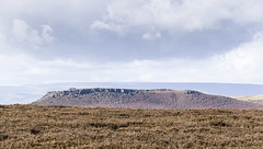
View WNW to Higger Tor from Houndkirk Road
| |
|
|
A walk on Houndkirk Moor 23
A cool morning with frequent showers, clearing to sunshine by the afternoon.
The southern portion of the Houndkirk Road offers fine views to the south and west into the heart of the Peak District. In the middle distance is the flat top of Higger Tor with its fringing crags of Namurian age ('Millstone Grit Series') Chatsworth Grit.
On the distant skyline is the high plateau of Kinder Scout, 12 miles distant.
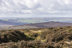
View west to Over Owler Tor from Houndkirk Road
| |
|
|
A walk on Houndkirk Moor 22
A cool morning with frequent showers, clearing to sunshine by the afternoon.
The southern portion of the Houndkirk Road offers fine views to the south and west into the heart of the Peak District. In the middle distance are the gritstone tors of Mother Cap Stone, just left of centre, and Over Owler Tor, to the right. Like Houndkirk Hill and Houndkirk Edge, these are composed of Namurian age ('Millstone Grit Series') Chatsworth Grit.
On the distant skyline are the high moorlands of the Derbyshire-Staffordshire border, beyond Buxton.
Seven miles to Sheffield
| |
|
|
A walk on Houndkirk Moor 21
A cool morning with frequent showers, clearing to sunshine by the afternoon.
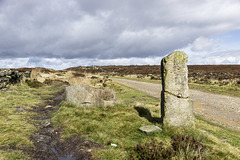
There are old stone mile posts along the Houndkirk Road. This one is near the south-west end. The visible inscription states "Sheffield 7 miles"
Shelter on Houndkirk Moor wall 2
| |
|
|
A walk on Houndkirk Moor 20
A cool morning with frequent showers, clearing to sunshine by afternoon.
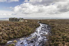
A view ESE over Houndkirk Moor, with the stone shelter and the wall disappearing into the distance. The morning showers have given way to mostly clear skies and sunshine with good, sharp lighting conditions.
View north-east over Houndkirk Moor from the shelt…
| |
|
|
|
A walk on Houndkirk Moor 19
A cool morning with frequent showers, clearing to sunshine by afternoon.
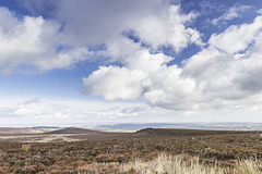
A view north-east from the stone shelter in the previous photo, over the wide expanse of Houndkirk Moor. To the left of centre in the middle distance is Houndkirk Hill. The rocks to the right of centre form Houndkirk Edge. The straight scarp edge marks the line of a fault which runs along the foot of the scarp in a NE-SW direction.
Both scarps are composed of Namurian age ('Millstone Grit Series') Chatsworth Grit
Shelter on Hounkirk Moor wall 1
| |
|
|
A walk on Houndkirk Moor 18
A cool morning with frequent showers, clearing to sunshine by midday.
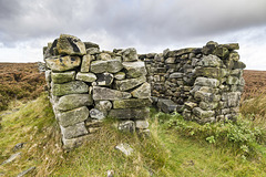
The path from Houndkirk Edge soon follows an east-west stone wall. This fine shelter, complete with stone seats, has been built along the line of the wall. The purpose is obscure, but possibly could have served as a shooting butt. Maybe there was a roof at one time.
Summit rocks of Houndkirk Edge looking NE to Hound…
| |
|
|
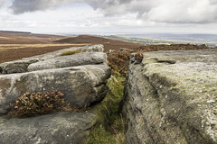
A walk on Houndkirk Moor 17
A cool morning with frequent showers, clearing to sunshine by afternoon.
Looking north-east from the suummit rocks of Houndkirk Edge (not named as such on the Ordnance Survey maps). Houndkirk Hill is just left of centre, with Sheffield city centre in the far distance. Ladty Canning's Plantation is on the far left skyline.
The rocks are Namurian age ('Millstone Grit Series') Chatsworth Grit.
Houndkirk Hill and guidepost view north
| |
|
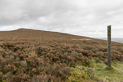
A walk on Houndkirk Moor 16
A cool morning with frequent showers, clearing to sunshine by afternoon.
Looking back northwards to the summit of Houndkirk Hill. A narrow path from the summit rocks descends to meet a more significant east-west path where there is a concrete guidepost at the junction. Possibly the post had direction markers at one time, but there is no sign of them now.
Jump to top
RSS feed- Latest items - Subscribe to the latest items added to this album
- ipernity © 2007-2026
- Help & Contact
|
Club news
|
About ipernity
|
History |
ipernity Club & Prices |
Guide of good conduct
Donate | Group guidelines | Privacy policy | Terms of use | Statutes | In memoria -
Facebook
X
