Houndkirk Moor
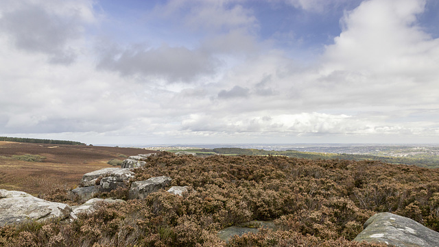
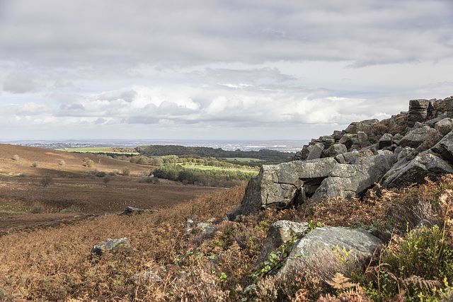
Houndkirk Moor is a broad expanse of heather moorland and bracken, situated on the south-west side of Sheffield, just inside the Peak District National Park boundary.
The Houndkirk Road - the old Sheffield to Hathersage turnpike road was constructed in 1758, following the route of previous pack-horse tracks.The road forms the north-west limit of the moor, separating it from Burbage Moor and Lady… (read more)
The Houndkirk Road - the old Sheffield to Hathersage turnpike road was constructed in 1758, following the route of previous pack-horse tracks.The road forms the north-west limit of the moor, separating it from Burbage Moor and Lady… (read more)
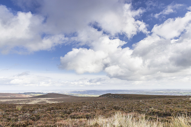
View north-east over Houndkirk Moor from the shelter
A walk on Houndkirk Moor 19
A cool morning with frequent showers, clearing to sunshine by afternoon.
A view north-east from the stone shelter in the previous photo, over the wide expanse of Houndkirk Moor. To the left of centre in the middle distance is Houndkirk Hill. The rocks to the right of centre form Houndkirk Edge. The straight scarp edge marks the line of a fault which runs along the foot of the scarp in a NE-SW direction.
Both scarps are composed of Namurian age ('Millstone Grit Series') Chatsworth Grit
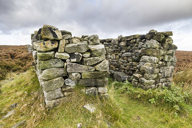
Shelter on Hounkirk Moor wall 1
A walk on Houndkirk Moor 18
A cool morning with frequent showers, clearing to sunshine by midday.
The path from Houndkirk Edge soon follows an east-west stone wall. This fine shelter, complete with stone seats, has been built along the line of the wall. The purpose is obscure, but possibly could have served as a shooting butt. Maybe there was a roof at one time.
Summit rocks of Houndkirk Edge looking NE to Houndkirk Hill
A walk on Houndkirk Moor 17
A cool morning with frequent showers, clearing to sunshine by afternoon.
Looking north-east from the suummit rocks of Houndkirk Edge (not named as such on the Ordnance Survey maps). Houndkirk Hill is just left of centre, with Sheffield city centre in the far distance. Ladty Canning's Plantation is on the far left skyline.
The rocks are Namurian age ('Millstone Grit Series') Chatsworth Grit.
Houndkirk Hill and guidepost view north
A walk on Houndkirk Moor 16
A cool morning with frequent showers, clearing to sunshine by afternoon.
Looking back northwards to the summit of Houndkirk Hill. A narrow path from the summit rocks descends to meet a more significant east-west path where there is a concrete guidepost at the junction. Possibly the post had direction markers at one time, but there is no sign of them now.
Summit of Houndkirk Hill looking NNE
A walk on Houndkirk Moor 15
A cool morning with frequent showers, clearing to sunshine by afternoon.
Another view from the summit of Houndkirk Hill, looking NNE. The rocks are Namurian age ('Millstone Grit Series') Chatsworth Grit. The sunlit houses are at Crosspool, on the west side of Sheffield; the Crosspool television tranmitter is prominent just to the right of centre.
Eggborough power station, 32 miles distant, is visible on the skyline left of centre; Drax power station, 37 miles distant, is just visible on the skyline towards the right.
Summit of Houndkirk Hill looking E over Beauchief
A walk on Houndkirk Moor 14
A cool morning with frequent showers, clearing to sunshine by afternoon.
An easterly view from the summit of Houndkirk Hill, looking over the south Sheffield suburb of Beauchief ('Beech-iff') and beyond. Norton Water Tower is prominent in the centre; the two tower blocks at Herdings visible to the left of centre.
In the very far distance on the skyline is West Burton power station on the River Trent, near Gainsborough, 32 miles away.
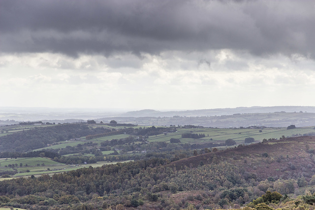
Summit of Houndkirk Hill looking south
A walk on Houndkirk Moor 13
A cool morning with frequent showers, clearing to sunshine by afternoon.
Another shower sweeps in from the west, partly obscuring this southerly view from the summit of Houndkirk Hill.
The dark hill in the centre is near Cocking Tor just south-west of Ashover, some 13 miles away.
Summit of Houndkirk Hill looking NE
A walk on Houndkirk Moor 12
A cool morning with frequent showers, clearing to sunshine by afternoon.
A north-easterly view from the from the summit of Houndkirk Hill. The rocks are Namurian-age ('Millstone Grit Series') Chatsworth Grit. The eastern side slopes gently down towards the A625 Hathersage Road and Dore beyond.
Sheffield is visible in the far distance.
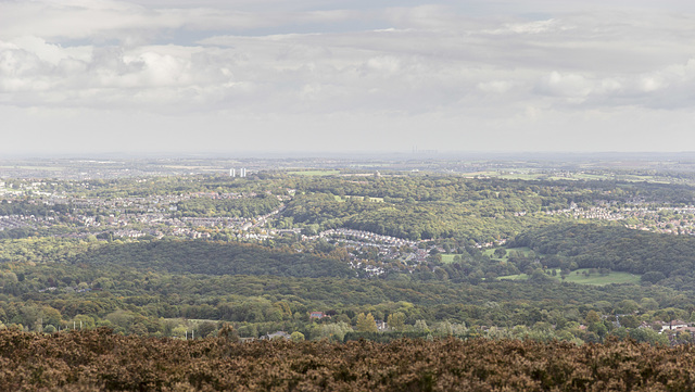
View north-east from Houndkirk Hill escarpment
A walk on Houndkirk Moor 11
A cool morning with frequent showers, clearing to sunshine by afternoon.
A north-easterly view from the north-west facing escarpment of Houndkirk Hill. The rocks are Namurian-age ('Millstone Grit Series') Chatsworth Grit.
The woodland strip in shadow, in the centre, is the Bole Hill Plantation on the north side of the Limb Valley. Sheffield city centre is visible in the far distance; Rotherham and Doncaster even further beyond.
Jump to top
RSS feed- Latest items - Subscribe to the latest items added to this album
- ipernity © 2007-2024
- Help & Contact
|
Club news
|
About ipernity
|
History |
ipernity Club & Prices |
Guide of good conduct
Donate | Group guidelines | Privacy policy | Terms of use | Statutes | In memoria -
Facebook
Twitter

